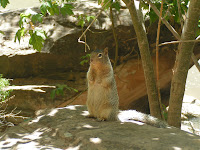
*New critters we’ve seen on our 2009 trip so far: black bears, grizzly bears, elk, fox, wolf, moose, beavers, groundhog, prairie dogs, big horn sheep, buffalo (bison), white tail deer, chipmunks, pronghorn, burros, pika, moose, Uinta ground squirrel, mountain goats, mule deer, longhorn beetle, otters, northern whiptail lizard, jackrabbit, rock squirrels, collared lizard
*New birds we’ve seen on our 2009 trip so far: bald eagles, golden eagles, wild turkeys, osprey, western meadowlark, mountain bluebird, sandhill cranes, Canadian geese, American white pelicans, trumpeter swans, killdeer, common merganser, great blue heron, raven, yellow-headed blackbird, Brewer’s blackbird, brown-headed cowbird, double-crested cormorant, Clark’s nutcracker, common goldeneye, white-breasted nuthatch, Steller’s jay, black-chinned hummingbird, Cassin’s finch, Cassin’s kingbird, peregrine falcon
*National Parks/Monuments visited on 2009 trip so far: 26
*State Parks visited on 2009 trip so far: 4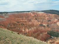
Around 9am on Wed. we pulled out of the Ruby Inn Campground heading 166 miles to our next destination, Zion National Park (
www.nps.gov/zion). There are two routes to Zion from Bryce Canyon. The short route requires a tunnel escort through the park and unhooking our tow vehicle as well as a $25 es
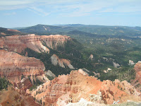
cort fee. The other route, about 81 miles further, also allowed for a short detour to visit Cedar Breaks National Monument (
www.nps.gov/cebr). The park road through Cedar Breaks is only 5 miles long but provides a number of turnouts enabling you to enjoy the view into the canyon. More importantly the route we chose allowed us to enter the park on the north end and drive south to its main entrance. H
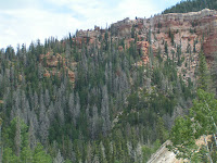
wy 143 out of Panguitch through Cedar City is another one of those scenic highways not to be missed. Over the course of 30 miles, we climbed over 4,000 feet to an elevation of over 10,600 feet, a new high for us. Although Cedar Breaks was pretty, it is one of the few places we visited this year where we would probably not return to see again. About half an hour after leaving the park, we merged onto I-15, the first time we had been on an interstate in almost 2,300 miles. Our 31 mile trip down I-15 dumped us off about 20 miles from the south entrance to Zion NP.
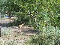
Somewhere along the line our original 7 day reservation for Zion became 5 days when we decided to utilize the campground inside the park (then later shortened to 3 days because of the high temperatures). Watchman Campground has electric only at most campsites and no sewer or water hookups. This really presented no problem for us as we are quite capable in going a week with the water we
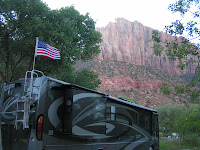
carry in our fresh water tank as well as our black and gray water tank capacities.
Our site at Watchman was perfect. A large pull-thru, shaded most of the morning by the cliffs, shaded most of the afternoon by tall cottonwood trees, and still provided easy access for satellite reception. Towering in the background was a gorgeous view of The Watchman, a giant rock formation so named for its loca
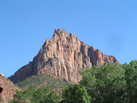
tion as it seems to watch over the entrance to the canyon. After we got settled, we drove over to the Visitor Center to pick up maps, brochures, Jr. Ranger booklets, and get the lay of the land. Spring through fall the Zion Canyon Scenic Drive is accessible only by shuttle bus so we checked out the logistics and times of that.
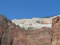
The next day we hopped the shuttle for the 6-1/2 mile scenic drive. Before the shuttle system began in 2000, nearly 5,000 cars, motorhomes, and buses visited the park daily with only 450 parking spaces to accommodate them. Zion does an excellent job with the shuttle system with buses running every 10-15 min. eliminating traffic jams and parking hassles, and the drivers bring the canyon to life with their narrative. (An interesting tidbit…a number of movies were filmed at Zion NP including
Butch Cassidy & the Sundance Kid, Electric Horseman, and the Eiger Sanction.)
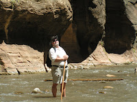
Our goal was to ride to the end of the loop at Temple of Sinawava and take the Riverside Walk. A friend in St. Louis had told us about this 2 mile roundtrip hike that is a paved trail following the Virgin River through the narrow canyon. At the end of the paved trail, you have the option to turn around and go back, or to continue wa
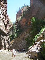
lking down the river through an area called The Narrows….
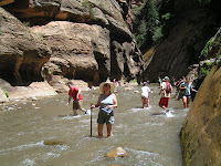
in the river! We chose this option and feel it’s probably one of the best things we’ve ever done. We had been advised by a park ranger to wear hiking boots, or tennis shoes at the bare minimum, because the rocks are jagged and slippery. Russ carried the back pack, I had the camera around my neck encased in a Ziploc bag, and armed with our walking sticks we started down the river along with dozens of other people. We were extremely happy we had the walking sticks as we saw a number of people struggling to stay upright between slippery rocks and at t
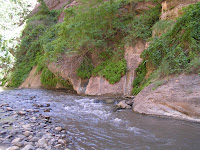
imes quick currents. We walked about half mile up the river with it reaching our knees at times. Sheer cliffs reaching over 1,000 feet surrounded us on either side. About 300 yards in front of us around the bend we could see people with the river up around their waist. Since we didn’t bring a change of clothes, we turned back. Next time we’ll go further because we’ll have a better understanding and be better prepared possibly even wearing my swimming suit!
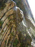
By the time we finished our walk back to the shuttle stop, I wouldn’t say our tennis shoes were dry, but they weren’t sopping wet and we were able to board the bus with no worries. On the way back we stopped at the Weeping Rock trailhead and hiked this ½ mile roundtrip trail. Though a short and paved walk, it was steep, ending at a rock alcove with dripping springs and hanging gardens. By the time we reached the top, the benches were a welcome sight for a brief rest. Back on the bus we decided to skip the Emerald Pools trails and head on back to the RV.
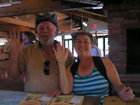
Early the next morning we brought our completed Jr. Ranger booklets to the Visitor Center and took the pledge becoming official Zion NP Jr. Rangers. We had also decided to take the shuttle bus loop without getting off this time, just enjoying the scenery and the narration. We passed many named rock formations such as The West Temple,
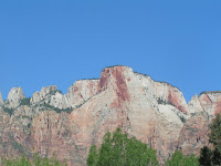
Altar of Sacrifice, Court of the Patriarchs, The Great White Throne, and The Organ. The driver pointed out a very strenuous hike to Angels Landing that ends at a summit high above Zion Canyon. However, the last half mile follows a steep, narrow ridge only 5 feet across with a drop of a couple thousand feet on each side and a chain rope in the middle for folks going both ways to hang onto. We could actually see people walking along that steep trail, and though the view is undoubtedly spectacular, it’s not something we’ll be doing any time soon, if
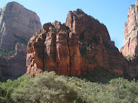
ever.
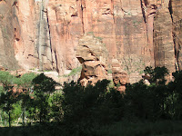
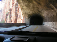
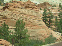
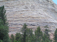
After returning to the RV, we gathered up the dogs for the 13 mile drive along the Zion-Mt. Carmel Highway towards the East entrance of the park. This scenic drive meanders along several switchbacks and takes you through the tunnel we discussed earlier. What was amazing was how the scenery of the canyon changed once you crossed through to the other side. I
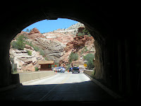
t was like an entirely different canyon but just as spectacular. A prime example is Checkerboard Mesa, which is made of Navajo sandstone and has two sets of lines forming a checkerboard pattern. The horizontal lines were formed from layers of windblown sands built up over time into sand dunes that were buried an
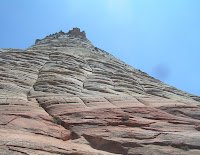
d hardened over millions of years. The vertical lines are actually shallow cracks caused by stress and erosion on the rock surface, and from what we read, a rare occurrence.
Tomorrow we leave for the north rim of the Grand Canyon, a place neither of us has ever been. We’ve could have stayed longer exploring Zion NP, but it will have to wait till next time.

No comments:
Post a Comment