Wednesday, May 26, 2010

Explore...Learn...Protect

*Critters we’ve seen on our 2010 trip so far: javelina, mule deer, desert grassland whiptail
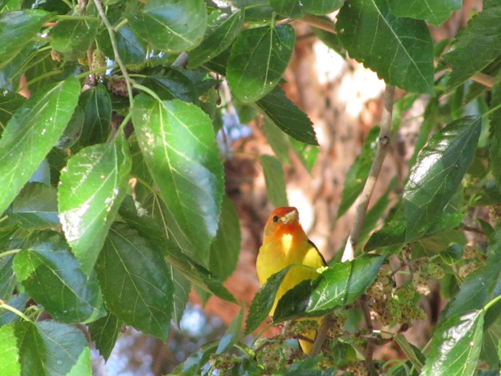
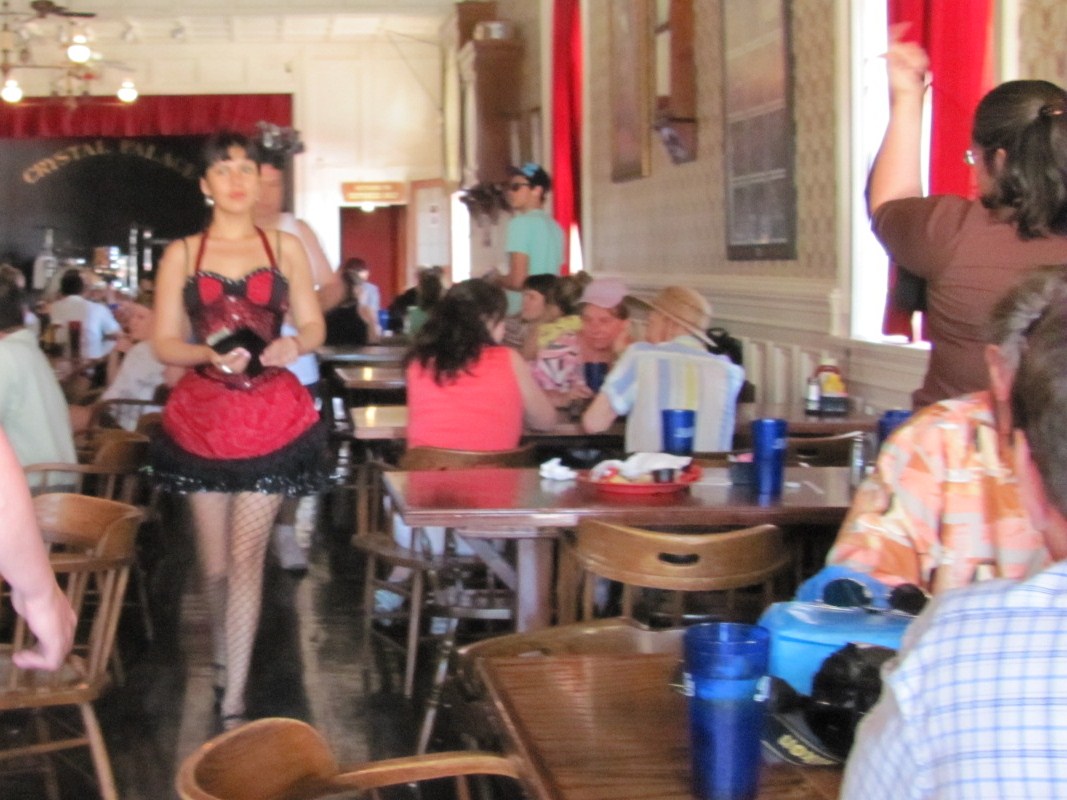
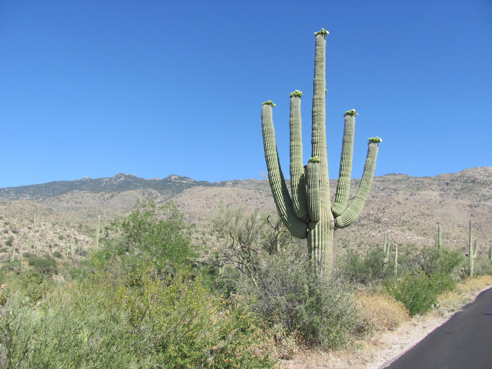
*Birds we’ve seen on our 2010 trip so far: white-wing dove, Gamble’s quail, western tanager, roadrunner
*National Parks/Monuments visited on 2010 trip so far: 9
*State Parks visited on 2010 trip so far: 1
*Total number of Jr. Ranger badges so far: 11


[Click on any picture to enlarge…then arrow back to the blog]

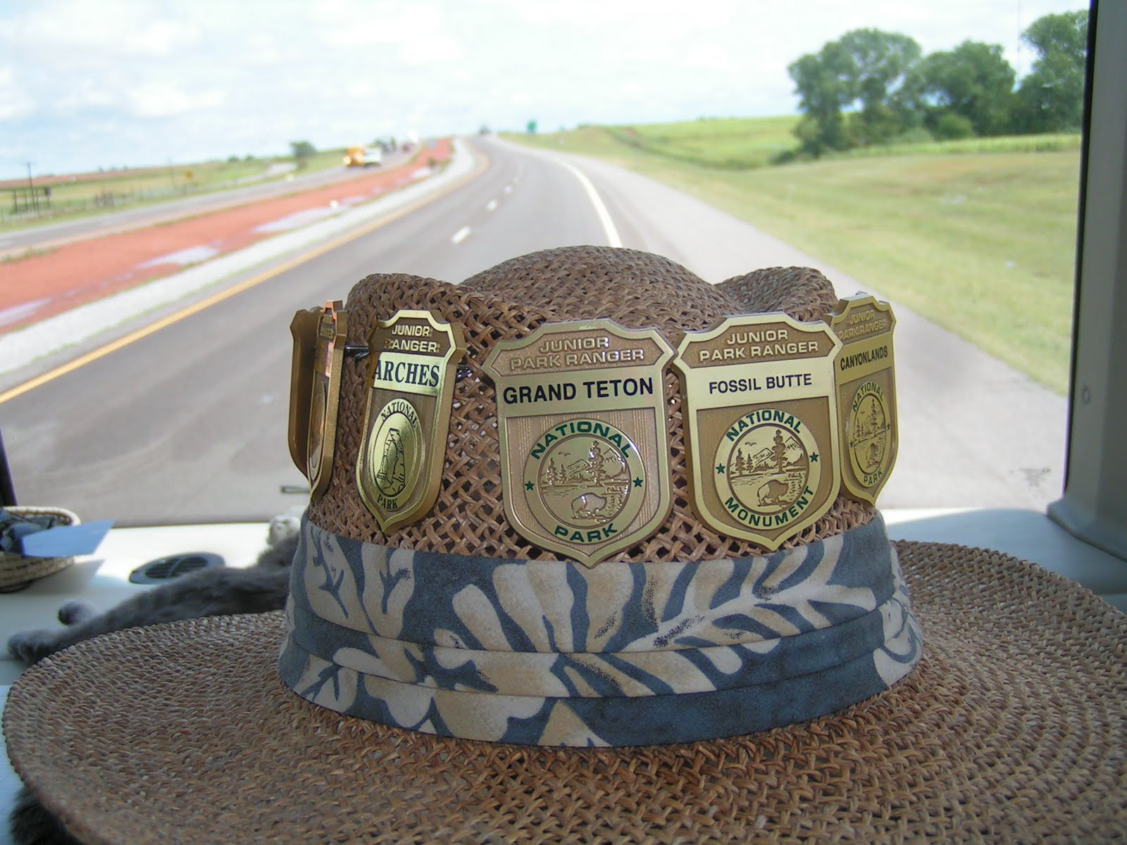
Although every national park, monument, and historic site have their own individualized Junior Ranger programs and oaths to take upon completion, all follow the same basic Junior Ranger motto: “Explore, Learn, Protect”. Explore your surroundings, learn from what you see and hear, protect these national treasures for future generations.

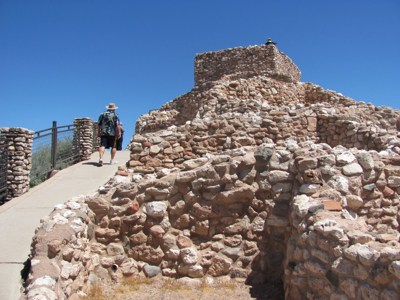
Generally geared for kids up to age 12, we discovered last year that anyone can participate. We have found it a great way to really learn about the area we’re visiting and thoroughly enjoy the process. Instead of just whizzing by the displays in the visitor centers or quickly glancing at things along the way, it forces us to really focus and learn more. Generally the program is free but occasionally a park will charge a buck or two. Some programs are tougher than others (even for adults), and on occasion we’ll run across a National Park Ranger who kind of gives us some attitude like “it’s supposed to be for the kids”. But mostly the Rangers are thrilled that we are taking part, and an official Park Ranger has to administer the oath. To date we each have completed 11 Junior Ranger programs and plan on earning more along the way including a couple we didn’t get last year because we didn’t know we could join in the fun.

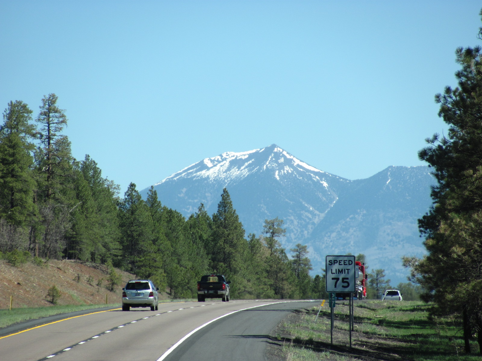
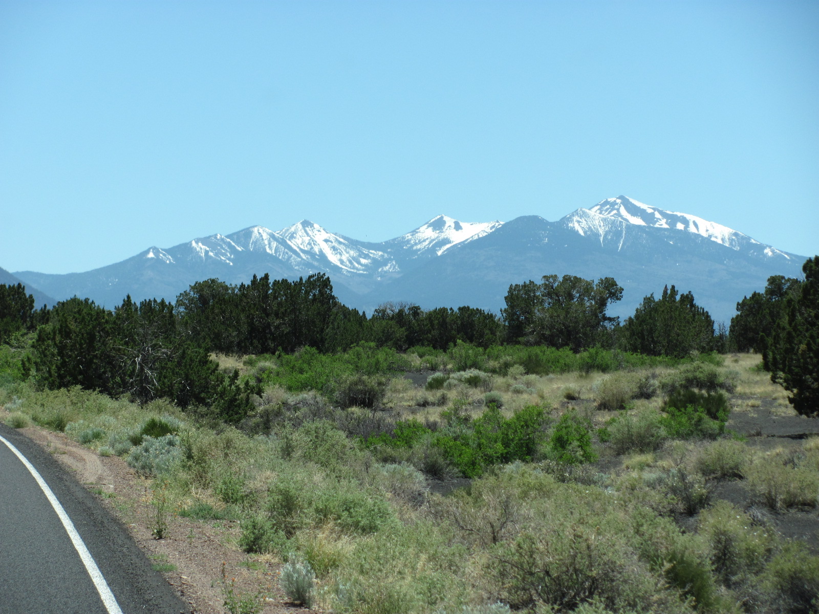
So as we left Camp Verde and headed for the Grand Canyon, we had decided to make a stop at Sunset Crater Volcano National Monument (www.nps.gov/sucr), and along the way saw Humphreys Peak in the distance. Located in the San Francisco Mountains about 11 miles north of Flagstaff, it is the highest mountain in Arizona at an elevation of 12, 637 feet. What a beautiful sight with its snow still glistening on top!

Sunset Crater’s Junior Ranger workbook can be viewed on their website, and it looked like we might actually be able to complete it in the short time we planned to be there. Once we arrived at the visitor center, Ranger Tom told us that we could actually complete it along the 35- mile scenic drive and turn it in at the Wupatki National Monument on the other end since they have a reciprocal agreement and have each other’s badges. Sounded cool to us as this had been on our agenda since the road continues out of Wupatki ending where we needed to head north.

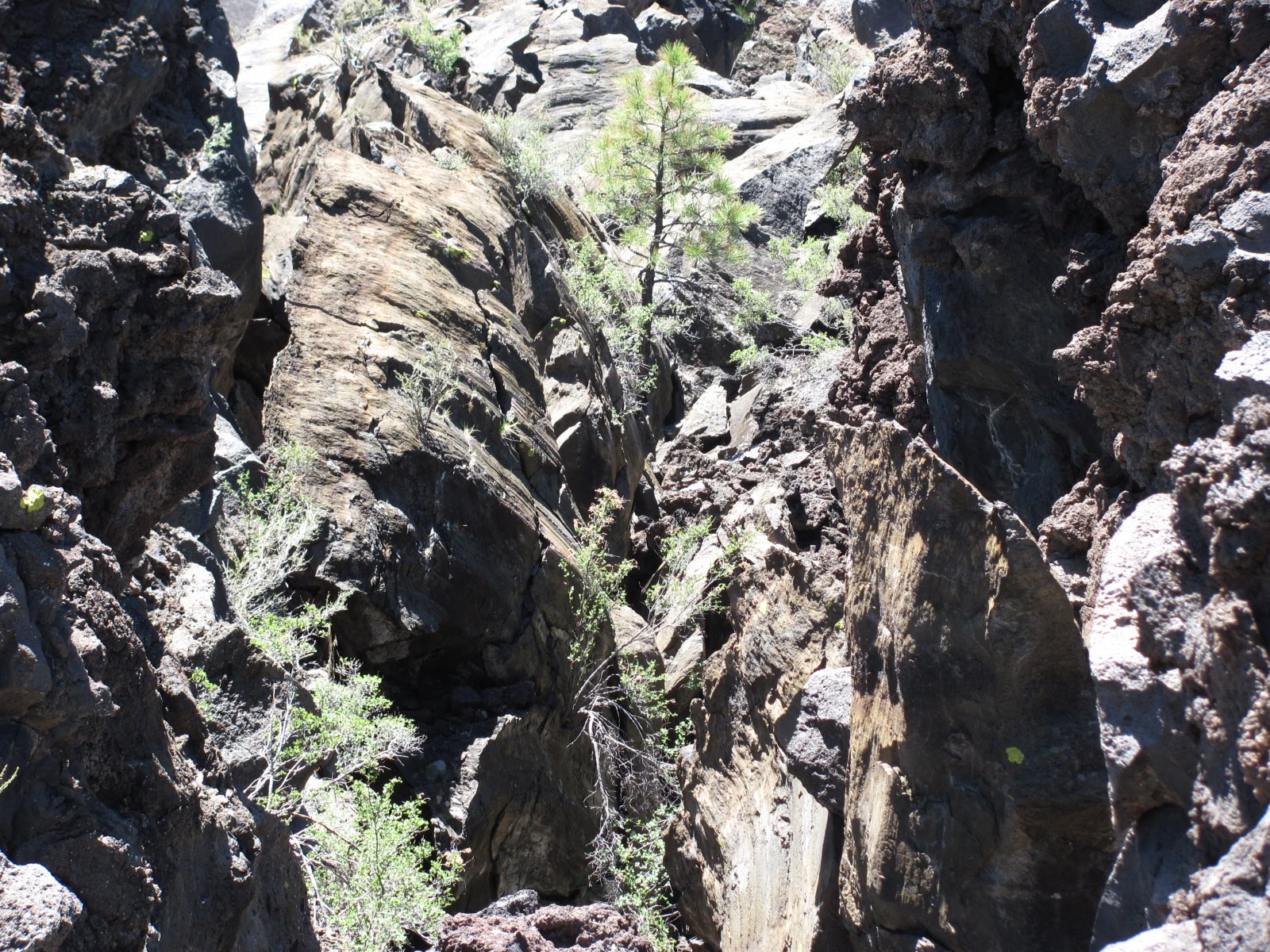
Neither of us had ever seen a volcano in person so going to Sunset Crater Volcano NM seemed like a no-brainer since it was sort of on the way, and the area turned out to be way cool. The crater was created by a volcanic eruption about 900 years ago but is the youngest on the Colorado Plateau. Though this volcano has been dormant for hundreds of years, it’s still a study in dramatic volcanic features. Rising 
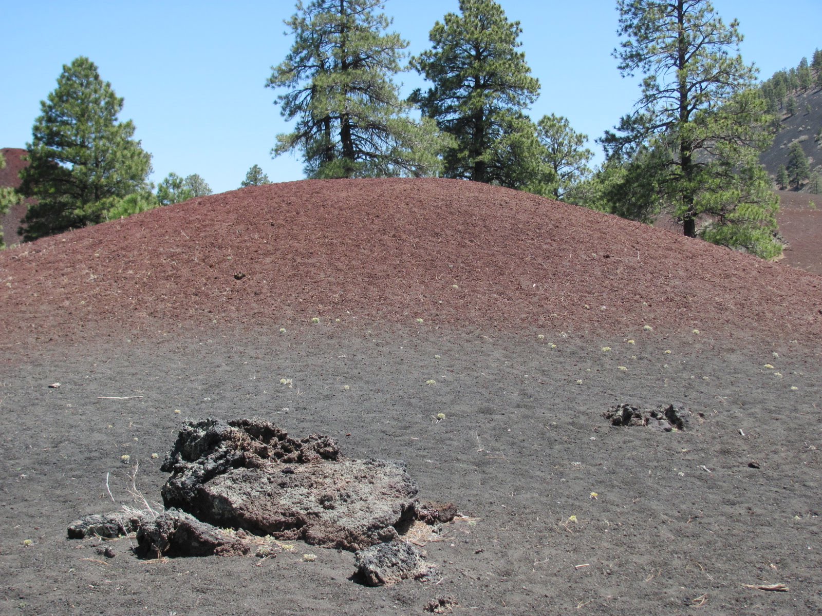
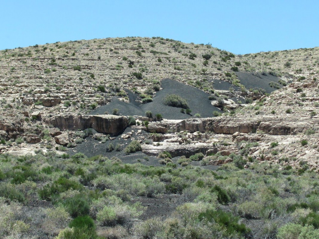
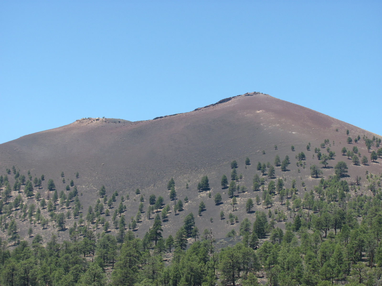
1,000 feet above the surrounding landscape, it is considered a classic example of a cinder cone volcano. The rest of the area is covered by rocky lava flows, popcorn-sized lava, cinder deposits, and squeeze-ups, but there are also signs of life emerging through the desolation in the form of pine trees, aspen trees, shrubs, wildflowers, and even small wildlife. The sunset name was given by explorer John Wesley Powell in the 1800s because of the reds, b
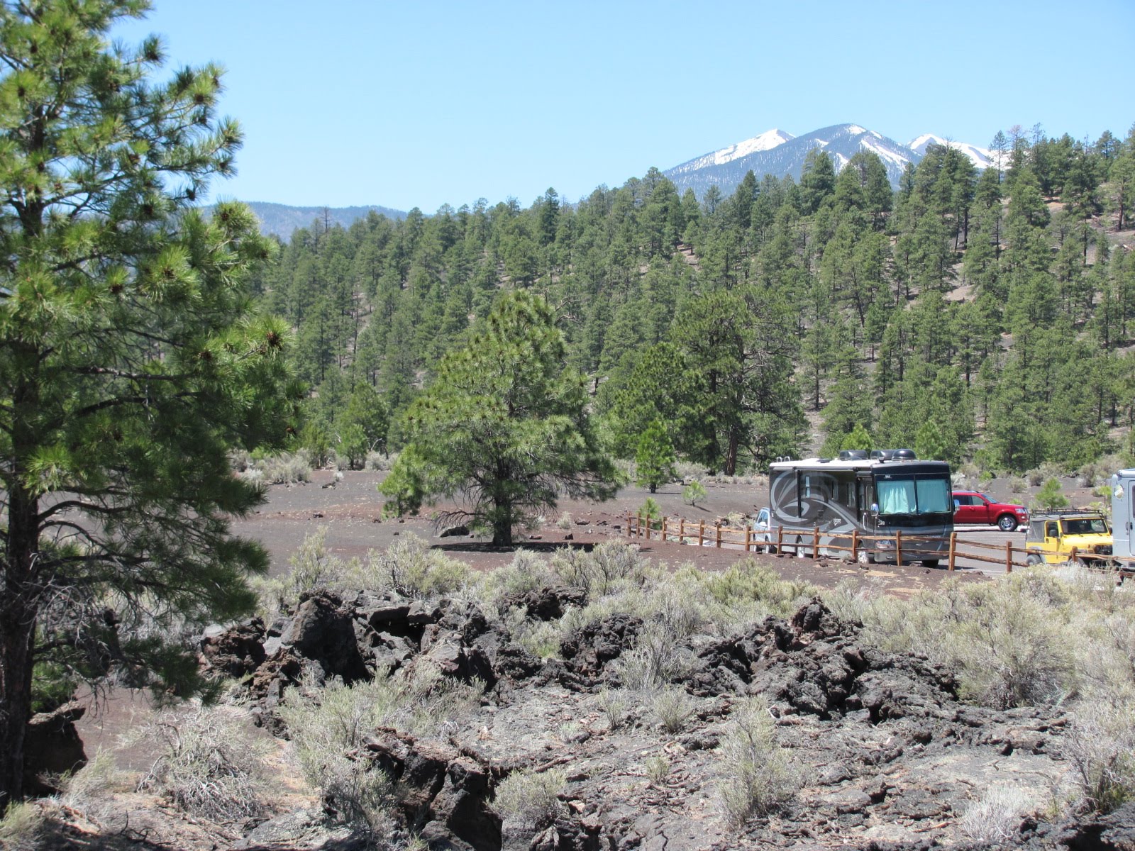
rowns, and yellows of its summit

Here are some interesting facts about Sunset Crater: summit elevation - 8,029 feet; base diameter - 1 mile; top diameter from rim to rim - 2,250 feet; depth of the crater - 300 feet; extent of the ashfall - 800 square miles.

According to what we’ve learned, more than 600 volcanoes existed in this area and nearly every hill and mountain you see was an active volcano at one time. There is a 1 mile loop trail with ¼ mile of it paved while the rest takes you across the rocky lava flows to the base of the volcano (we only walked the ¼ mile paved section), but you too can experience the trail through the virtual field trip on the site’s homepage. Hiking and climbing the volcano are prohibited.

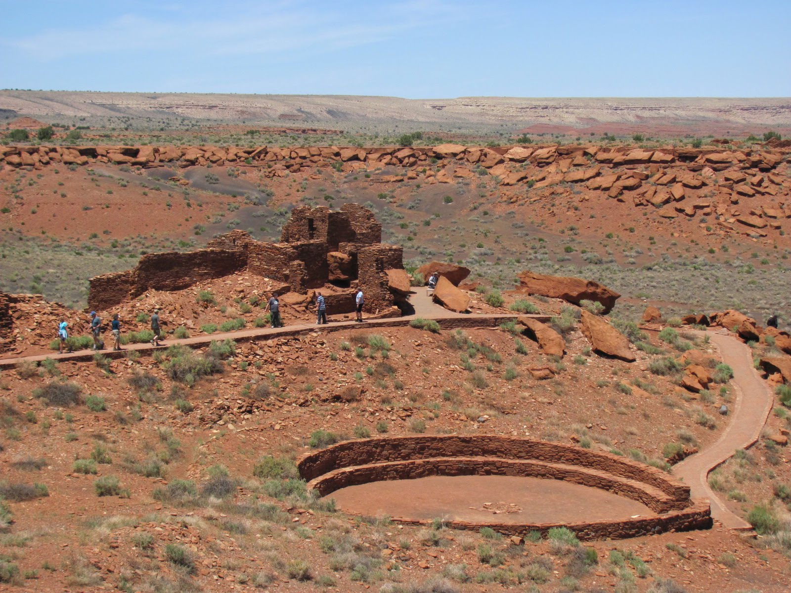
When we arrived at Wupatki National Monument (www.nps.gov/wupa), the first thing we did was take our completed Junior Ranger workbooks to the front desk of the visitor center. The volunteer got the ranger for us, and initially we were a little worried…Ranger Chuck seemed like it was going to be gruff and really give us some attitude. On top of it he was a little intimidating as he was one of the law enforcement rangers and completely armed. He did give us some good natured grief, even throwing Russ’ workbook on the floor because his drawings were so much worse than mine! The volunteer came over and “reminded” Ranger Chuck that he’s supposed to “encourage the Junior Rangers” not berate them…LOL He signed our certificates, gave us our badges, and then took us over to the Wupatki National Monument backdrop to take our oath. I asked him if he’d mind taking our picture, to which he said sure, but as I handed him the camera, he said “wait a minute” and ran off towards the office. He returned with his official park ranger hat and placed it on my head for the photo…how cool is that! He then gave us the oath, which he really embellished, and had us cracking up. Turns out Ranger Chuck was a really great guy as are nearly all the park rangers we’ve met.

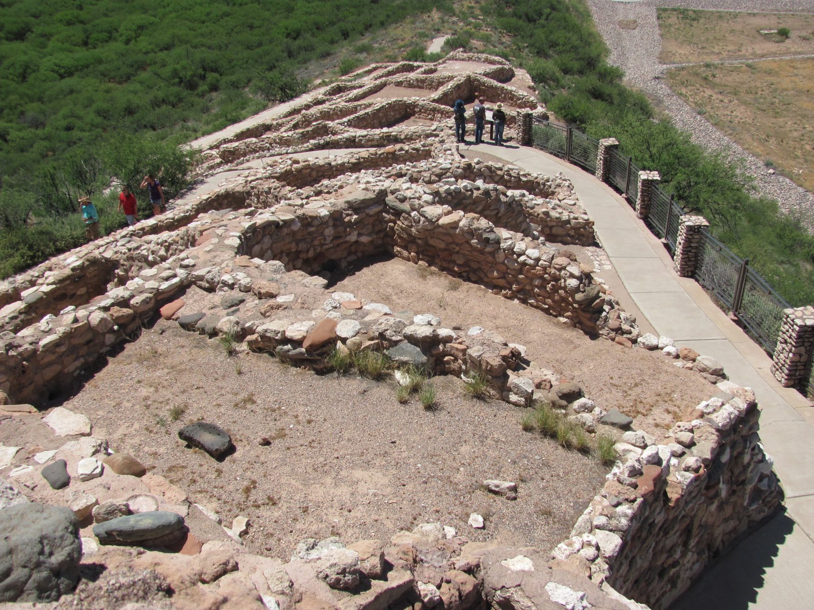
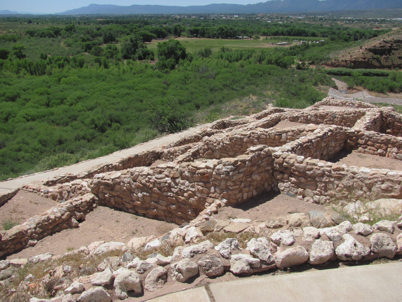
We walked outside to the trail leading out to the pueblos, and according to the pamphlet, “Wupatki pueblo was home to numerous groups of people over thousands of years. Less than 800 years ago, it was the tallest, largest, and perhaps the richest and most influential pueblo around. It was home to 85-100 people, and several thousand more lived within a day’s walk.” The theory is that the people moved here to escape the eruptions of Sunset Crater after they lost their homes, but around 1250 they left the area…guess it was just time to move on. Unfortunately we didn’t have time to complete the Wupatki Junior Ranger program…perhaps another time.


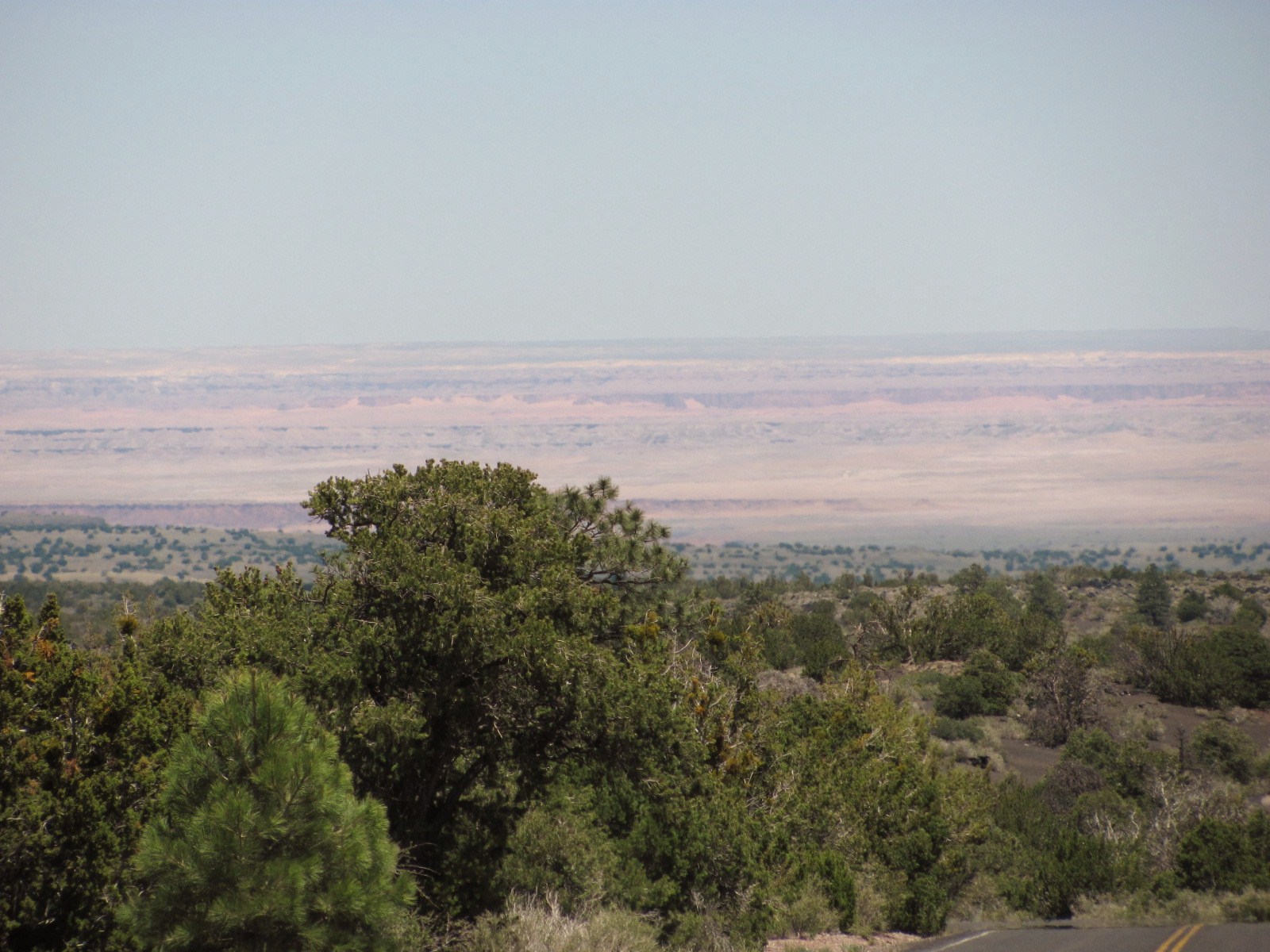
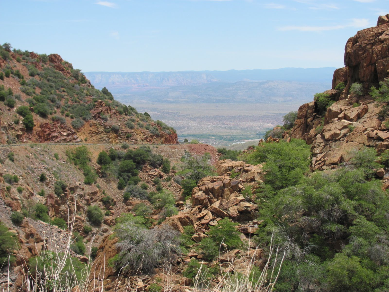
As we continued our drive out of the park, we commented on the diverse contrast in landscape views on the 35-mile scenic drive we had just taken. We passed smaller pueblos seeming to pop out of the desert grasslands, volcanic hills, mesas, red sandstone, white limestone, forests, lava flows, and in the distance snow-capped mountains and even the Painted Desert. What a fascinating little side trip off the beaten path.


Monday, May 24, 2010

A Week At Camp

*Critters we’ve seen on our 2010 trip so far: javelina, mule deer, desert grassland whiptail
*Birds we’ve seen on our 2010 trip so far: white-wing dove, Gamble’s quail, western tanager
*National Parks/Monuments visited on 2010 trip so far: 7
*State Parks visited on 2010 trip so far: 1

[Click on any picture to enlarge…then arrow back to the blog]

Our journey continued on to Camp Verde, AZ, about 250 miles north of Benson. We arrived at Camp Verde RV Resort after the office had closed, but signs directed us to the night host’s campsite. Seated outside were Dave with his little dog, Tank, and brother-in-law, Bill, enjoying cocktail hour. Dave and his wife, Trish, were spending at least a month there as camp hosts, and Bill was visiting for a few weeks. Tank is a small white dog, and Dave kept telling Tank that Mikey and Abby were “real dogs”…LOL! Originally we were to be parked in the back section in full sun, but Dave said “let’s see if we can do better”. He put us in the spot next to Bill and 2 down from him that had a great shade tree! Only down side was all the birds eating the berries in the trees and creating quite a mess on the RV and car, but we had nice, cool, wonderful shade! What a great campground with a great staff including those we met in the office the next day! We chatted with Dave, Trish, and Bill quite a bit over the next several days, but I never did get a picture of them. However I did get pictures of one of the beautiful birds known as the western tanager that were “decorating” our rig and car. Dozens of them flew from tree to tree everyday, but this little fellow stayed on the ground long enough for a closer look.

Fri. we loaded the dogs in the car and headed for Montezuma Castle National Monument (www.nps.gov/moca) that is nestled into a limestone recess 100 feet above Beaver Creek in the Verde Valley. This is not an actual castle but rather a 5-story, 20-room cliff dwelling that was home to about 35-50 Sinagua Indians more than 600 years ago, but nobody knows why they left the area by the early 1400s. Access to it was closed in the 1950s, but you can walk a short loop trail that will take you to its base. Beaver Creek is several hundred yards from the dwellings, and it really makes you stop to think how easy we have it today. Along the trail they have a small narrated diorama that gives you an idea of life for the Sinagua. These people not only hauled water, game, and grains across the plain but had to carry it all up ladders to their homes! As you can see, dogs are allowed on the trail, and in fact a doggie water bowl is provided at the visitor center directly below the human water fountain.


Back in the car, we drove 11 miles northeast to the Montezuma Well National Monument (http://www.nps.gov/moca/montezuma-well.htm), a sinkhole that is filled with water and was formed by the collapse of a limestone cavern about 11,000 years ago. The 1/3 mile trail takes you up a short hill and down to the rim where over 1.5 million gallons of water flow into it everyday at a constant temperature of 74 degrees. Measuring 55 feet deep and 368 feet across with cliffs 70 feet above the water’s surface, the well is fed by 3 or 4 large underwater vents and exits through a side cave. Sinagua Indians also lived in dwellings located in the walls around the well that can be seen from the rim. It is still considered a sacred site by many local Indian tribes today.
From here we drove another 25 miles to Sedona, AZ, often referred to as Red Rock Country because of the magnificent red sandstone formations in and around the area. If you don’t like the color red, you don’t want to live here! There must be a city ordinance code because many of the buildings are of the same color. The red rocks form an incredible backdrop to the entire town, and nearby Bell Rock is one of the area’s most photographed attractions. It was formed hundreds of millions of years ago, and the “youngest” rock at the top is around 272 million years old...meaning the rest is much older!
On our way home we drove through the historic town of Cottonwood, but the most interesting site was Ye Ole Hippie Emporium! Must be a hit as the parking area in front was full as we drove by.

Mon. we ventured in the other direction towards Tuzigoot National Monument and the historic copper mining town of Jerome. Tuzigoot National Monument (www.nps.gov/tuzi) is another fine example of where the Sinagua lived. Atop the hill are the remains of a well preserved 2 to 3-story pueblo for which entry to most rooms back then was by way of ladders through rooftop hatches. At its busiest, the pueblo consisted of over 100 rooms that housed probably 250 people. Some of the adjacent rooms have only a few feet of wall remaining, but unlike the other ruins we visited, we could actually climb up to the roof of the pueblo for some spectacular views of the surrounding area.


As we passed through the town of Clarkdale, we took a slight detour to see the train depot for the Verde Canyon Railway (http://www.verdecanyonrr.com/). This passenger train takes you on a 4-hour, 40-mile roundtrip tour along the Verde River through forests and a 680-foot-long tunnel. It has outdoor viewing platforms with shaded canopies, and it just happened to be stationed at the depot when we drove through. Dave and Bill had taken the trip a couple days earlier and said it was spectacular. Guess we’ll have to add it to our list for another time.

The town of Jerome was founded in 1876 and is quite an interesting little place. Sometimes called “America’s Most Vertical City”, its elevation is 5,246 feet, and due to the 30-degree incline of the mountainside on which it’s built, gravity has pulled a number of the buildings down the slope. Today Jerome is a thriving tourist and artist community with many of the current businesses using those buildings built in the late 1800s and early 1900s. One of the most famous in town is the Connor Hotel, originally built in 1898, and today has 12 historic rooms for rent. Brass plaques are everywhere either describing the history of a building or just life in the area. We walked up and down one of the main streets, stopping in a few of the eclectic artsy shops, and then drove a little further up the mountain to an overlook with a great view of the valley below.


Wednesday, May 19, 2010

The Old West

*Critters we’ve seen on our 2010 trip so far: javelina, mule deer
*Birds we’ve seen on our 2010 trip so far: white-wing dove
*National Parks/Monuments visited on 2010 trip so far: 4
*State Parks visited on 2010 trip so far: 1


Benson, AZ, is located about 40 miles southeast of Tucson, and centrally located to a couple places we wanted to see plus it meant we could visit with our good friend, Mike, who works in Tucson during the week.

We were still having issues with the electrical system and figured it had to be tied to the inverter/converter which converts the DC power (12 volt) into AC power (110) mainly used when drycamping. The fact that this was our 3rd set of batteries in 3 years indicated that something else was wrong, and even after the new set last week, we kept getting an over temperature warning.

We checked in at Cochise Terrace RV Resort (http://www.cochiseterrace.com/) and had a spot directly across from the office in their short term asphalt lot. The spaces were large pull-thrus with a nice view of the mountains in the distance, and the staff was extremely friendly and helpful. Their resort map/brochure listed several RV repair places in the area including several mobile units, so Russ made a couple calls the next day, and Alan from Bondurant Mobile RV Service came out within the hour. He quickly confirmed our suspicions…the fan in the inverter was not working which was causing the drain on the house batteries and the overheating issue. Before he had even arrived, he had charged the gal in his office with locating a new one just in case. She located one in CA, and he was going to try to get authorization for coverage under our extended warranty since this issue with the inverter has been ongoing for some time. That evening Mike came over for dinner, we had a great visit, and made plans to meet up for lunch in Tucson on our way out of town Mon.

Sat. we decided to play tourist, and our first stop was the town of Bisbee, located about 75 miles south. Bisbee (http://www.discoverbisbee.com/) is an old mining town surrounded by the Mule Mountains, and back in the 1900s Bisbee was the largest city in the southwest between St. Louis and San Francisco. Nowadays it is quite a tourist attraction. In front of The Bisbee Mining & Historical Museum are several pieces of old machinery and a coal train…ideal for picture posing. We didn’t tour the museum or take the copper mine tour but simply walked and drove the streets of town. Many homes and buildings are built on the hillside, and in fact you have to climb a flight of stairs to get to the City Park! In the 70s Bisbee became somewhat of an artist’s colony and appears to still be so today. It’s been referred to as a quirky little town, and we’d definitely agree with that! Lots of funky shops and art on buildings!


Halfway between Benson and Bisbee lies the most famous western town in the world, Tombstone, site of the Gunfight at the O.K. Corral. Also known as “The Town Too Tough to Die”, Tombstone is a living, breathing town that still maintains the atmosphere of the old west especially on Allen Street which is closed off to cars. You can take a narrated stagecoach or covered wagon tour of the town, cowboys and saloon girls roam the streets, and you can even see a reenactment of the famous gunfight (for a small fee, of course). Tombstone is nothing if not a definite tourist trap, but a fun one. Shoot, you might even see Doc Holliday or Wyatt Earp moseyin’ along.


We ate lunch at the Crystal Palace Saloon (http://www.crystalpalacesaloon.com/), which has received the Best Historically Accurate Saloon award by True West Magazine. In photos of then and now, the bar itself looks the same except now there are tall chairs for sitting whereas back then you just bellied up to the bar! When we walked in, Russ had hoped that this sexy little saloon gal was going to be our server, but alas we got the cowboy.

After lunch we moseyed over to the Tombstone Epitaph building, where the oldest continuously published paper in Arizona is still being printed. Inside is a small museum of period furnishings, old presses, and walls covered with articles and history all at no charge (wow, there is a free attraction in Tombstone!)

On our way out of town we had to make a stop at Boot Hill Graveyard (another free attraction!) It was given this name because most of its early occupants died with their boots on. Contrary to popular belief, none of the Earp boys are buried here nor is Johnny Ringo or Ike Clanton, but Billy Clanton and two others who were killed at the OK Corral gunfight are. Some of the tombstones are quite interesting to read. One of our favorites was: Here lies George Johnson, Hanged by Mistake 1882, He was right, we was wrong, But we strung him up and now he’s gone.

Oh, and on the way back to Benson, we went through another border patrol checkpoint. So that makes 3 in 3 different states for us.

Sun. we drove the other direction to Saguaro National Park (www.nps.gov/sagu/index.htm), which consists of two separate districts about 30 miles apart, but we only visited Saguaro East. We arrived too late in the day to do the Jr. Ranger program as theirs takes several hours, but we toured the visitor center and then took the 8-mile scenic drive. We were both a little disappointed because we had envisioned that there would be way more saguaros. There are thousands of them, just spread out. Did you know that saguaros normally live for 150-200 years but don’t get their first “arm” until they are about 65-75 years old? In the picture at right you can see the size of these things as Russ is standing between a mature saguaro on his left and an ocotillo on his right. Amidst all the saguaros and ocotillos are prickly pear and cholla cacti, many of which were in full bloom. Who says there’s no beauty in the desert!

Alan called early Mon. morning to let us know that the inverter had not arrived so we extended our stay at Cochise Terrace, and early Tues. morning he called with good news…he had the inverter and he’d be out within the hour! He and his assistant, David, worked quickly to remove the old inverter, install the new one, and made sure everything was working properly before they left. We can’t say enough about their professionalism and great service. They don’t have a website but can be reached at (520) 378-0549. By the way, it was covered by the extended warranty so only cost us the deductible and the shipping.

One thing you may not know is that Arizona does not change their clocks for daylight savings time. So in the summer they are basically on west coast time, which is fine except that means that the sun comes up at 5:30 in the morning instead of 6:30 and that means the dogs think it’s time to get up and go outside!

We left Wed. morning, and met Mike for lunch at In-N-Out Burger (http://www.in-n-out.com/). This chain is only located in CA, AZ, NV, and UT (though they are talking of expansion to other states), and we hadn’t had an In-N-Out burger since we left CA in 2000! They only serve burgers, fries, and drinks…the same basic menu since they opened in 1948. Everything is still made fresh to order, and the fries are made from hand cut, fresh, whole potatoes. Employees are extremely friendly and customer service oriented, and we learned from Mike that they’re starting pay is about $11/hour…maybe we should apply! Another thing we learned from Mike is ordering your burgers “animal style”, meaning mustard is fried into the meat patties as they cook and in addition to the lettuce and tomato they also include pickles, grilled onions and extra spread (basically a Thousand Island dressing). We’d never heard this before but is evidently something the “insiders” know…thanks, Mike! You can also order your fries “animal style” meaning they will come with cheese, spread, and grilled onions. Think we’ll skip that one and just get 'em regular.