Tuesday, June 28, 2011

Ride With A Ranger

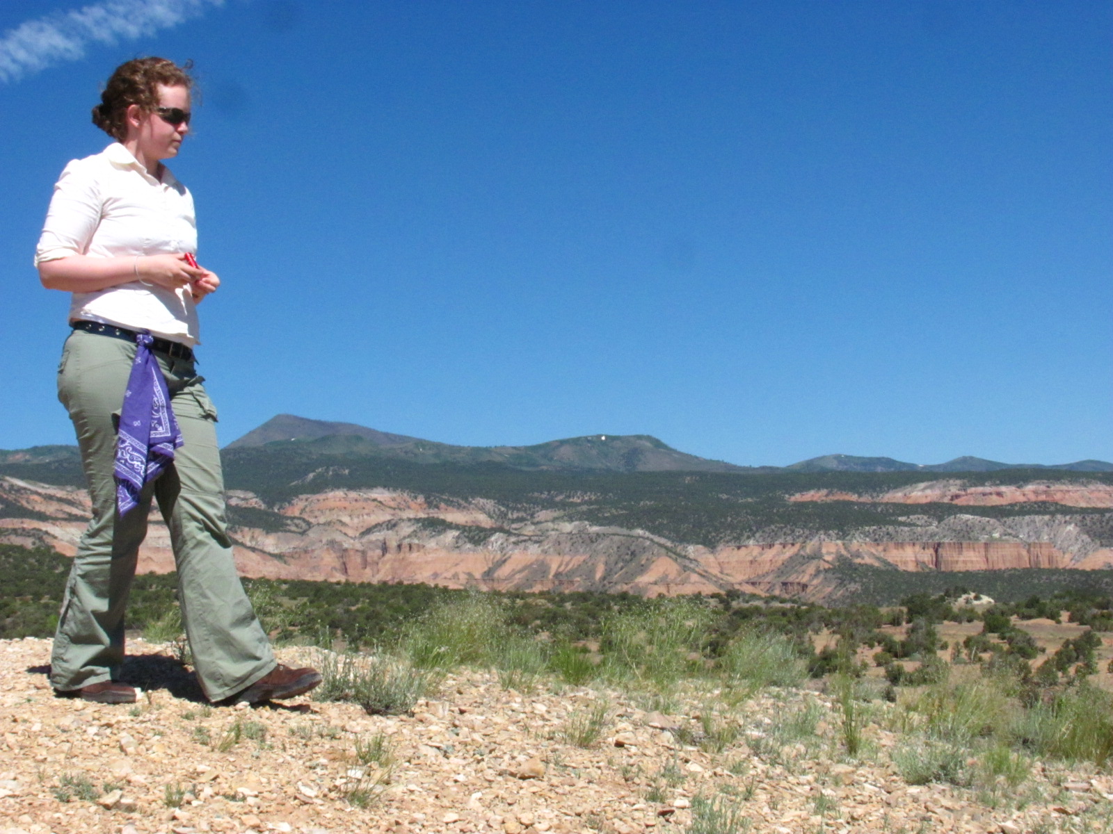
Part of our orientation as campground hosts was to tour the Cathedral Valley District with a ranger on one of our days off. This would allow us not only to have an expert guide showing us the way but also 4-wheel drive is definitely needed for this trek, something we don’t have. This was going to be an all day excursion to the north end of the park so packing a lunch and plenty of water was required. Our supervisor, Ranger Brenda, picked us up around 8am, and also accompanying us on this trip was Laura, a new archaeology intern.

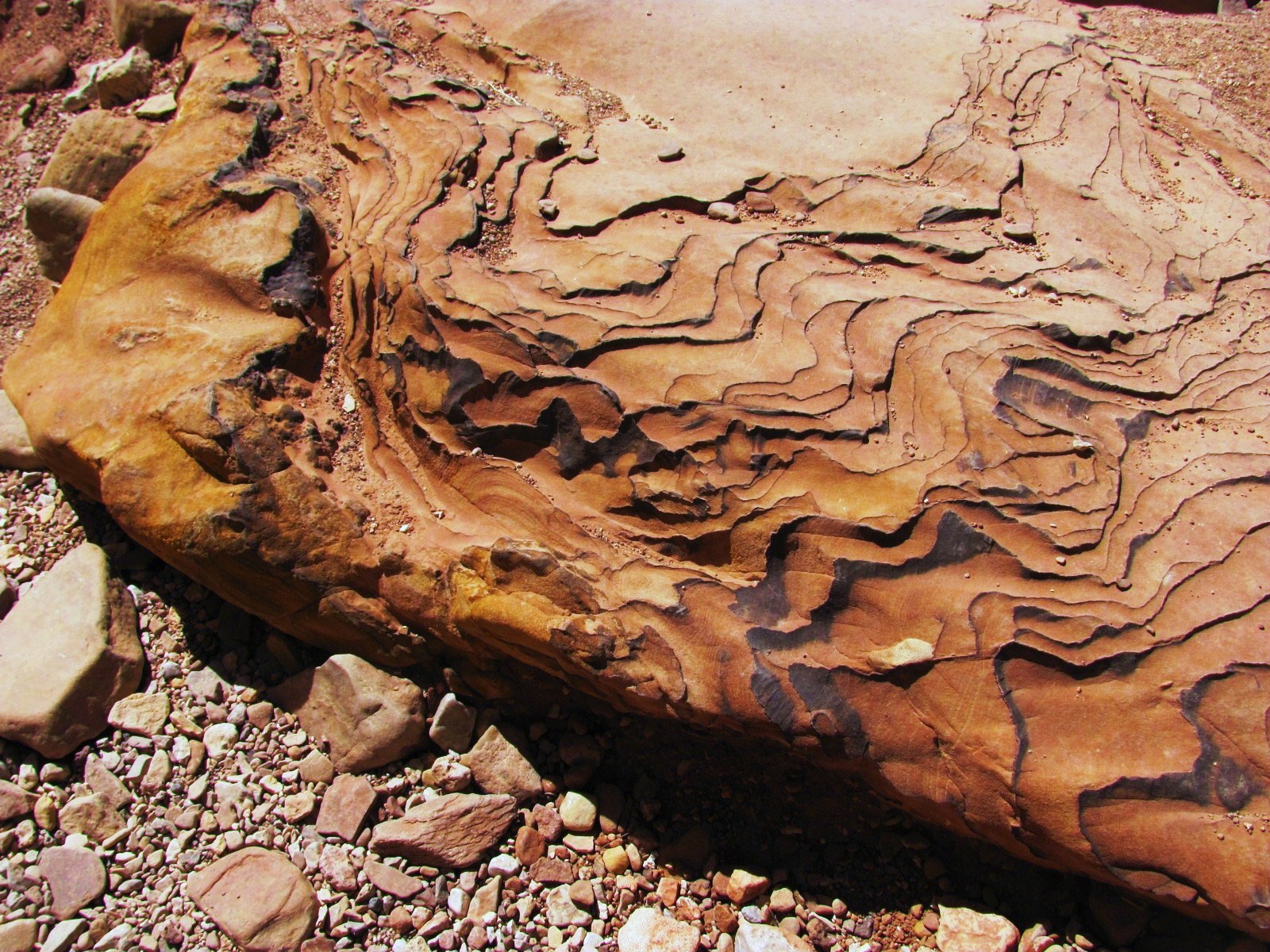
The trip started by heading east on the main road that would take us outside the park where we crossed the Fremont River, which was running about 18 inches deep…a piece of cake for the Tahoe! We were still outside the park boundary for the next 10 miles or so, but the scenery was still amazing as we passed the Bentonite Hills. These hills are said to have been formed from volcanic ash during the Jurassic Period some 156 to 147 million years ago. Bentonite is a type of clay that is characterized by colorful layered bands, and these hills are truly something to see.


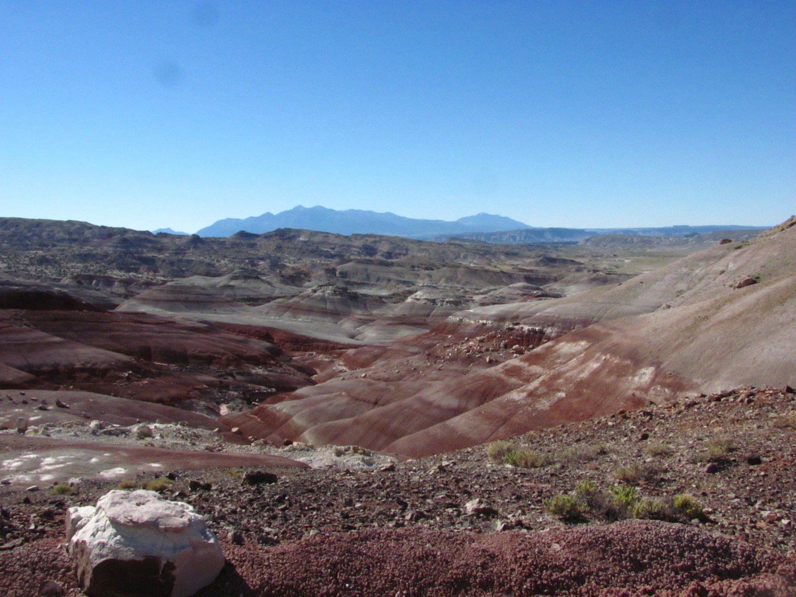
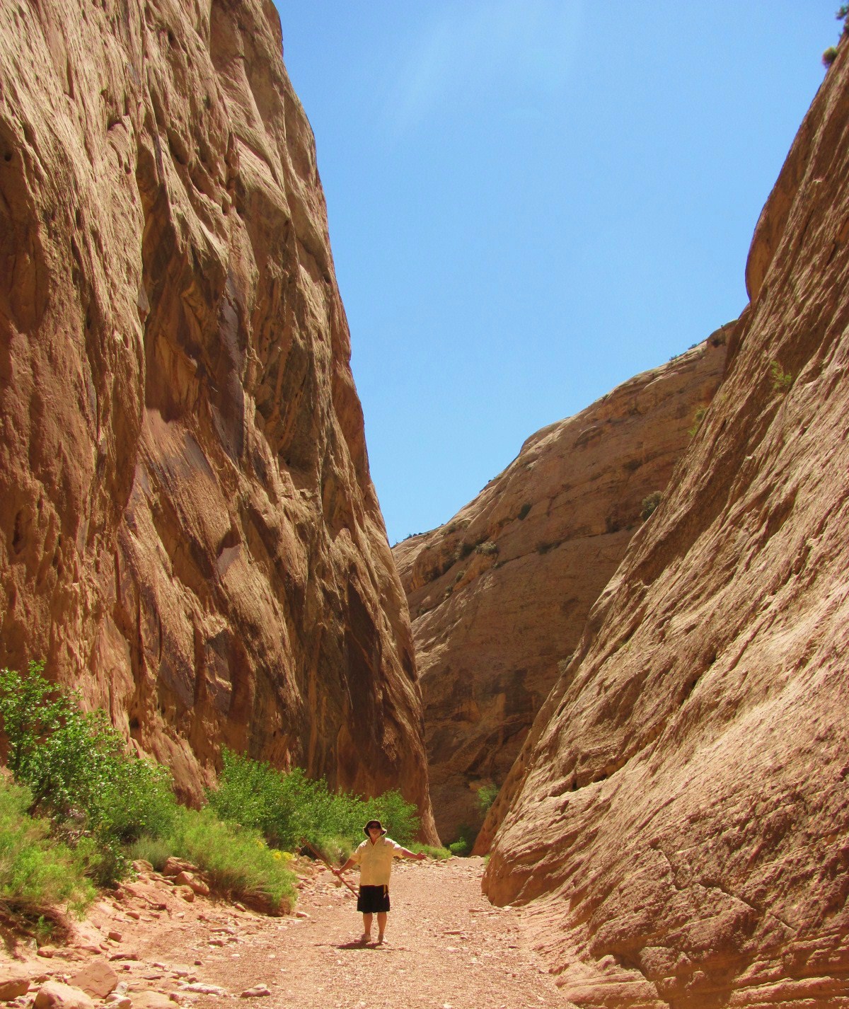
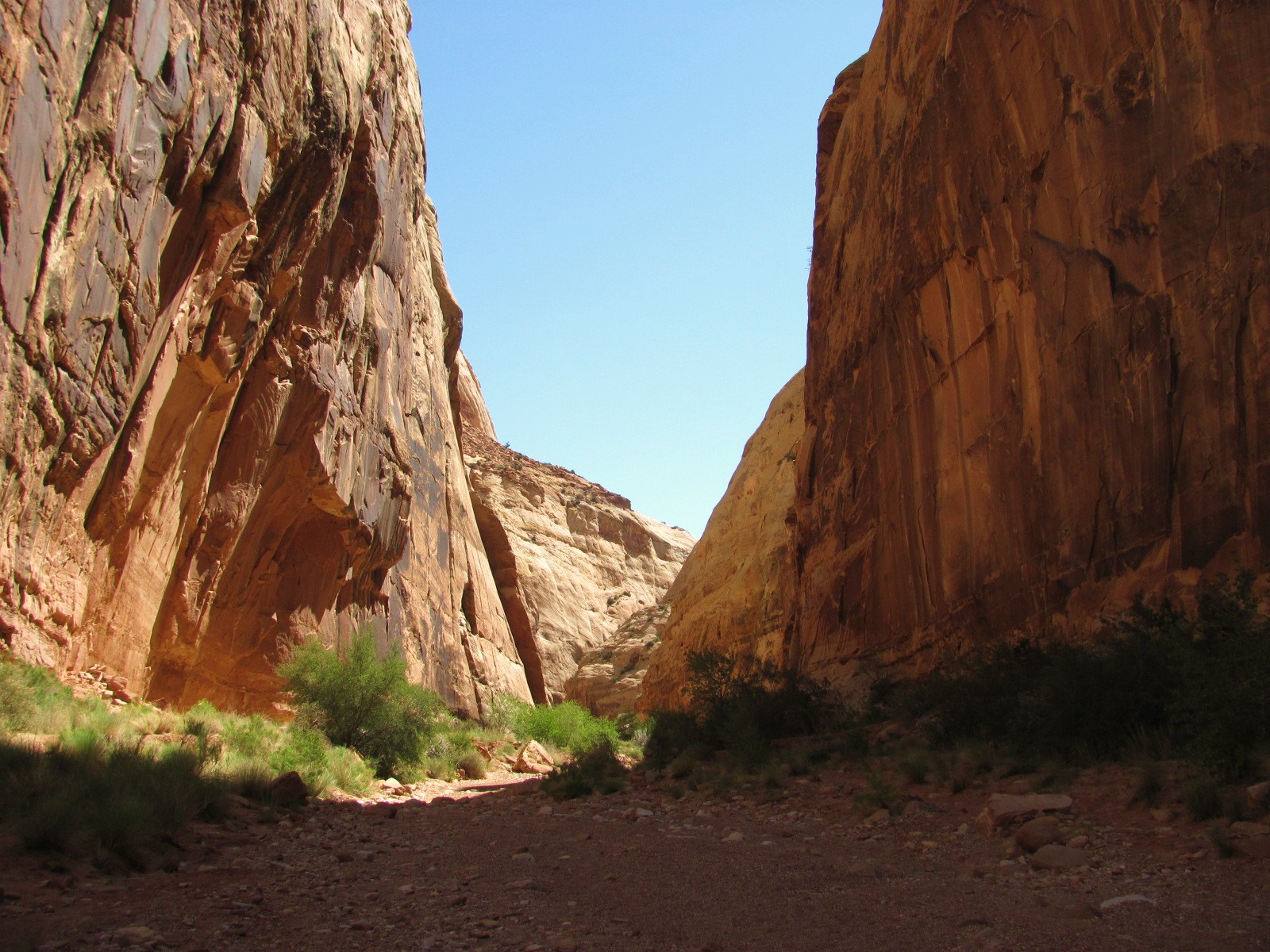
We stopped a couple of times along the way for photos, and once we reached the Upper South Desert Overlook, it was time to get out and stretch our legs. All of us walked part of the trail, but only Laura and I continued on to the top of the overlook. What a spectacular view!


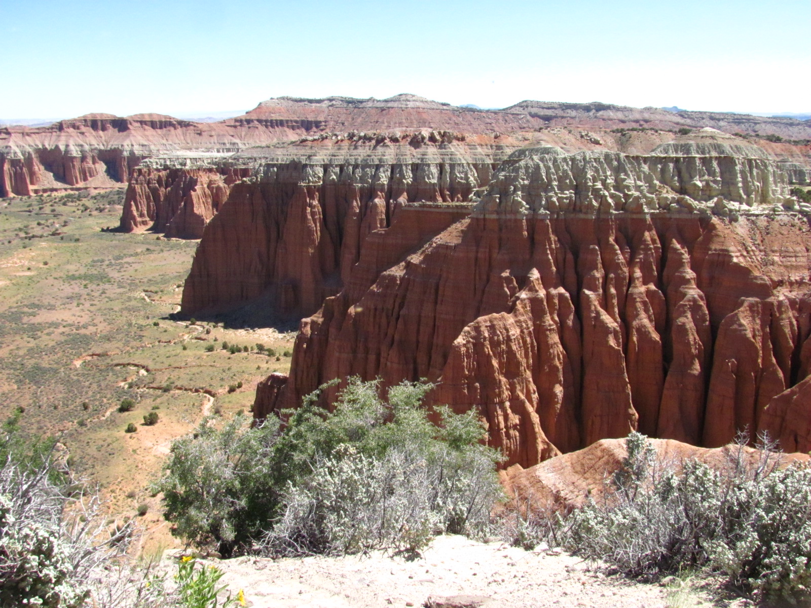
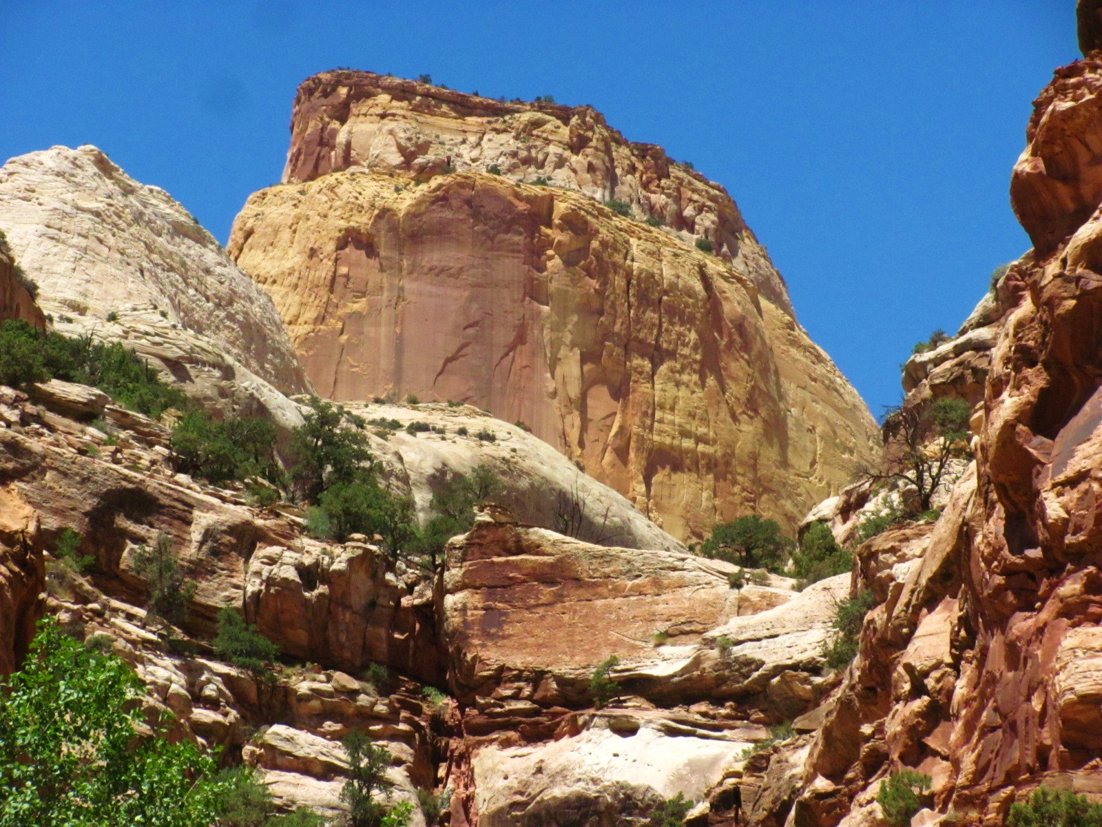
Deep erosion has carved out this area of the backcountry called the Cathedral Valley because of the free-standing monoliths (or cathedrals) that seem to just crop up from the desert floor.

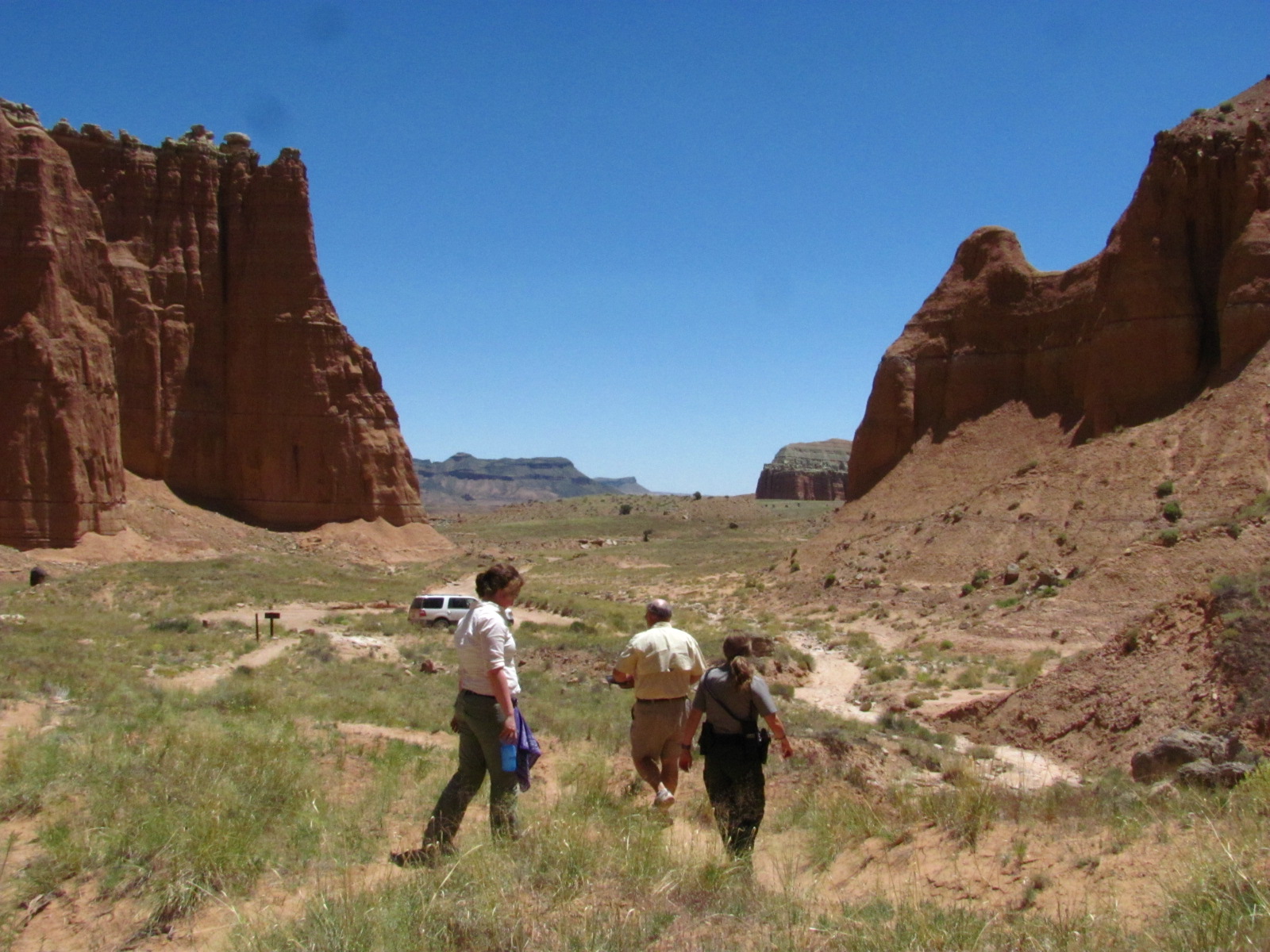
It was now about 11:30 and Brenda planned for us to enjoy our lunch at the Cathedral Valley Campground, another very 
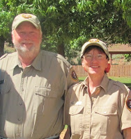
primitive campground like Cedar Mesa in the south with only 6 sites but far less fewer trees. We did manage to find some shade under a juniper and were shortly joined by Rangers Kyle (left) and Alex, who were doing routine patrol of the Cathedral District. Other than these two guys, we saw only one other car during this entire backcountry trip.

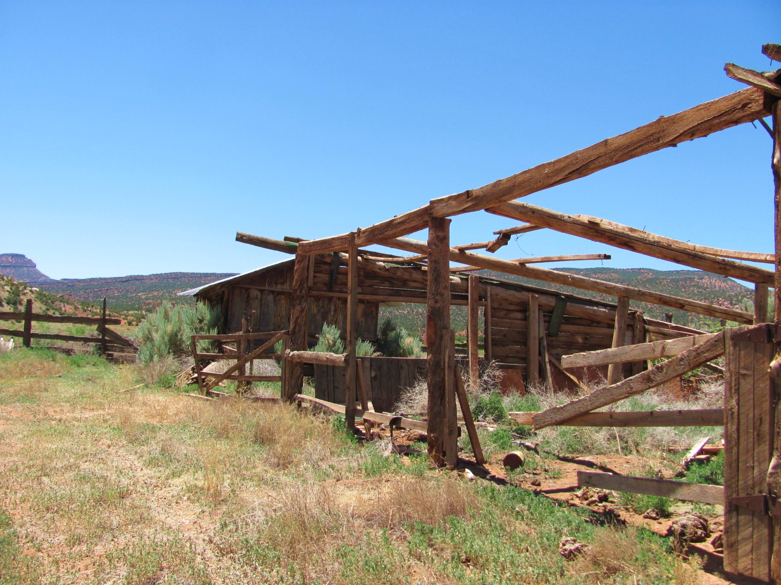
Back in the car we headed down a steep series of switchbacks into the Upper Cathedral Valley where the historic Morrell Cabin is located. It can be accessed by a short walking trail, but Brenda’s seen it plenty of times and Russ says he’s seen enough historic cabins so Laura and I walked through the sagebrush to check it out. This cabin was built in the 1920s and originally stood several miles west of its current location. In 1932 Lesley Morrell bought the cabin, numbered each of the logs, dismantled it, and hauled the pieces down the mountainside in a horse-drawn wagon to be rebuilt on this site
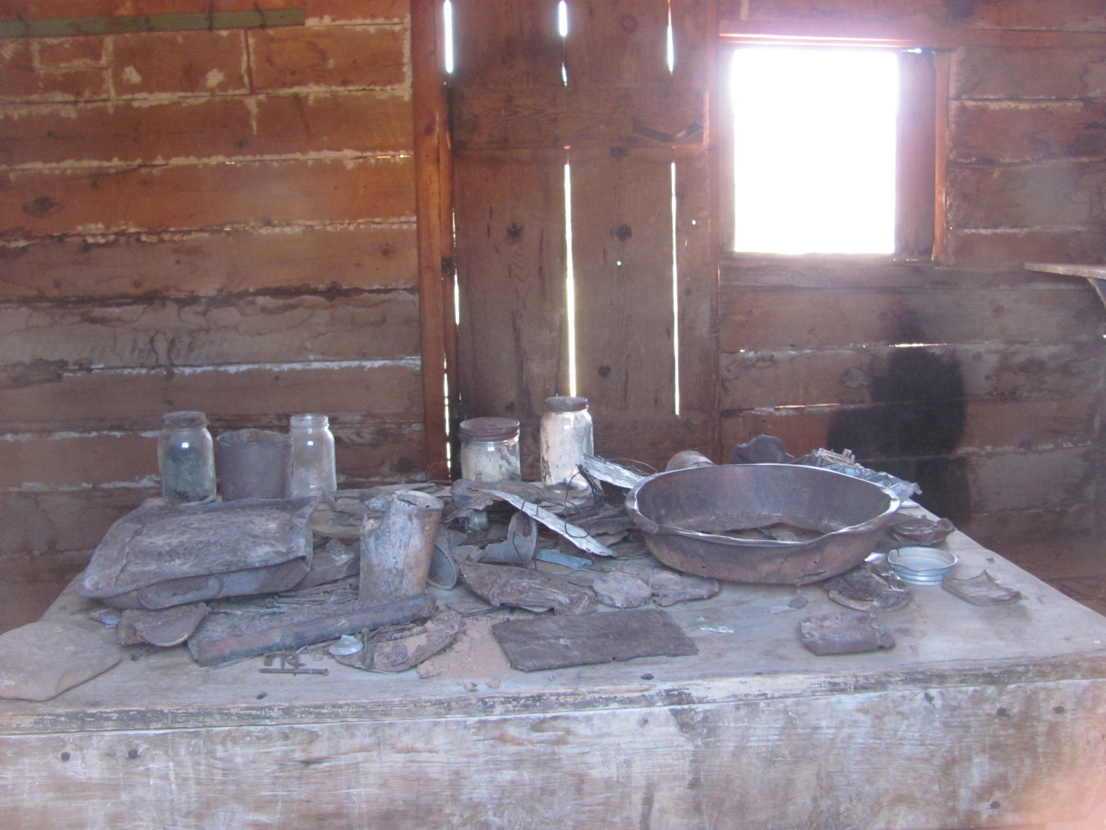
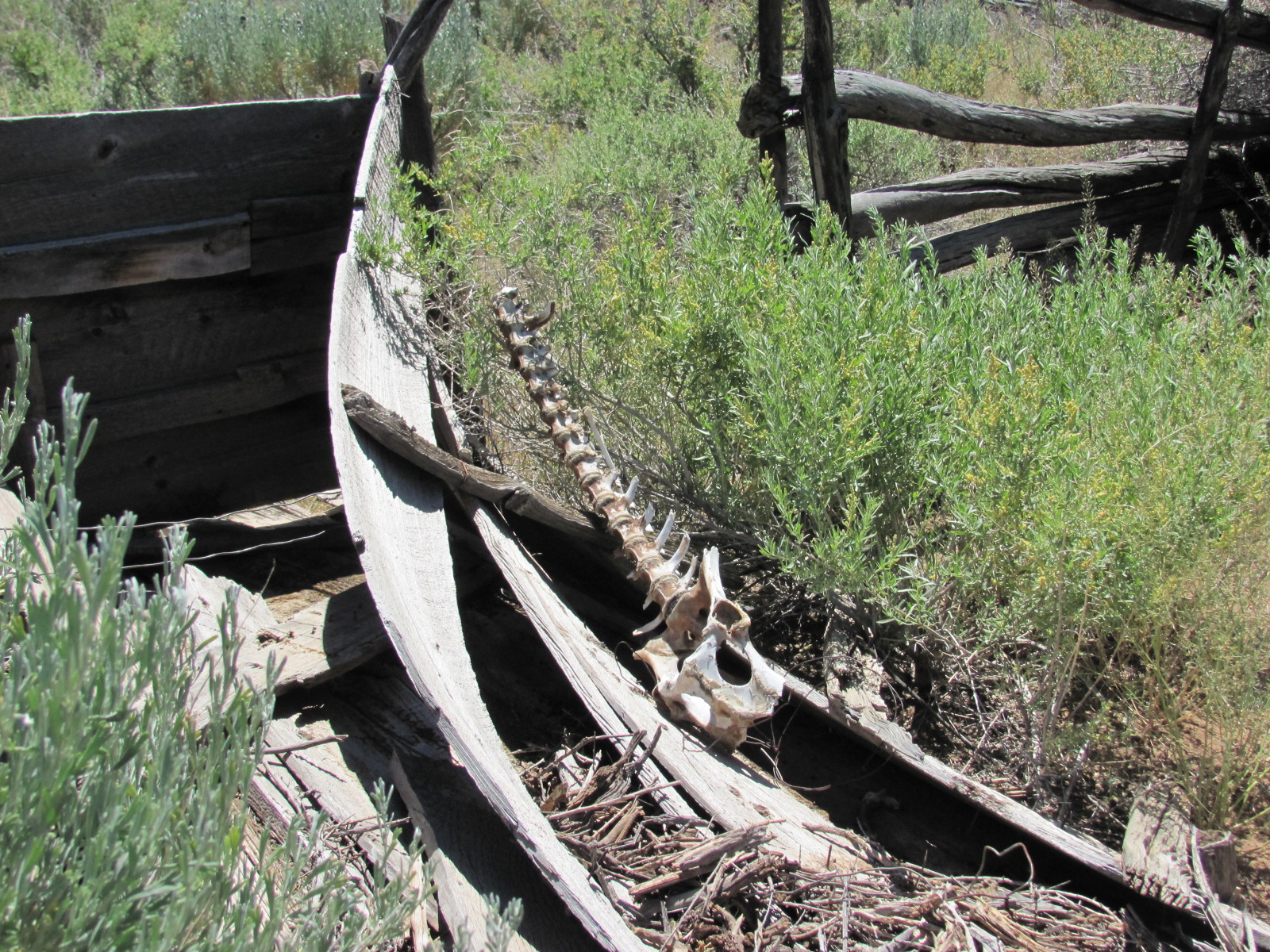
. Over the next 40 years the cabin was used by cowboys annually moving their livestock. As a sign near the cabin reads “Western hospitality dictated that the cabin be kept furnished and stocked with food, open to all who needed shelter or a meal.” It was regularly used until the National Park Service purchased the property in 1970. Though the door was locked, we could peer through the windows and I was able to get a shot of a table strewn with dust covered jars, cookware, and other items for the tired cowboy. Laura will be returning here as part of her job to inventory and update the condition of the cabin and its contents. As we walked past the corral, we noticed the remains of a large animal….a well-cleaned spine in one area and a leg with hoof intact in another area that was probably from a more recent kill since there was also quite a bit of fur laying around.

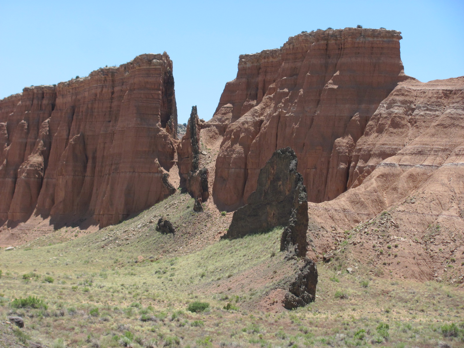
As we continued our drive, we passed several black vertical rocks that Brenda explained were basalt dikes and are what remain long after the soft sandstone around them has eroded away. In this picture you can actually see not only one stand alone dike but also where some are exposed through the sandstone and will one day also stand alone.

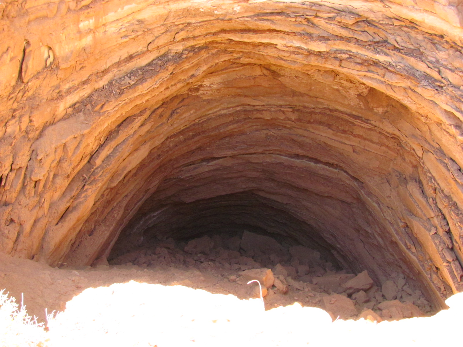
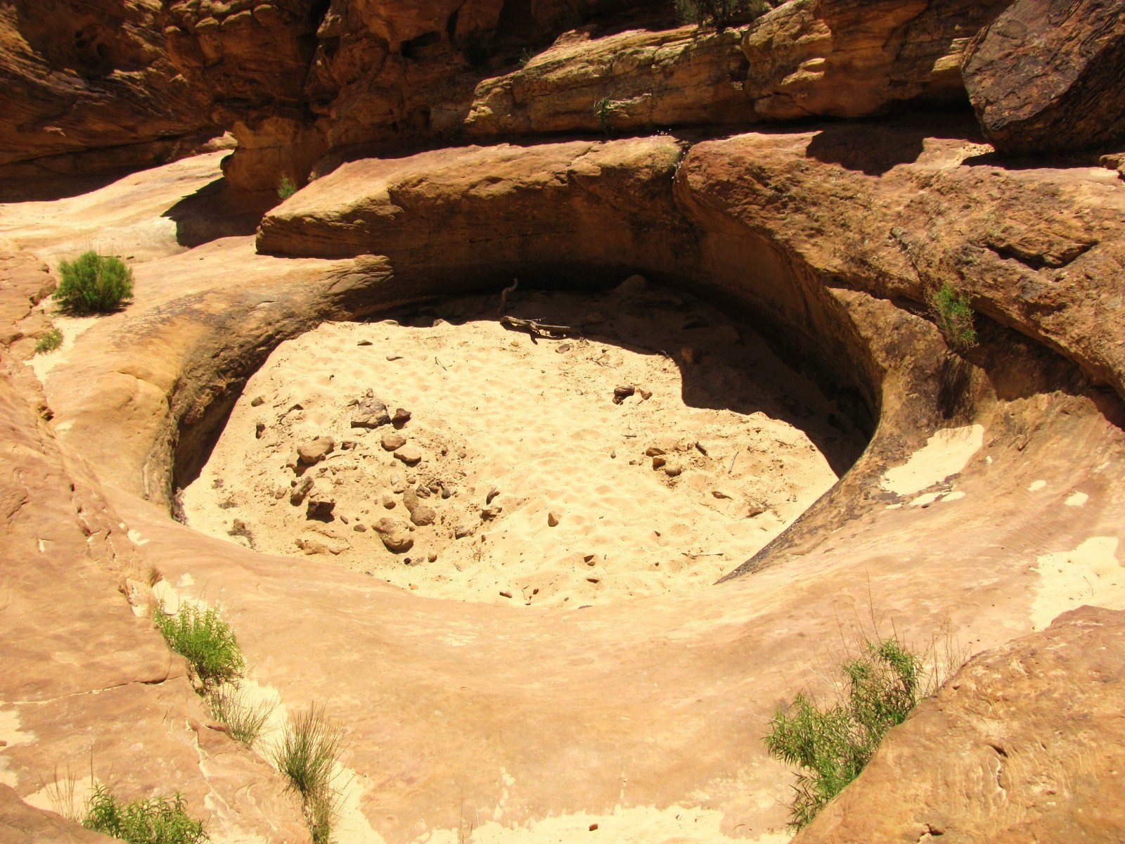
Brenda was leading us towards a specific area she wanted to show us known as the Gypsum Sinkhole that is 200-foot deep sinkhole and about 50 feet in diameter. Gypsum is an abundant mineral in the area, and this sinkhole was created when a plug of gypsum eventually dissolved and collapsed under the weight of the overlying rock layers. I wasn’t able to get a photo of the entire thing partially due to it size, but also because it can be treacherous getting too close to the edge. As we walked back to the car, I was struck by the vastness and relative beauty of this region.

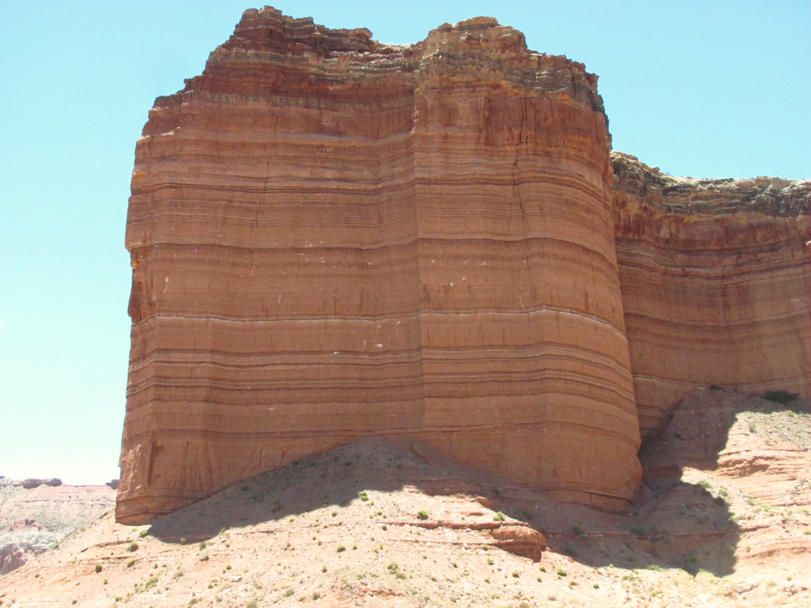
On the way to our next stop, Brenda pointed out the Layer Cake Wall, and by looking at it I’m sure you can see how it got its name. Don’t think we’ve ever seen any geological wonder so evenly layered!


One of the coolest things we saw on this trip was Glass Mountain. More of a mound than a mountain, it stands about 15 feet high and is actually an exposed plug of gypsum that formed as a result of the mineral being deposited about 165 million years ago from evaporating seawater and then crystallized. It’s now being exposed as the soft sandstone around it slowly erodes away…just another one of those geological marvels. Unfortunately vandals have also slowly chipped away at the crystals, and in such a remote area it’s hard to catch them in the act.


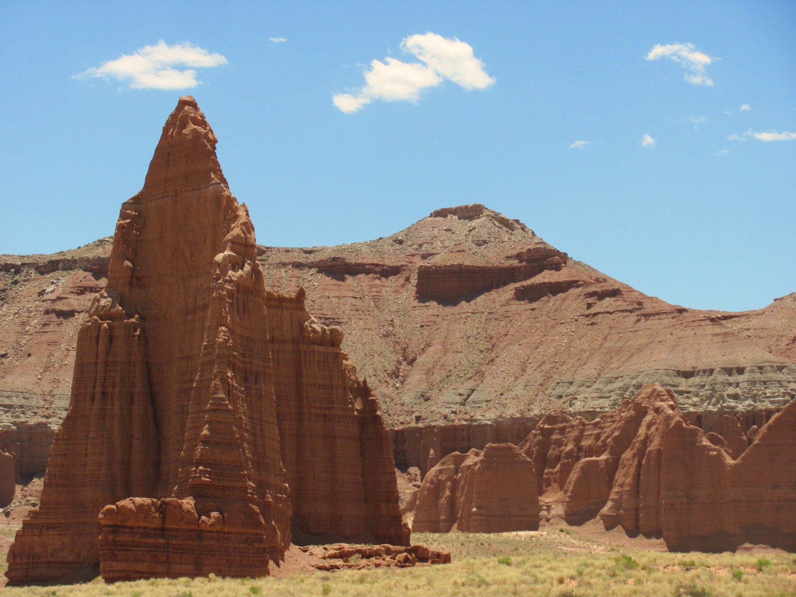
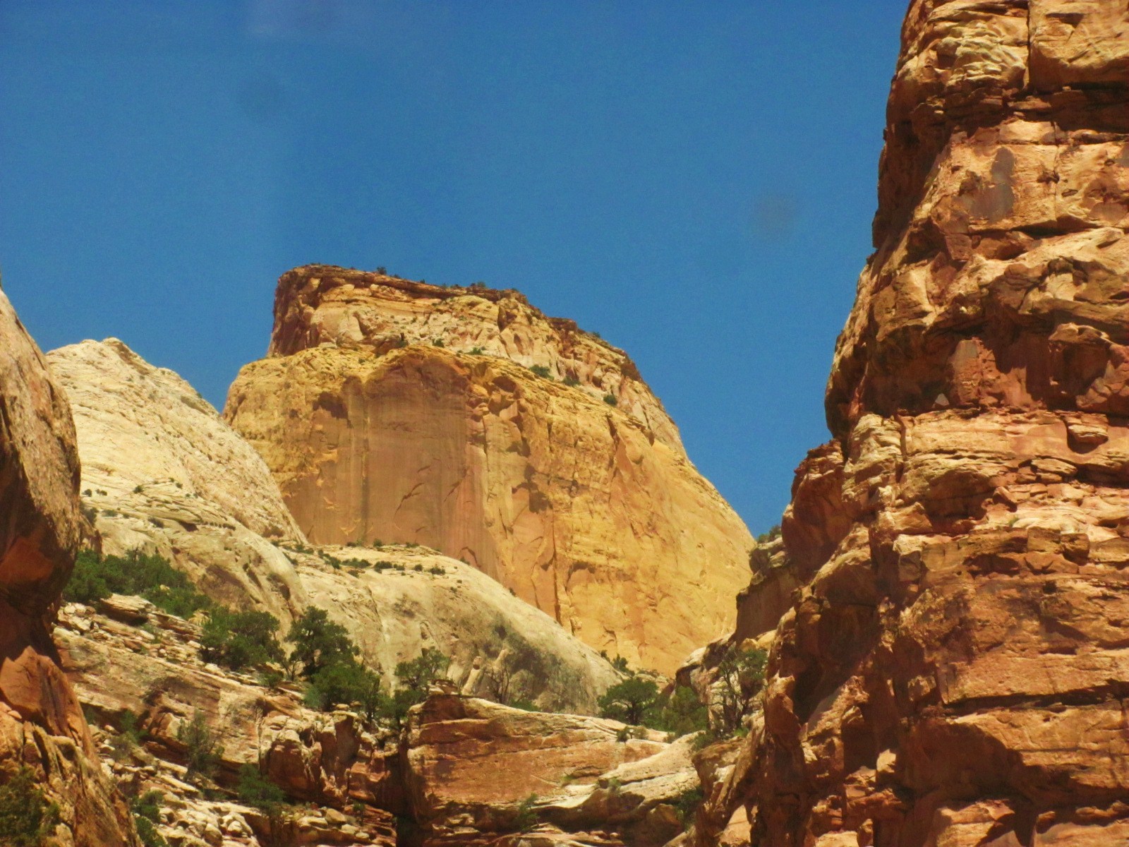
Of course the highpoint of any visit to the Cathedral Valley District is seeing the Temples of the Sun and Moon, massive sandstone monoliths that stand nearly 400 feet tall above the desert floor. Understanding the creation of these cathedrals, cliffs, valleys, and the entire surrounding area from ancient seas, volcanic ash, and ice ages over eons of times can be mind boggling, and its desolate, serene beauty seems almost other worldly.

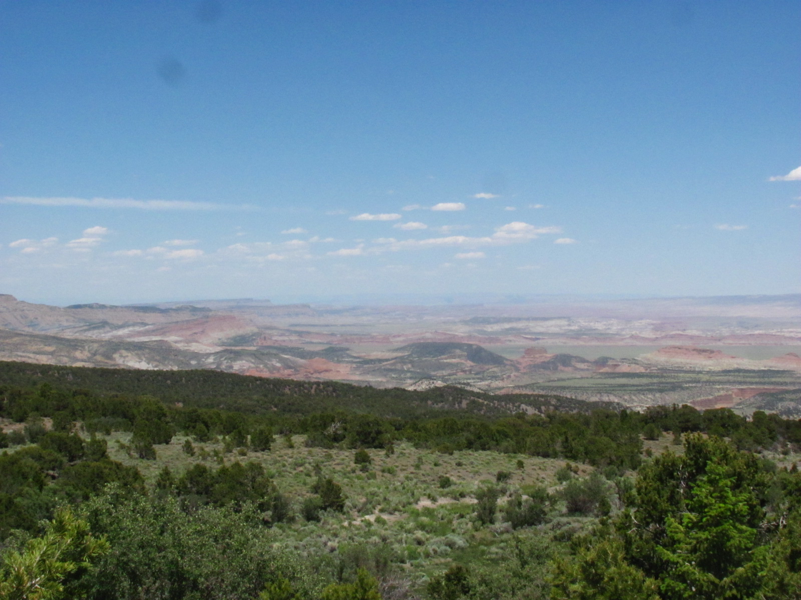
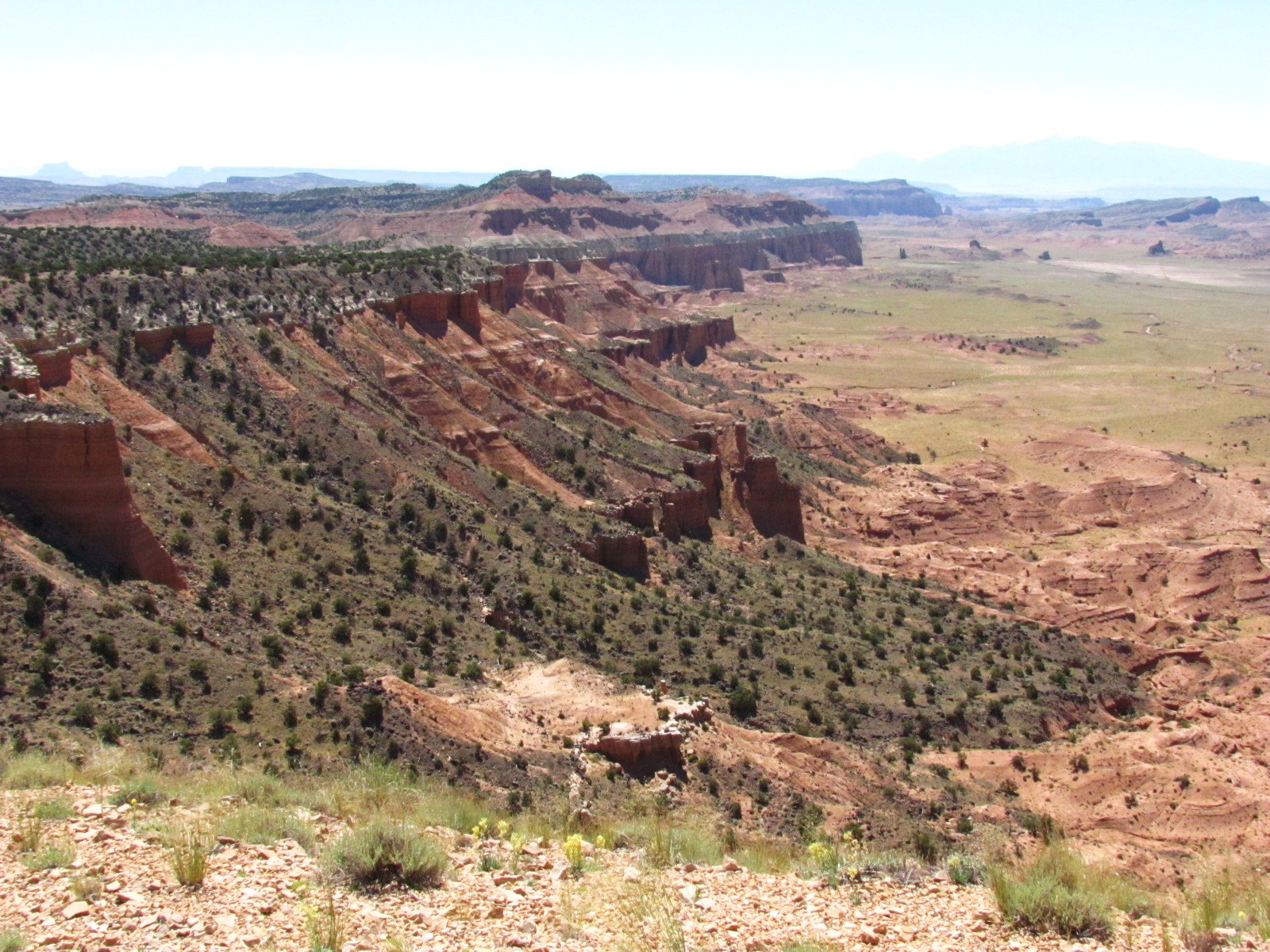
Instead of making the normal 57-mile loop, Brenda had decided to backtrack some and make the return trip back through Fishlake National Forest. As we climbed the mountainous region over a series of switchbacks, we enjoyed some breathtaking views looking back at 
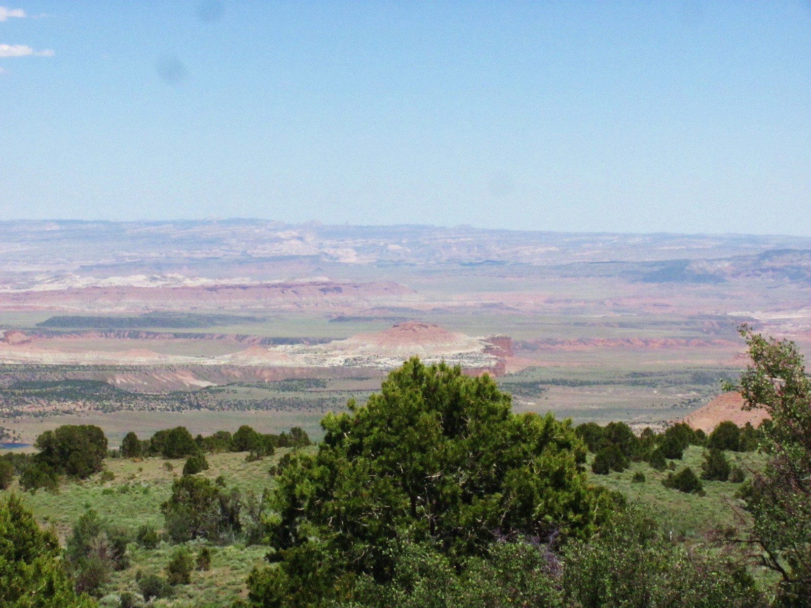
the Cathedral Valley below. We covered about 150 miles on this trip, and Brenda was an excellent guide making the time fly. Capitol Reef is truly an amazing and diverse national park with so much to see.

Wednesday, June 22, 2011

A Pleasant Drive

Besides Capitol Gorge Road at the end of the Scenic Drive, there is another unpaved road off to the right known as Pleasant Creek Road. It’s three miles to the creek, which we were able to easily navigate in our car, but once the creek is reached, 4-wheel drive is needed to not only cross the creek but to travel the remaining 10 miles or so called South Draw Road.

Along the way we passed the Capitol Reef Field Station (http://www.uvu.edu/crfs), a facility located in the heart of the park and dedicated to education and field research. A dirt road off to the left takes you to the station which is situated on top of a mesa so we took a little side trip up the hill. We stayed in the car and only toured the parking lot since prior approval is needed for a visit. Its four modern-looking, energy-efficient buildings blend in well with the surrounding landscape. Opened in conjunction with Utah Valley University in 2008, the dorms can accommodate 24 overnight guests and allows students and teachers a classroom environment for field observation, research, and interpretation.

Back on Pleasant Creek Road, we also passed the remains of Sleeping Rainbow Ranch, a former dude ranch built in the 1940s that was so named by its original owners for the layers of colorful rock found in Capitol Reef. Unfortunately all that’s left are a couple of old crumbling buildings and corrals.

When we reached the creek, we naturally got out to explore the area. The creek seemed to be flowing pretty good but without 4-wheel drive, there was no way we were going to cross it. Even though this is a desert environment, with the nearby creek there were plenty of flowers in bloom and not just cactus flowers. We would have stayed longer to explore, but there were some nasty biting flies swarming around (and biting!) so we high-tailed it back to the car (after getting some photos, of course).


Since we could go no further, we headed back towards the Scenic Drive, and once there, decided to take another drive down Capitol Gorge Road. Different times of day create different views depending on sun and shadows, and it seems there’s always something you missed the first time through. The drive also afforded us another spectacular view of The Golden Throne.


Sunday, June 19, 2011

4 Years & Counting!

The old saying “time flies when you’re having fun” surely describes the past 4 years because it doesn’t seem like we’ve been on the road that long. Today marks our 4th anniversary, and this year, as you know, we tried our hand at campground hosting. This just happens to be one of our days on duty so no time to celebrate, but that’s ok…we can still reminisce and be grateful for this wonderful opportunity we’ve had to see so much and meet so many great people.

The animals are still hanging in there with us. Mikey will be 15 later this year and Abby just turned 9 while Jo turned 17 a couple months ago. All seem to enjoy discovering new places especially the dogs because of all those wonderful new smells at every stop!

Once again we made our trek out west spending a couple of months between Grand Teton National Park and Yellowstone doing one of our favorite things…watching the wildlife. We also spent nearly 3 weeks just outside Washington, DC, making the drive into our nation’s capital many times day and night. So much to see and do there for free!

We made our annual month-long trip to St. Louis, spending time with old friends and family. Our annual tailgate party in downtown St. Louis that 4 years ago had 15 people in attendance grew to nearly 50 this year. And of course we went east to visit Russ’ sister and family in NJ, and Susan’s sister and husband in DE. It’s been so great that we’ve been able to spend quality time with so many, and we’ve joked that we’ve seen more of our family and friends in the last 4 years than we did in the previous 25!

Spending our winters in the Orlando, FL, area allows us visits to see Mickey and his friends as often as we like, and Walt Disney World is so beautiful at Christmas.

We don’t know where this journey will continue to lead us, but we are truly appreciative for all that we've experienced and look forward to another great year.

FOUR YEARS BY THE NUMBERS
35,409 RV miles
34,171 Saturn miles
11,158 feet highest elevation
4,651 gallons of diesel
1,852 monthly health insurance premium
625 longest 1 day drive
184 National Parks/Monuments Cancellations (in our National Parks Passport book)
151 most consecutive days in one place
106 campgrounds
106 highest temperature
85 National Parks/Monuments visited
80 cost of an annual National Parks pass (well worth the investment)
45 cost of our C2C campground membership (best investment we have ever made)
40 states traveled in
37 states spent the night in
35 annual maintenance fee for our campground membership
23 Saturn mpg
20 Junior Ranger badges earned
18 lowest temperature
18 family members visited
16 Sweet Adelines choruses visited
16 nights spent in Wal-Mart parking lots
12 Missouri Tigers football games
10 State Parks stayed in
8.2 RV mpg
5 St. Louis Cardinals baseball games
4 MLB parks
3 ferry rides
3 nights spent in Camping World parking lots
2 ferry rides that included the RV
2 states of residence
2 countries visited
2 shuttle launches
2 fish caught
1 St. Louis Rams football game

BEST/WORST- 6/19/08

National Park
Picking the best National Park is a tough one. We are going to go with Shenandoah Valley for its sheer beauty and solitude, and Gettysburg for its significance and the most humbling experience. There really isn't a "worst" National Park. Updated 6/19/09: Badlands National Park has to rank as one of the best. We still have not found a bad one. Updated 6/19/10: Badlands may not even be in the top 10 anymore. Yellowstone, Grand Teton, Glacier, Zion, Bryce, Grand Canyon, Canyonlands, and Devils Tower are all amazing in their own right, and are listed in no particular order. Updated 6/19/11: Now that we’ve had the chance to explore Capitol Reef, we may need to add it to the best list though we still haven’t found a “worst” National Park.
Campground
The Fiesta Key KOA in Long Key, FL, with its view out the front window of the Gulf and sunsets is hard to beat. Shiloh's RV & Travel Resort in Monroe, LA, was by far the worst. Updated 6/19/09: Hart Ranch in Rapid City, SD, and Pine Island RV Resort in Jay, OK, are two of the best. Although Shiloh is still the worst, Frosty Acres Resort in Schenectady, NY, comes close. Updated 6/19/10: Long Key State Park has to be added to the best…ocean 20 ft. in front of the RV. Updated 6/19/11: No change.
Location
Long Key, FL, and Front Royal, VA, were equally enjoyable. No need to rush, no traffic, just the time to spend as you like. See Monroe, LA, for the worst. Updated 6/19/09: Add Rapid City, SD, to the list of best. Updated 6/19/10: Long Key State Park and any of the national parks of the Colorado Plateau. Updated 6/19/11: No change.
Restaurant
If you ever make it to Titusville, FL, Dixie Crossroads is the place to eat. If you ever make it to DeFuniak Springs, FL, Bo's Family Country Cafe is a place of last resort. Updated 6/19/09: No change. Updated 6/19/10: Café Diablo in Torrey, UT, has been added to the best. Updated 6/19/11: No change.
Pizza
Lombardo's in St. Louis, MO, is hard to beat. Think it has something to do with the cheese! Buck's in Denham Springs, LA, leaves a lot to be desired. Updated 6/19/09: No change. Updated 6/19/10: No change. Updated 6/19/11: No change.
Roads
Georgia and Texas seem to consistently have the best roads. Louisiana is the worst with New Jersey not far behind. Updated 6/19/09: Illinois and Minnesota have joined the ranks of bad roads. Although we are beginning to realize our federal highways are all in need of repair. Updated 6/19/10: Not sure that they are getting better. Updated 6/19/11: A lot of money being spent but still not much better.
Wal-Mart
The best Wal-Mart was in Front Royal, VA, and had only been open a few days when we visited. The worst is in Berlin, NJ, and we can understand why Russ' sister is not big on Wal-Marts! Updated 6/19/09: With Wal-Mart being our choice for basic staples, we do see a lot of them. Almost all of the newer ones are very nice, and one we visited outside Columbus, OH, is now #1. Updated 6/19/10: No change. Updated 6/19/11: No change.
Supermarket
The Schnuck's in Eureka, MO, was great. We have never been to a Piggly Wiggly that is worth the price of admission. Updated 6/19/09: No change. Updated 6/19/10: Sweetbay in Clermont, FL, is added to the best. Updated 6/19/11: No change.
Bakery
Tellico Grains Bakery in Tellico Plains, TN, was fantastic. As far as the worst, is there really a bad bakery?? Updated 6/19/09: We have stayed away from bakeries! Updated 6/19/10: No change. Updated 6/19/11: No change.
Moment
Another tough one. Watching the shuttle launch, seeing the Milky Way from the Keys, and a big black bear on the Appalachian Trail. The worst moment....was that the awning?!?! Updated 6/19/09: Niagara Falls and Walt Disney World at Christmas can be added to the best, and the awning still ranks as the worst. Updated 6/19/10: Grizzly bears, eagles, and walking The Narrows. Updated 6/19/11: Watching wolf pups frolic in the sage and a mama grizzly teaching her cubs to forage.

A FEW THINGS WE'VE LEARNED
1) A possum is a flat animal that sleeps in the middle of the road.
2) There are 10,000 species of spiders, and most have visited us.
3) Gnats do not taste good.
4) The average person standing on any street corner of any city or town in this country has more common sense than the entire U.S. Congress combined.
5) There are as many varieties of camping vehicles as there are people out doing it.
Updated 6/19/09:
6) Our house batteries are important…take good care of them.
7) Anything under 32 degrees Fahrenheit is cold.
8) We will again watch fuel prices rise throughout the summer.
9) We have more fear coming down the mountain than we did going up.
10) Financial experts/advisors are pretty much worthless. Once they get your money, they never recommend selling. They seem to use the same pitch as the market continues to plummet, “All my big clients are buying because we are near the bottom.”
Updated 6/19/10:
11) Time is short and passes quickly.
Updated 6/19/11:
12) As a campground host, you find that everyone is pleasant and super friendly until you have to tell them they cannot do something and then watch out!

Saturday, June 18, 2011

The Main Passage

Capitol Gorge begins as a two mile gravel road at the end of the Scenic Drive and until 1964 was the main passage through Capitol Reef. The drive through the Gorge follows the curves of this water-carved, sheer-walled canyon, and the sun was shining so brightly on the colorful walls that in spots it almost seemed to wash them out but not entirely. One of these areas that we passed along the way was the Tapestry Wall so named because of the vertical shades of color within the rock formation and in the right light the colors seem to change.

The road ends at a parking lot from where you can begin walking the trail through the streambed of the gorge with canyon walls nearly 100 feet high on both sides. The trail is relatively flat and follows an old wagon trail through the canyon that in some spots is only about 40 feet wide. The rock formations that surround you are amazing, and you can even spot an occasional cactus flower in bloom.


In the 1800s and early 1900s travelers who came this way carved their names into a section of the canyon wall that is now known as the Pioneer Register. (Nowadays it would be considered graffiti and you’d be fined $250 for writing on the rocks!) Some of the names are more than 20 feet above the floor of the wash, and we guess they must have stood on their buckboards to achieve this. We were expecting some sort of orderly fashion to the register with perhaps a date at the top and the names carved nicely below it. However, it’s really just a hodge-podge of names and dates, some written over others, including some more recent ones…still kind of cool though. (You may need to double-click the photo to enlarge and get a better view.)

We continued down the trail heading to The Tanks, which are pockets hollowed out in the stone from the elements over time that can hold gallons of rainwater, a vital source in this desert climate. Some are quite small, but we’ve heard that there are some in the back country that are as large as a swimming pool! These pockets of water help give the Waterpocket Fold its name. The trail to get to these tanks is a series of little switchbacks marked with rock cairns with an elevation change of about 80 ft. (at least that’s what the trail sheet said but seemed like more than that to me!) We scrambled our way up, but when we reached The Tanks it was a little disappointing as they were completely dry and appeared as just holes in the ground. There was a little bit of water in a crevice area but that was it. Glad we weren’t thirsty pioneers looking for promised water! Oh, well, it was a good hike.

We made our way back down and started back along the gorge the way we came, continuing our walk in the streambed passing some more interesting rock formations that we hadn’t seen going the other way. The one pictured at left is actually not very big and about shoulder high off the ground so I was able to get a nice closeup. We also stopped to capture a photo of the Golden Throne, towering in the distance at 1,400 feet above the road. At one point we noticed a couple people walking on a trail that hugged the canyon wall a couple feet above us. We decided that might be easier walking than on the gravel and rocks in the wash so we climbed up and found a nice dirt path. A few feet further we noticed a signpost facing the opposite direction. When we got in front of it we found that it read Petroglyphs with an arrow pointing towards the canyon wall. We hadn't noticed the dirt path initially and thought the trail began in the streambed (they do merge together at one point). Anyway, the Fremont Indian petroglyphs are worn quite a bit and over the years there has been some vandalism with people using them as target practice, but they’re still really cool to see.

A couple days later we had to go into Torrey and had our first “fast food” burger since we arrived at the beginning of April. There are actually two burger joints in town situated directly across the street from one another. Everyone told us that the burgers at Slackers were much better than those at Chillz so we decided to give it a try. Slackers Burger Joint runs a daily special (1/4 lb. burger and fries for $4.99), and we ordered two. We brought a soda to share and sat outside on the patio enjoying a lovely day. Even at 2 in the afternoon, the parking lot was packed and the place was hoppin’ (only 2 cars at Chillz). They have an extensive menu including several varieties of burgers, sandwiches, salads, handmade shakes, and much more. We can’t compare the two places, but the folks were right about the yummy burgers and fries. Of course maybe it was just because we haven’t had a burger or fries in over 2 months! Guess if you’re ever in the area you’ll just have to check it out for yourself.