Wednesday, June 30, 2010

Back In Time

*Critters we’ve seen on our 2010 trip so far: javelina, mule deer, desert grassland whiptail lizard, white-tailed antelope squirrels, jackrabbit, juvenile Chuckwalla, Great Basin collared lizard, bats, llamas, Utah prairie dogs, chipmunks, coyote, yellow-bellied marmot
*Birds we’ve seen on our 2010 trip so far: white-wing dove, ravens, Gamble’s quail, western tanager, roadrunner, violet-green swallow, California condor, great blue heron, mountain bluebird, wild turkey, black-chinned hummingbird, juniper titmouse, magpie
*National Parks/Monuments visited on 2010 trip so far: 18
*State Parks visited on 2010 trip so far: 4
*Total number of Jr. Ranger badges so far: 18

[Click on any picture to enlarge…then arrow back to the blog]

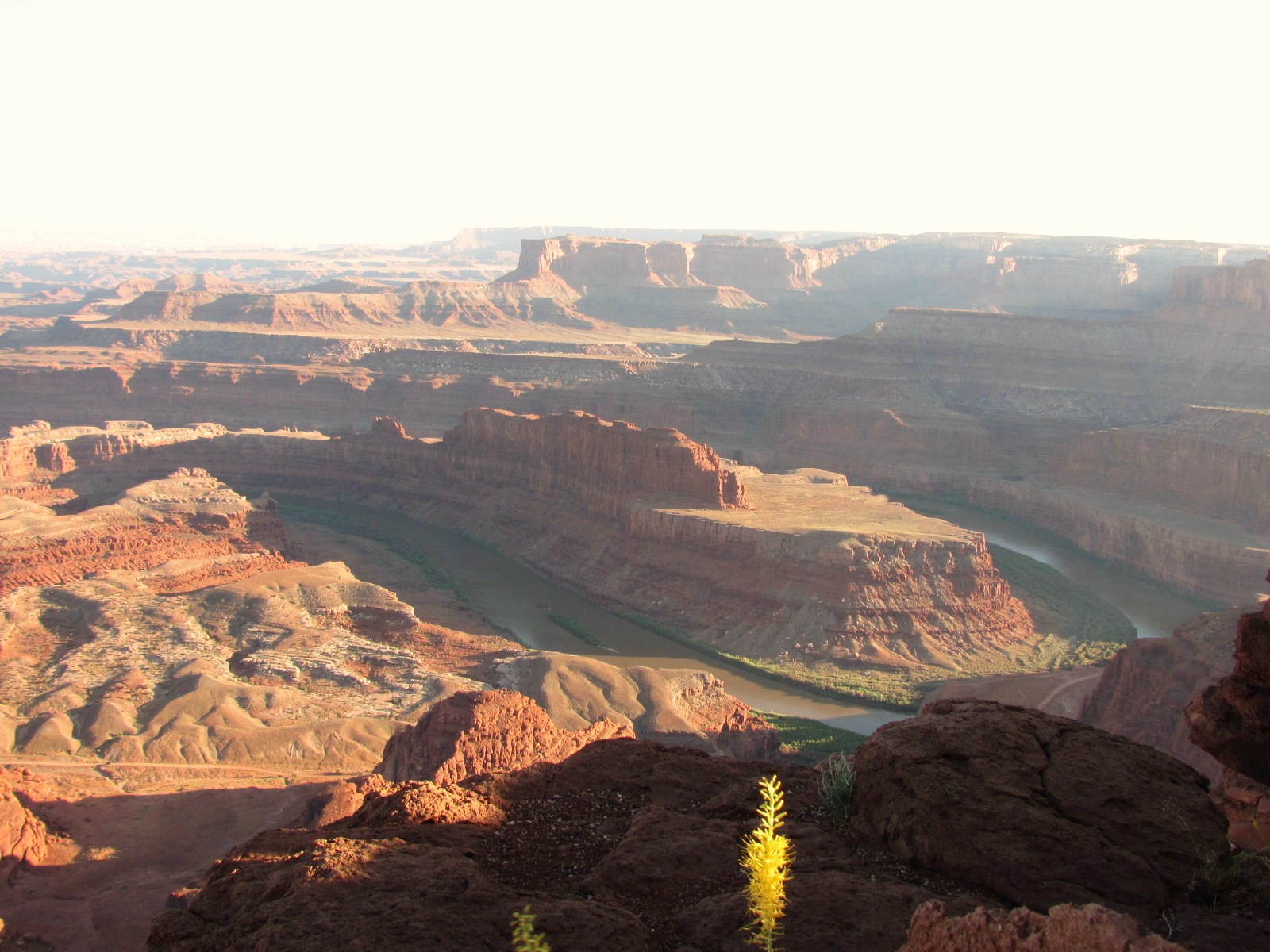
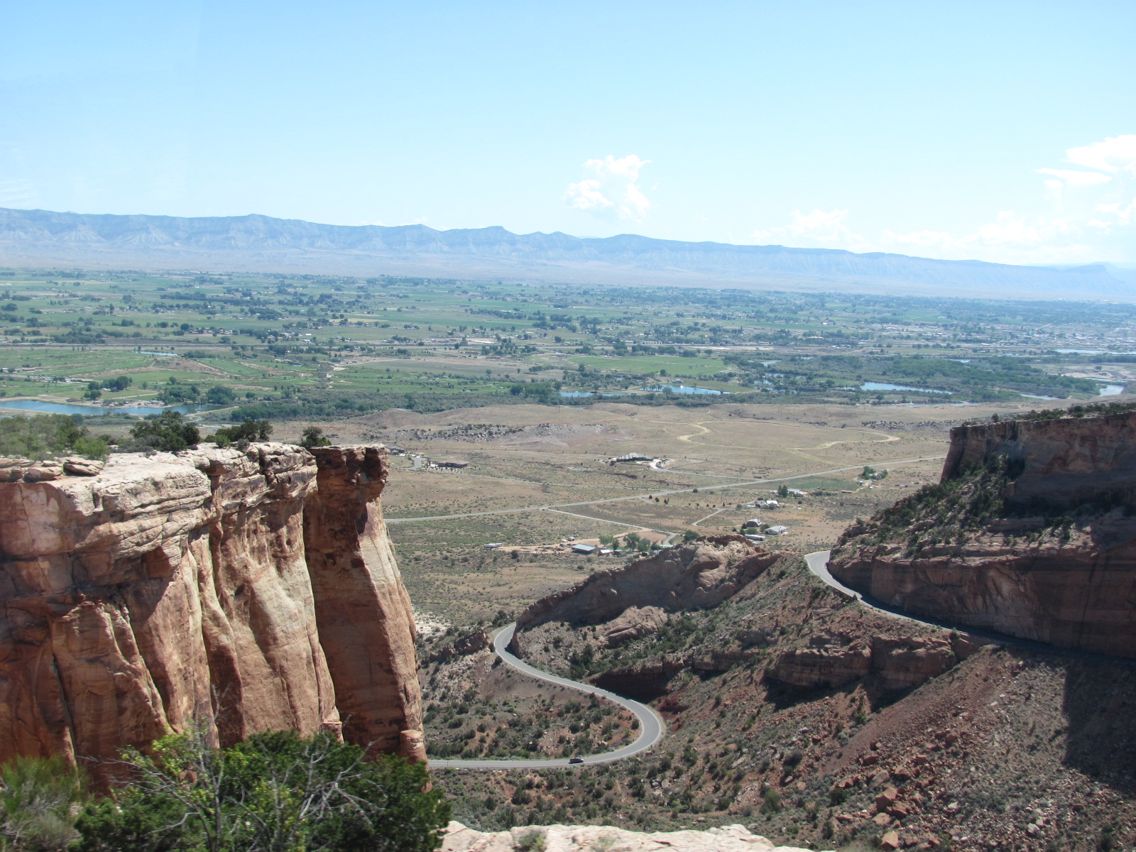
Our next stop added another state to where The Folly has spent the night since Colorado National Monument (www.nps.gov/colm) is located between Fruita and Grand Junction, CO. We arrived through the west entrance (Fruita) on Fri., driving the first 4 miles of Rim Rock Drive to the campground. This drive is 23 miles of switchbacks with an elevation change of approxim
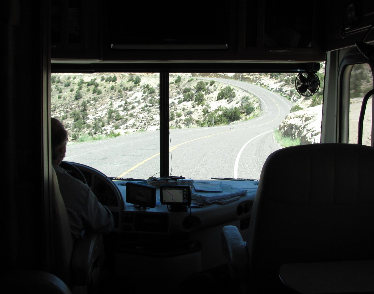
ately 1,100 feet, and the view at left is from close to the top looking back down the road. There are two tunnels on this section of the drive with a center height of 16’ but 11’5” near the edges. Our RV’s height is just under 13’ so to be safe we basically needed to drive down the center of the tunnels, which was a little unnerving a times!

There are no hookups at Saddlehorn Campground, and while pinyon and juniper trees are abundant throughout, they are small and offer little shade. We were just hoping the house batteries would continue to work properly with the hot weather. Even after 3 years, there’s still a lot we really don’t know about the inner workings of drycamping. Though generators could run from 8am-8pm, we didn’t want to run it the whole time for two reasons: 1) the constant noise would probably disturb other campers 2) it would use a lot of our diesel. So we tried to be sparing with its use saving it for the hottest parts of the day to run the A/C. These motorhomes heat up pretty quickly inside, and we especially need to be careful because of the animals. In fact Sat. we loaded all 3 into the car and drove about 2/3 of Rim Rock Drive.

Driving among rock layers that are millions of years old, we passed Independence Monument, all that remains of a continuous ridge that once formed a wall between two canyons. We also passed Balanced Rock, Artists Point, Fallen Rock, Coke Ovens, and reached the highest point on Rim Rock Drive at 6,640 ft. before turning around. Since the animals were with us, we 
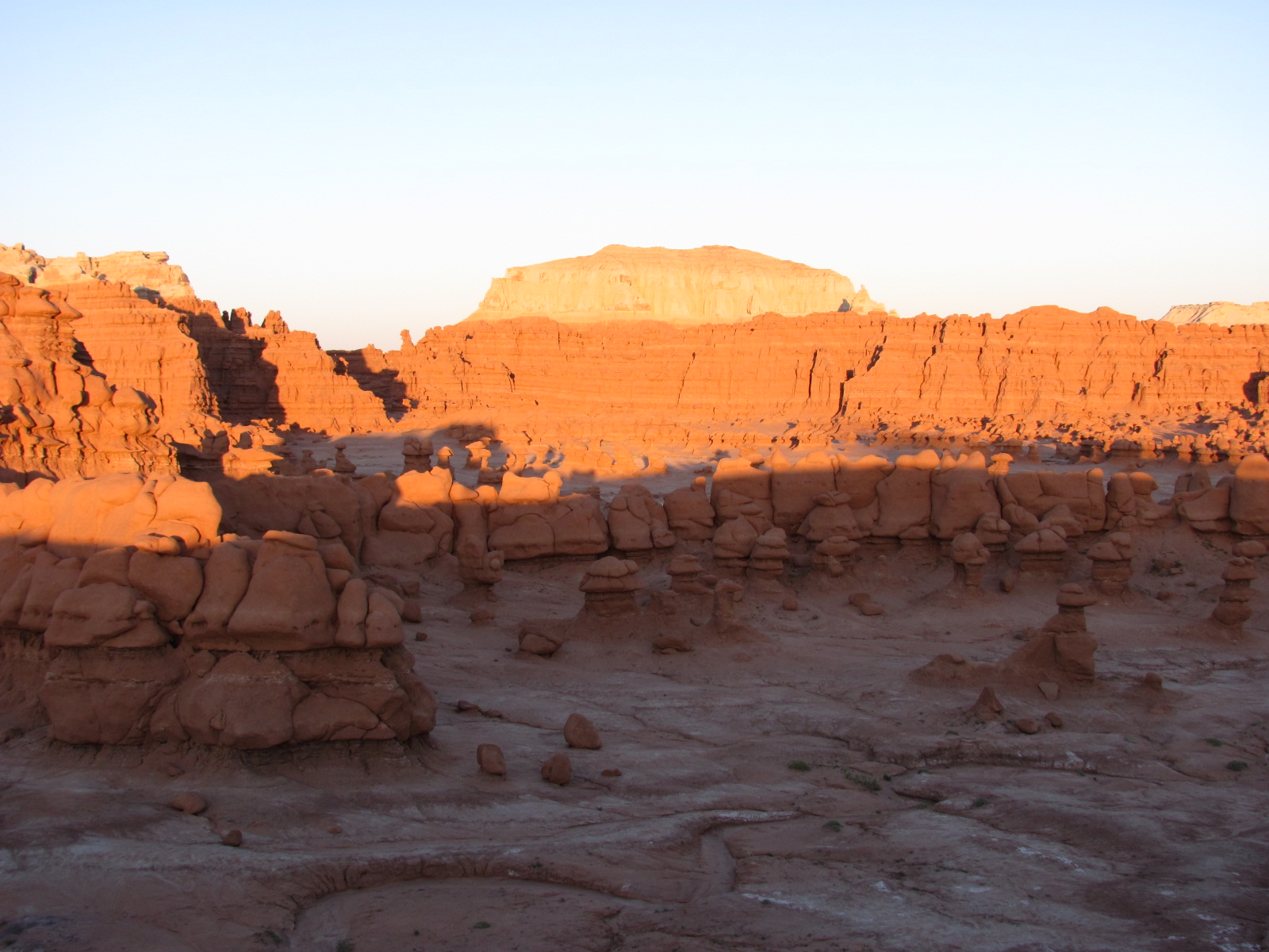
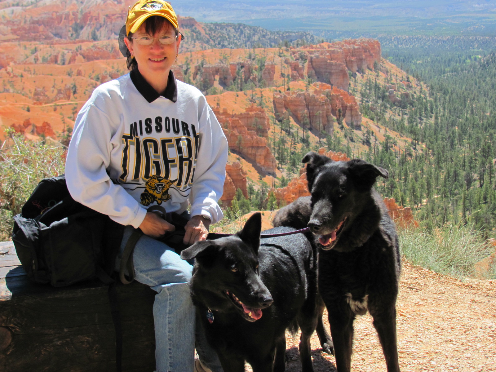
weren’t able to hike any of the trails but did get out taking advantage of some incredible views from the many overlooks. Of course after a month in Utah seeing quite a number of impressive canyons, they were all beginning to look alike and this one wasn’t as impressive as others we’d seen. Had we seen it first, we probably would have been more awe struck. Don’t get us wrong, though, it’s still an incredible place to see. Just realizing the billions of years that it has taken to sculpt and create this masterpiece is mind boggling. Plus we did earn another Junior Ranger badge.

After two nights, we decided to head a little further north and hopefully maybe to cooler weather. We drove the scenic route along Hwy. 139 that took us to a height of 8,268 ft. at Douglas Pass. Our destination was Dinosaur National Monument (www.nps.gov/dino), which stretches across the state line between CO and UT, and is home to the world's largest Jurassic period dinosaur quarry. However, we weren’t able to see the wall that displays the nearly 1,500 fossils since it is only viewable through a glass wall at the visitor center that was being rebuilt, but you can take a virtual tour of it on their website.

We arrived at the temporary visitor center on the UT side of the Monument, and when we walked in to get the lay of the land before heading to the campground, one of the volunteers noticed our Jr. Ranger badges. She told us that not only could we become Jr. Rangers of Dinosaur NM, but we could also earn a Junior Paleontologist badge and gave us the both workbooks! This temporary visitor center has many fossils and exhibits on display plus offers a shuttle to the Fossils Discovery Trail to see unexcavated fossils still embedded in the rock, which we decided we’d do the next day.

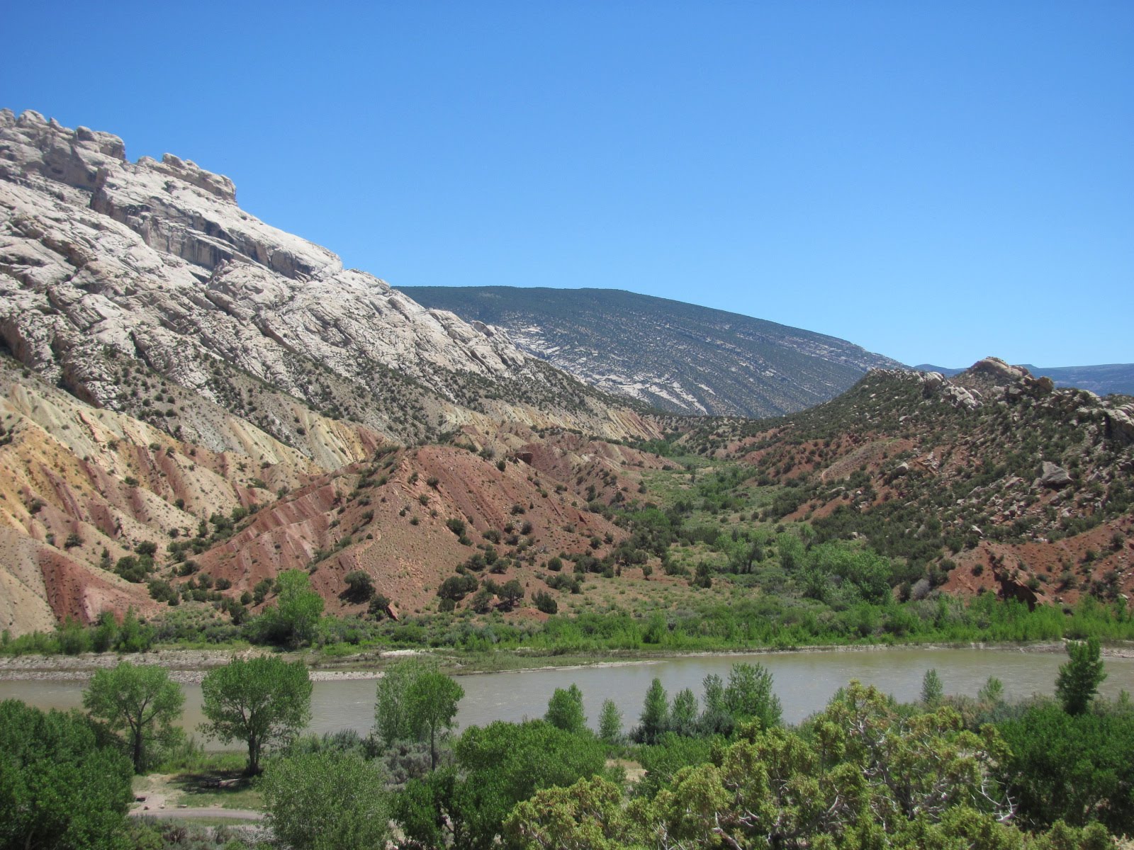
The campground was located along the Green River, a 
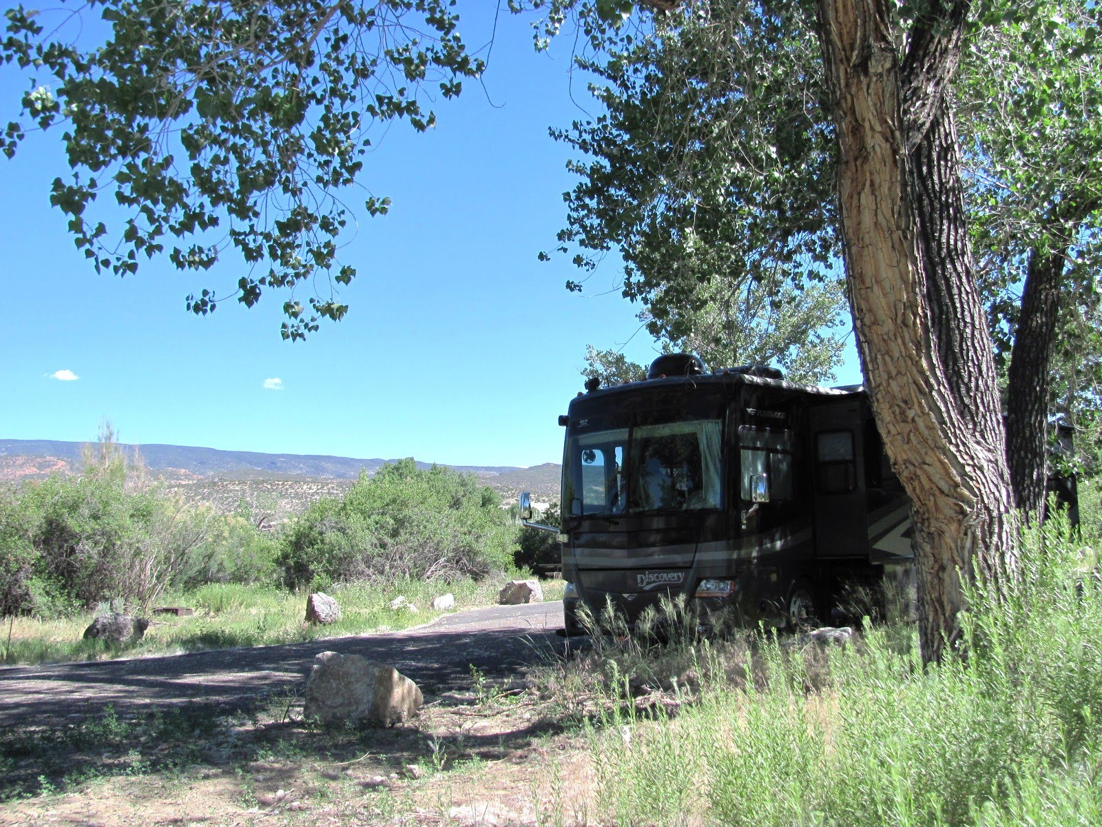
main tributary of the Colorado River, and though we weren’t able to see it from our campsite because of all the trees and brush, it was only a short walk away. The temperatures weren’t much cooler and we still had no hookups, but at least we had a nice shade tree (and still able to get satellite reception).

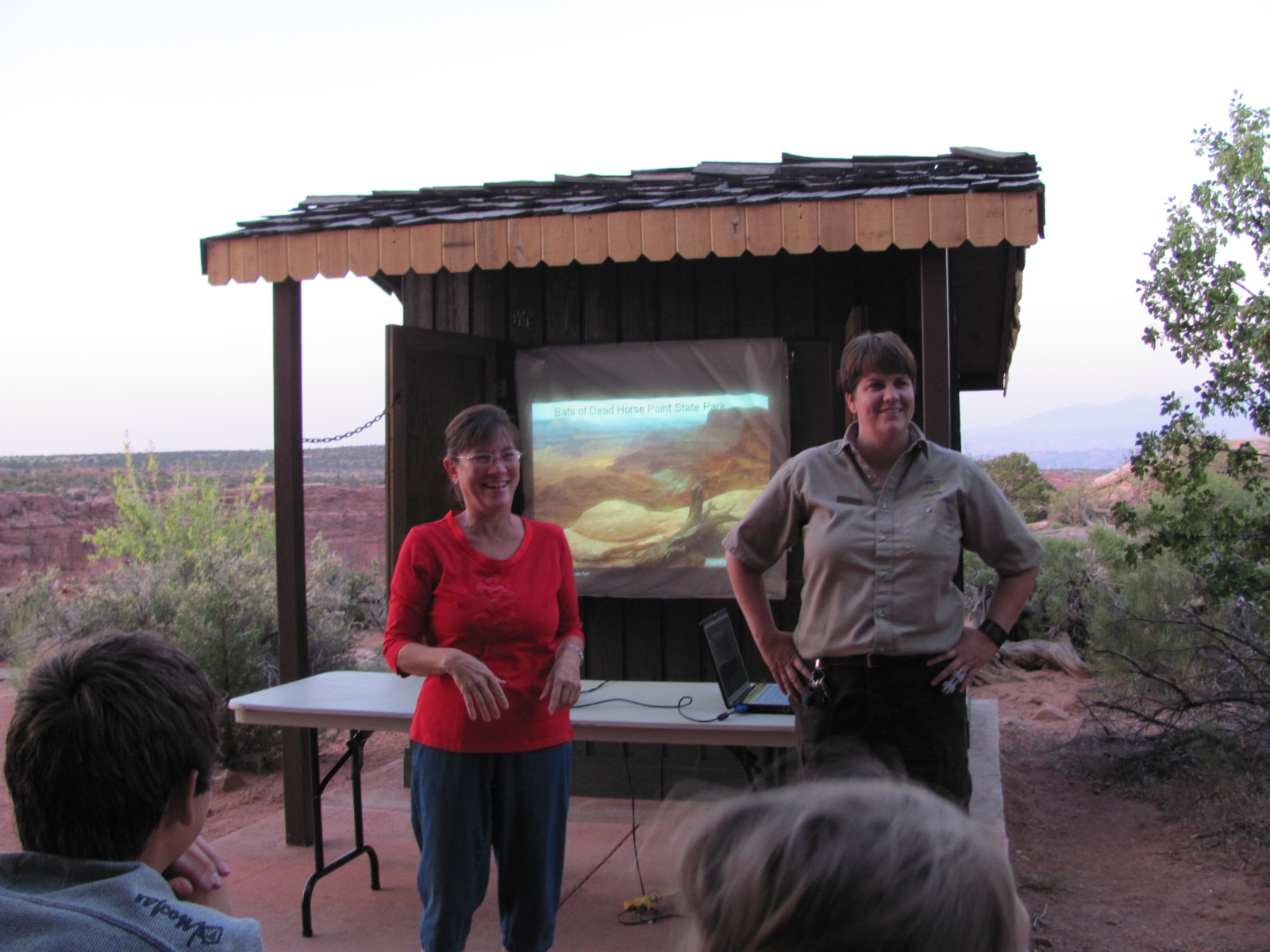
A night sky ranger program was being offered the first night led by Niles Allen. He and his wife, Bonnie, are volunteers who travel to various national parks assisting with the night sky programs. His was the best star program we’ve attended so far as he is quite knowledgeable, enthusiastic, and eager to share the night sky with his audience. Four telescopes were set up, and we saw not only Saturn and the moon but also Venus, the Hercules Star Cluster (145 light years across, containing hundreds of thousands of stars), Wild Duck Star Cluster (containing about 2,900 stars), a ghost star (the remains of a star that died millions of light years ago), and Mizar (a double star located in the handle of the Big Dipper).

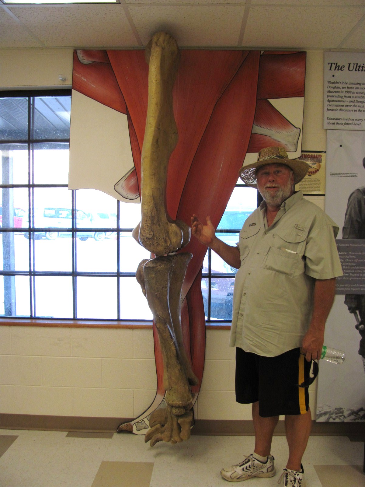
The next morning we drove to the visitor center to catch the shuttle to the fossil site. Generally it’s a ½ mile self-guided hike, but we were fortunate to be on the shuttle with the ranger going up for shift change. The 7 of us got a personalized tour along the way, which was good since we probably would have passed right by bone fossils without realizing it. Most simply look like the rest of the rock, but a couple have a white arrow pointing them out like in the picture at left. At right is a vertebrae, and in the picture below left, Russ is pointing to part of a leg bone…can you imagine the size of this thing!?! By the way, did you know that the Brontosaurus is now called the Apatosaurus? Back in the 1800s fossils of the Apatosaurus had already been discovered and named when someone discovered a skeleton that he believed to be of an entirely different genus and named it Brontosaurus. In the 1990s the name correction began to take place, but we just found out.

Tues. morning I took a drive to the Josie Bassett Morris homesite. This fascinating, independent woman lived most of her 90 years in the area, living the last 50 years in a cabin that she built with the help of one of her grandsons. She farmed the land, raised cattle, pigs, and chickens, and enjoyed entertaining guests. She married 5 times and divorced 4, brewed apricot brandy and chokecherry wine during the Prohibition, and though she died in 1964, she lived here without running water, electricity, or a telephone. I included the picture at left because if you enlarge it, the placard shows pictures of her in and around her home. The wallpaper you see has been removed (or rotted away) and only bare logs are visible inside the cabin, but here and there I found small scraps of the floral wallpaper and the newspaper she used for insulation still attached to the wall. I decided to take the 1-1/2 mile roundtrip Hog Canyon hiking trail that took me to one of the box canyons Josie used as a natural corral for her livestock. As I walked along, I tried to imagine living the hard life she led…what a remarkable woman.

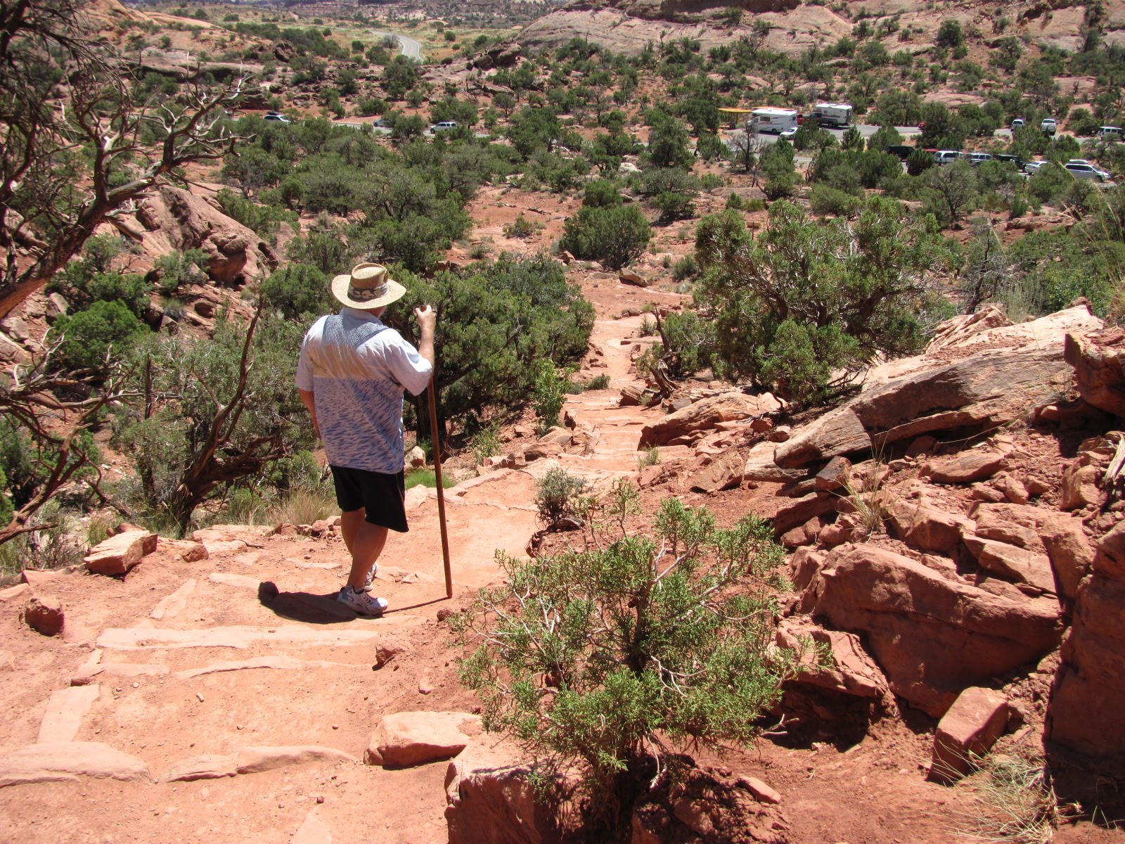
The next day we headed for WY via Hwy. 191 reaching a summit of 8,446 ft., making a couple of stops along the way. The first was in Ashley National Forest at the Aspen Grove Interpretive Trail. We had pulled off into this parking lot mainly to stretch our legs, but when we discovered the trail, we decided to take the dogs for a walk (we even let them off the leash!) The trail was relatively short, meandering among the trees and flowering plants, and ended at a lovely green meadow with a small lake amid the pines.

Back in the RV, our next stop was Flaming Gorge Nati
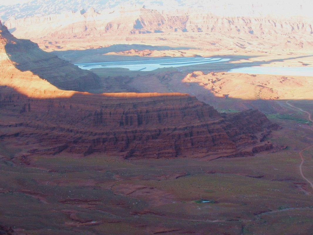
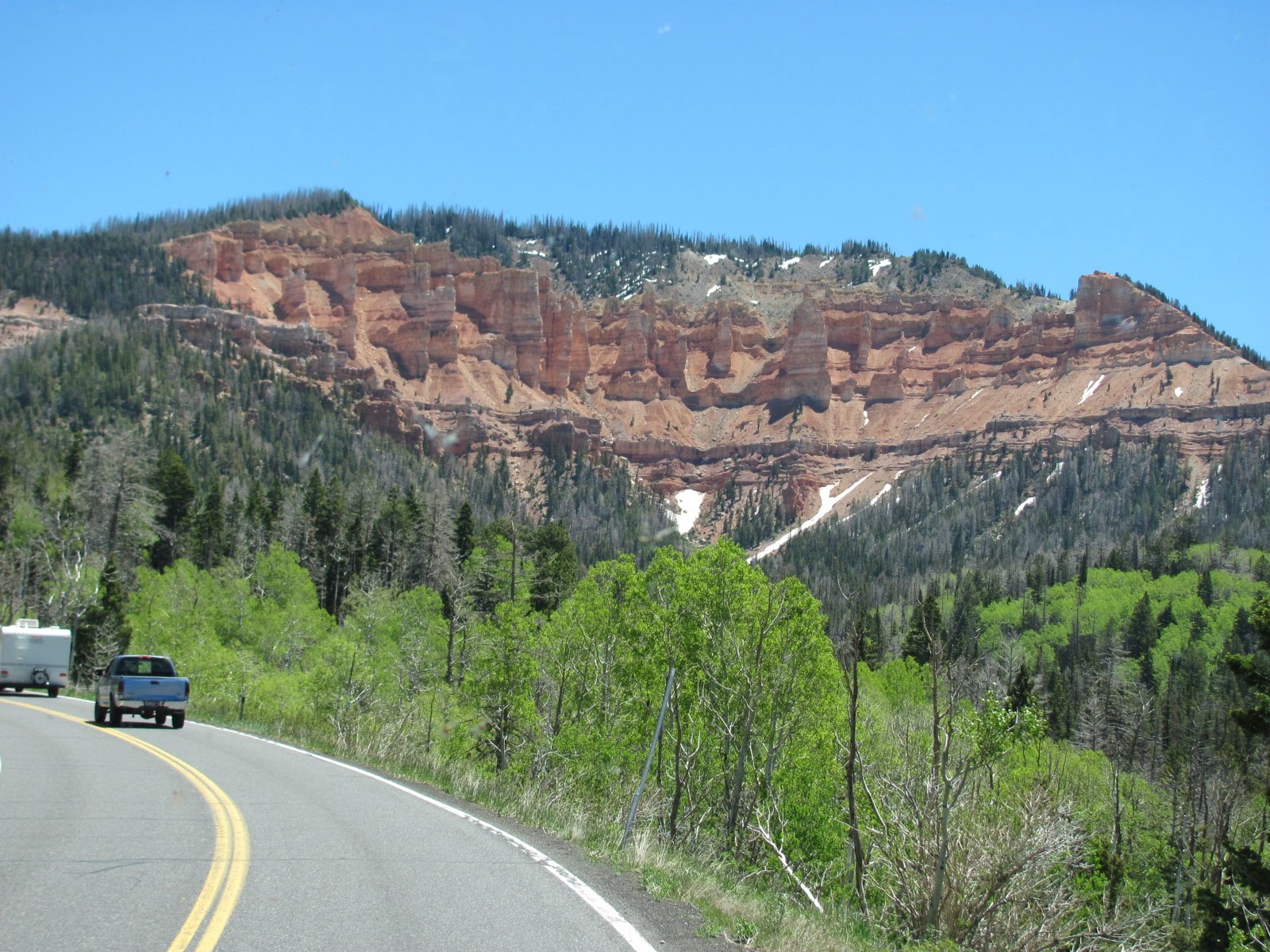
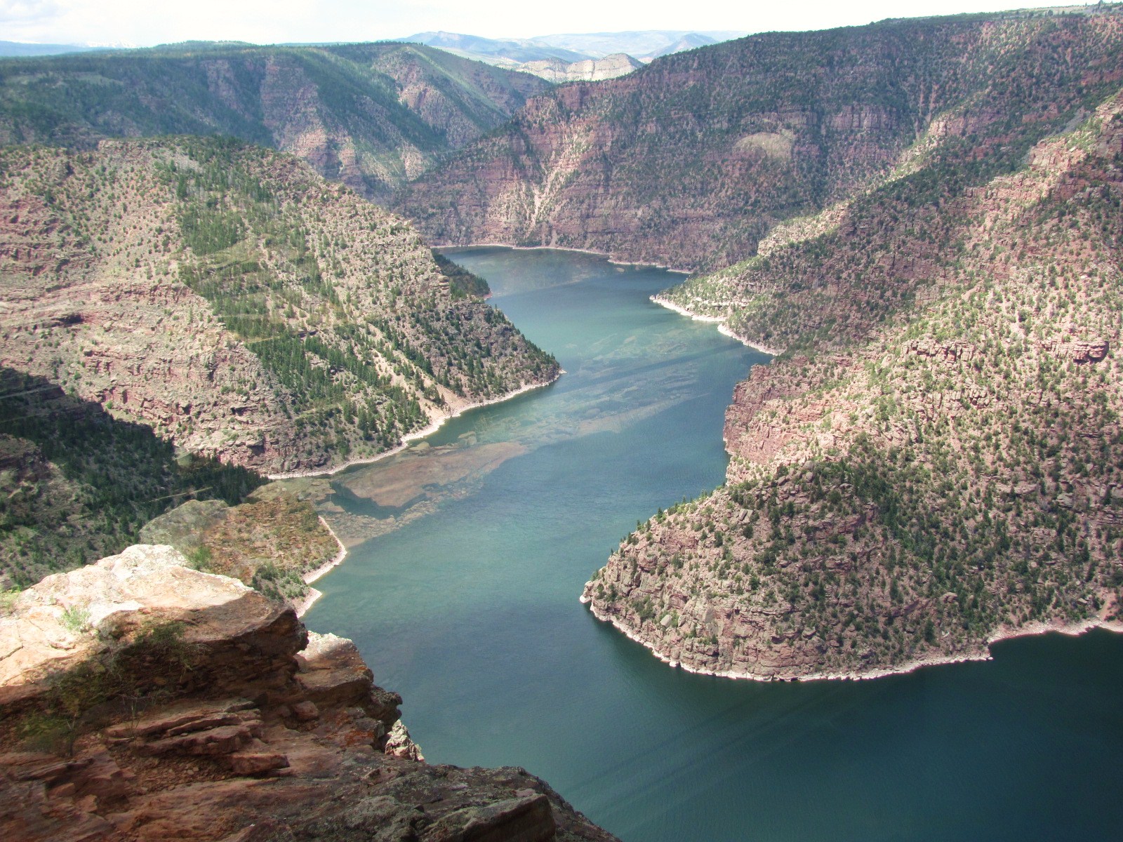
onal Recreation Area (http://www.utah.com/nationalsites/flaming_gorge.htm), and we stopped at the Red Canyon Visitor Center where we found this gorgeous sight outside the full length plate glass windows. The visitor center is located at the cliff’s edge over 1,000 feet above the Flaming Gorge Reservoir that was formed by the Flaming Gorge Dam on the Green River. The area is famous for boating, fishing, and its trophy lake trout.

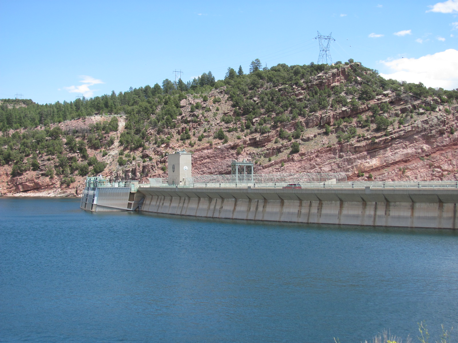
Hwy. 191 crosses over the dam, so after leaving the visitor center, that’s where we headed. We had read that free tours of the dam were available, so we parked in the lot, started up the generator to run the A/C for the animals, and went inside. The tour lasted about an hour starting at the top of the dam 500 ft. above the river, down the elevator 7 floors, through the power plant past the generators, and behind the dam face across to the other side. Here at the dam’s base you have the opportunity to feed the huge trout just below in the river. There’s basically a gumball machine filled with fish pellets, and for 25 cents you get a small handful. However not all the pellets end up in the hand, especially when little kids are buying some. But not to fear, no cleanup staff needed because there is a large yellow-bellied marmot that takes care of it! A marmot generally looks like a very large squirrel that can weigh 5 – 11 lbs., and this one looked like it was tipping the scale at the high end. It was funny to watch her as she would wait until everyone had left the fenced in area, and then sneak in to devour all the pellets that had dropped on the ground. She obviously knows the schedule and comes 
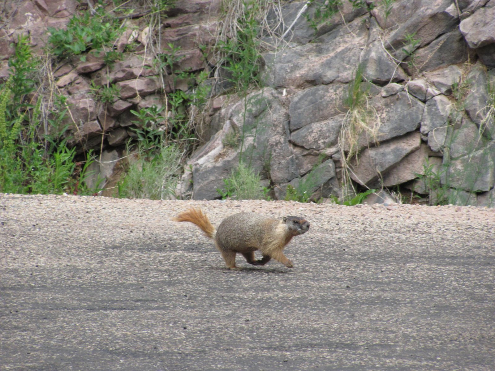
out of her hiding place a few minutes before the tour group is ready to head back every hour. Oh, and we’re sure the fish know the schedule, too!

After the tour it was on to our destination for the night…the Wal-Mart in Rock Springs, WY. There are usually a couple other RVs that overnight in the lots when we do, but this one looked like a campground! There had to be about 25 RVs, trailers, and campers of all varieties. Initially we were thinking that the campground down the road was probably upset because they’d be losing business, but when we passed it early the next morning, it was packed, too.

Friday, June 25, 2010

Off the Beaten Path

*Critters we’ve seen on our 2010 trip so far: javelina, mule deer, desert grassland whiptail lizard, white-tailed antelope squirresl, jackrabbit, juvenile Chuckwalla, Great Basin collared lizard, bats, llamas, Utah prairie dogs, chipmunks
*Birds we’ve seen on our 2010 trip so far: white-wing dove, ravens, Gamble’s quail, western tanager, roadrunner, violet-green swallow, California condor, great blue heron, mountain bluebird, wild turkey, black-chinned hummingbird, juniper titmouse
*National Parks/Monuments visited on 2010 trip so far: 16
*State Parks visited on 2010 trip so far: 4
*Total number of Jr. Ranger badges so far: 15


[Click on any picture to enlarge…then arrow back to the blog]

One of the coolest places we wanted to revisit this year was Goblin Valley State Park (http://www.utah.com/stateparks/goblin_valley.htm). Last year we visited in Aug. and we were about the only ones there. However, in June this year the campground was nearly full, which made it quite a different experience…much noisier so you don’t have that same eerie feeling. We ventured down to the valley about 8:30 PM, and it was still fairly light though the moon was already high in the sky. We walked down part of the Carmel Canyon Trail, and then cut over to the valley floor. As you may recall, the valley was once part of an ancient sea and consists of thousands of ghostlike rock formations made of Entrada sandstone that were created by uplift as well as wind and water erosion. Our favorite goblin of course is what we like to call E.T….you can see the resemblance, can’t you? If you let your imagination go wild, you can see all sorts of faces and objects within the formations. In fact, we’re sure we saw Donald Duck! This year we also discovered that the state parks have Junior Ranger programs, so yes, we earned another badge even though it’s a different shape than the ones given by the national park. While it is off the beaten path, Goblin Valley State Park is definitely a must see if you are in the area.


The next day we stopped briefly at the Capitol Reef National Park (http://www.nps.gov/care) visitor center to get our NP passport book stamped. We had visited this park last year but the road through it takes you to where we needed to go. We were heading for Dead Horse Point State Park (http://www.utah.com/stateparks/dead_horse.htm) located about halfway between Arches and Canyonlands National Parks. This little gem is also off the beaten path but what impressive views from the visitor’s center and overlooks. We had booked 5 nights at the campground, and though it took some effort to get the RV leveled, we thoroughly enjoyed our stay in spite of those nasty little gnats and the heat. Thank goodness we at least had electricity to run the A/C! Plants and animals have adapted very well to this desert environment, and along the lines of “where there’s a will, there’s a way”, this tiny flower at our site is finding a way to grow.

Dead Horse Point sits atop a plateau at an elevation of about 6,000 feet and the canyon towers about 2,000 feet above the Colorado River. The name comes from a legend that the point was once used to corral wild mustangs. Cowboys rounded up the horses, chose the ones they wanted, and for reasons unknown, left the other horses on the point with no water where they died of thirst (though we also read that the gate was left open so the horses could return to the open range but for some reason they stayed on the point). By the way, this area was also used in the final scene of the movie Thelma & Louise.

From one of the overlooks we saw some bright blue ponds in the distance and learned that they are actually solar evaporation ponds for potash (potassium chloride). Water is pumped from the Colorado River into the underground potash deposits, dissolving the salt. This salt solution is pumped into shallow, vinyl-lined ponds where it slowly evaporates in the hot sun. A blue dye is added to the water to help it absorb more of the sun’s rays, which gives it the bright blue color. When all the water has evaporated, the remaining potash is harvested and turned into fertilizer.

The park has a great visitor center with lots of informative exhibits. In fact, it’s one of the best we’ve seen, and while there, we earned another Junior Ranger badge. We also attended an evening ranger program on bats that was broken into three sections, the first being an ice breaker of charades using myths about bats and encouraging audience participation. During the next section she gave a very educational talk on bats in general and those found at Dead Horse Point. Did you know that a full-grown bat weighs no more than a dime?? For the final section around 9pm, we walked over to the rim to see if we could see any bats flying. Only saw a few and are they ever fast! She also told us that in about an hour if you sat on the front porch of the visitor center, you might be lucky enough to have some fly directly over your head to get at the insects hovering around the light. We actually came back later the next night to experience this, and a couple flew over about half a dozen times…very cool!

During our stay we made side trips to Canyonlands National Park (http://www.nps.gov/cany) and Arches National Park ((http://www.nps.gov/arch), both of which we had visited last year (July2009ArchesCanyonlands). Both are so amazing and so different. Russ commented if you had never been to the Grand Canyon, and someone brought you to Canyonlands and told you it was the Grand Canyon, there’d be no reason you wouldn’t believe him. We once again visited the Island in the Sky section of Canyonlands, one of three distinct sections and the most easily accessible. Our first stop was the Green River Overlook, and while there Russ made a discovery. The overlook’s fence is composed of logs and layers of stones. On the cap stone Russ noticed what looked like leaves spray painted on top, and he asked a nearby ranger about them. The ranger said he had never noticed them before, but they were indeed plant fossils!

Our main goal this time was to walk the Upheaval Dome Overlook Trail, a one mile round trip hike with an elevation gain of about 200 feet. Upheaval Dome measures 1 mile in diameter and looks like a large volcanic crater with peaks jutting from the center. It’s a mystery as to how it was created, and even scientists can’t agree on whether it was caused by a meteor impact or as a result of a salt dome. They are two extremely different theories that you’d think could be proven one way or the other. While up there, Russ even “discovered” a little arch (he's pointing to it below left).


At Arches NP, we did little hiking as it was very hot. However we did get out at the Double Arch and walked about halfway down the trail. Double Arch actually has three major openings that began as one pothole arch and are still continuing to slowly enlarge. We also stopped at Delicate Arch, a free-standing sandstone formation that stands 45 feet high and 33 feet wide. The hike to the arch is 3 miles and considered strenuous, so we opted out of it again this year, but I was able to get a much better picture of it from the beginning of the trail. (Russ bought me a new camera for my birthday in March that has a 10x optical zoom.) And for all you Star Wars fans, we spotted Jabba the Hut nearby!


We took a drive one day along State Road 128, a scenic byway that takes you through the Colorado Riverway Recreation Area that cuts through the red rock gorge of the Colorado River. On the river below, we could see quite a number of rafters floating along the waterway. With the temperature over 100, it seems these people might have had the right idea!

Another day we loaded the dogs into the car driving into the nearby town of Moab, and then turned onto State Road 279, another Utah scenic byway following the Colorado River. Locally it is also known as “Potash Road” as it ends at a potash mine. Along the way we stopped at the Poison Spider Mesa Trail pullout to view more petroglyphs and some dinosaur footprints that are located high up on a rock slab and have been painted white for easier viewing. (We chose not to hike the trail up there since we had the dogs.)

A bit
further down the road, we spotted a sign for the Jug Handle Arch so we turned right onto the dirt road to check it out. Traveling very slowly along this rocky road, we found ourselves among the cliffs at the bottom of a canyon. About 5 miles in, we pulled over, and Russ stopped an oncoming car to ask how much further and if it was worth the trip. The guy indicated that it was still quite a ways and there were some deep ruts so he wasn’t sure we could make it without 4-wheel drive. He also said it was basically a huge rock that had fallen across the road but the scenery was beautiful. This seemed odd since we’ve learned during our travels that an arch is naturally formed from a hole in the rock and created through erosion. We let the dogs out to stretch their legs, and since there was hardly any traffic, Abby had a blast running up and down the road. Since we didn’t want to chance getting stuck, we turned around figuring it just wasn’t meant to be that we see the arch. Right before we were back at SR 279, guess what we saw at the intersection several hundred feet above the road? Yep, you guessed it…the Jug Handle Arch, measuring 46 feet high and only 3 feet wide. It had been right there where we first turned, but once again we had seen some amazing scenery off the beaten path.

Saturday, June 19, 2010

Has It Really Been 3 Years??

Today marks our 3rd year anniversary of living and traveling on the road fulltime…and we’re still friends! The year saw us mourn the death of Russ’ mom, Bernice, and our very good friend and traveling companion, Scott Gad.

The year also saw us travel to new locations and meet new friends. We were able to visit Russ’ sister and family in NJ, and Susan’s sister in DE. From there we headed out west seeing many of the national parks that neither of us had been to before. We were so impressed with Montana, Wyoming, Utah, and Arizona during 2009 that we decided to head back out there for the summer of 2010. As we write this, we are finishing up over one month on the Colorado Plateau. We continue to explore new sights in The Folly as well as our trusty Saturn Vue. We hike those trails that we are able and are constantly amazed by what we see and learn. Water that is more than 4,000 years old finally making its way to the valley floor and exposed rock more than 2.5 billion years old boggles the mind. The stars you see without the light pollution of large cities are unbelievable.

We made our annual month-long trip to St. Louis, spending time with old friends and family. In Oct. we spent the month in the Florida Keys at three different state parks and made new friends who visited us while we were in Orlando. Speaking of Orlando, we spent the winter months there and continue to enjoy Walt Disney World. This spring we spent time on the white beaches of the Florida, Mississippi, and Alabama Gulf Coasts. Little did we know that a short time later these beaches would be threatened by a major oil spill.

We have taken many pictures over the last three years and have many fond memories of our travels. The trip has been much better than either of us originally thought it could be. We are still glad we got on the bus and our hope is that each of you may someday get to see this great country as we have.

THREE YEARS BY THE NUMBERS
28,220 RV miles
26,558 Saturn miles
10,996 feet highest elevation
3,596 gallons of diesel
1,787 monthly health insurance premium
597 longest 1 day drive
151 most consecutive days in one place
134 National Parks/Monuments Cancellations (in our National Parks Passport book)
106 highest temperature
91 National Parks/Monuments visited
88 campgrounds
80 cost of an annual National Parks pass (well worth the investment)
45 cost of our C2C campground membership (best investment we have ever made)
39 states traveled in
35 states spent the night in
35 annual maintenance fee for our campground membership
23 Saturn mpg
18 lowest temperature
18 family members visited
13 Junior Ranger badges earned
12 Sweet Adelines choruses visited
10 Missouri Tigers football games
9 nights spent in Wal-Mart parking lots
8 State Parks stayed in
7.8 RV mpg
5 St. Louis Cardinals baseball games
4 MLB parks
3 ferry rides
3 nights spent in Camping World parking lots
2 ferry rides that included the RV
2 states of residence
2 countries visited
2 shuttle launches
2 fish caught
1 St. Louis Rams football game

BEST/WORST- 6/19/08

National Park
Picking the best National Park is a tough one. We are going to go with Shenandoah Valley for its sheer beauty and solitude, and Gettysburg for its significance and the most humbling experience. There really isn't a "worst" National Park. Updated 6/19/09: Badlands National Park has to rank as one of the best. We still have not found a bad one. Updated 6/19/10: Badlands may not even be in the top 10 anymore. Yellowstone, Grand Teton, Glacier, Zion, Bryce, Grand Canyon, Canyonlands, and Devils Tower are all amazing in their own right, and are listed in no particular order.
Campground
The Fiesta Key KOA in Long Key, FL, with its view out the front window of the Gulf and sunsets is hard to beat. Shiloh's RV & Travel Resort in Monroe, LA, was by far the worst. Updated 6/19/09: Hart Ranch in Rapid City, SD, and Pine Island RV Resort in Jay, OK, are two of the best. Although Shiloh is still the worst, Frosty Acres Resort in Schenectady, NY, comes close. Updated 6/19/10: Long Key State Park has to be added to the best…ocean 20 ft. in front of the RV.
Location
Long Key, FL, and Front Royal, VA, were equally enjoyable. No need to rush, no traffic, just the time to spend as you like. See Monroe, LA, for the worst. Updated 6/19/09: Add Rapid City, SD, to the list of best. Updated 6/19/10: Long Key State Park and any of the national parks of the Colorado Plateau.
Restaurant
If you ever make it to Titusville, FL, the Dixie Crossroads is the place to eat. If you ever make it to DeFuniak Springs, FL, Bo's Family Country Cafe is a place of last resort. Updated 6/19/09: No change. Updated 6/19/10: Café Diablo in Torrey, UT, has been added to the best.
Pizza
Lombardo's in St. Louis, MO, is hard to beat. Think it has something to do with the cheese! Buck's in Denham Springs, LA, leaves a lot to be desired. Updated 6/19/09: No change. Updated 6/19/10: No change.
Roads
Georgia and Texas seem to consistently have the best roads. Louisiana is the worst with New Jersey not far behind. Updated 6/19/09: Illinois and Minnesota have joined the ranks of bad roads. Although we are beginning to realize our federal highways are all in need of repair. Updated 6/19/10: Not sure that they are getting better.
Wal-Mart
The best Wal-Mart was in Front Royal, VA, and had only been open a few days when we visited. The worst is in Berlin, NJ, and we can understand why Russ' sister is not big on Wal-Marts! Updated 6/19/09: With Wal-Mart being our choice for basic staples, we do see a lot of them. Almost all of the newer ones are very nice, and one we visited outside Columbus, OH, is now #1. Updated 6/19/10: No change.
Supermarket
The Schnuck's in Eureka, MO, was great. We have never been to a Piggly Wiggly that is worth the price of admission. Updated 6/19/09: No change. Updated 6/19/10: Sweetbay in Clermont, FL, is added to the best.
Bakery
Tellico Grains Bakery in Tellico Plains, TN, was fantastic. As far as the worst, is there really a bad bakery?? Updated 6/19/09: We have stayed away from bakeries! Updated 6/19/10: No change.
Moment
Another tough one. Watching the shuttle launch, seeing the Milky Way from the Keys, and a big black bear on the Appalachian Trail. The worst moment....was that the awning?!?! Updated 6/19/09: Niagara Falls and Walt Disney World at Christmas can be added to the best, and the awning still ranks as the worst. Updated 6/19/10: Grizzly bears, eagles, and walking The Narrows.

A FEW THINGS WE'VE LEARNED
1) A possum is a flat animal that sleeps in the middle of the road.
2) There are 10,000 species of spiders, and most have visited us.
3) Gnats do not taste good.
4) The average person standing on any street corner of any city or town in this country has more common sense than the entire U.S. Congress combined.
5) There are as many varieties of camping vehicles as there are people out doing it.
Updated 6/19/09:
6) Our house batteries are important…take good care of them.
7) Anything under 32 degrees Fahrenheit is cold.
8) We will again watch fuel prices rise throughout the summer.
9) We have more fear coming down the mountain than we did going up.
10) Financial experts/advisors are pretty much worthless. Once they get your money, they never recommend selling. They seem to use the same pitch as the market continues to plummet, “All my big clients are buying because we are near the bottom.”
Updated 6/19/10:
11. Time is short and passes quickly.

Friday, June 18, 2010

Twice Is Nice

*Critters we’ve seen on our 2010 trip so far: javelina, mule deer, desert grassland whiptail lizard, white-tailed antelope squirrel, jackrabbit, juvenile Chuckwalla, Great Basin collared lizard, bats
*Birds we’ve seen on our 2010 trip so far: white-wing dove, Gamble’s quail, western tanager, roadrunner, violet-green swallow, California condor, great blue heron, mountain bluebird, wild turkey, black-chinned hummingbird
*National Parks/Monuments visited on 2010 trip so far: 13
*State Parks visited on 2010 trip so far: 2
*Total number of Jr. Ranger badges so far: 13

[Click on any picture to enlarge…then arrow back to the blog]

You’ll notice that there are many similarities between this year’s summer tour and last year’s as our plan was to visit several of the same national parks again, but instead of starting up north and then heading south, we reversed it hoping it would be cooler down south and warmer up north by the time we got to each this year. However, we’ve already hit temps in the low 100s in NV and we read that it’s still chilly in WY. In fact on our drive to Bryce Canyon National Park in UT (www.nps.gov/brca), we still saw evidence of snow. Our route took us through Red Canyon, Dixie National Forest, and two tunnels. (If you’d like to view last year’s trip, click on August2009Bryce.)


This year instead of staying at the campground just outside the park, we made reservations at one of the campgrounds inside the park. There are 99 campsites but only 13 can be reserved in advance, all the rest are first-come, first-served, and with our size RV, we could only stay in the A or B loop, meaning our choice of sites was more limited than the 99. None of the sites have hook-ups (meaning no water, sewer, or electric), but we can be quite self-sufficient for several days. Back in Feb. Russ had made a reservation for 1 night in June in the A loop, but a couple weeks ago we decided we’d like to try to stay 3 or 4 nights. Of course, there were no more reservations available so we were going to have to take our chances and hopefully get lucky.

Shortly after we arrived at North Campground, the camp host came by and confirmed that this particular site was already reserved for the rest of the week but gave us some pointers on possibly getting one of those first-come, first-served spots. A little while later we drove through the campground looking to see what sites might work in terms of size and satellite reception, and for indications of who might be leaving the next morning (tags with the departure date are on each site but some folks wait till the next morning to pay for the next day). We spotted a couple sitting outside at a spot we thought would work in the B loop so Russ decided to ask them if they were indeed leaving the next morning. They confirmed that they would be leaving at 6 AM, so we made a plan to be there by 6:30 to put our tag on that spot and leave the car till we could move the RV. The plan worked! For the next 3 nights we had another great spot with a view of the trees and shade in the morning since Russ pulled into the site instead of backing in. How lucky we were since the campgrounds here fill up quickly this time of year!

Bryce Canyon is one of the best locations in the U.S. for viewing the night sky because of the lack of light pollution, and Tues. night there was an astronomy program at the Visitor Center. Since we had attended the lecture part last year, we decided to skip it this time around and just head over about 9:45 for the telescope viewing. Around 100 people arrived after the lecture, and the rangers had 4 large telescopes of varying sizes set up with 3 of them tracking Saturn…how I wish we could include a picture of what we saw! It is truly an amazing sight, and this time 6 of Saturn’s moons were also in view. Of course, they look like small dots on either side of the planet and the ranger even rattled off their names. By the way, did you know that Saturn actually has 62 moons?? While waiting in line for another view, a meteor was spotted blazing across the night sky (though the ranger said it was probably a piece of space junk). The fourth telescope was trained on the sliver of the moon…a viewing that still never ceases to amaze!

Thurs. we loaded the dogs in the car since they are allowed on paved trails. We parked at the Lodge, and took the path out back to the Rim Trail. This trail can take you from 1 mile to 11 miles roundtrip, and we walked about 1.5 miles roundtrip, past Sunset Point to Inspiration Point and back. What incredible views! One of the other trails will lead you down into the canyon but that was a little too ambitious for us. Besides we couldn’t take the dogs…that’s our story and we’re sticking to it! After getting back in the car, we drove to Bryce Point at an elevation of 8300 ft. for more spectacular views.


The next day we left Bryce Canyon heading for Torrey, UT. This 113-mile drive once again took us along Hwy. 12, one of the great scenic byways in the country. As you may recall from last year, Hwy. 12 is quite a winding road, and for a number of miles at the top of the ridge there are straight drop-offs on both sides and minimal shoulders. The picture on the right simply does not do justice to the experience of driving along that narrow ridge. Though the view is spectacular, Russ doesn't get to enjoy it much since he's concentrating on staying on the road! The highway rises to a summit of 9600 ft., weaving in and out of Dixie National Forest, and at one point we pulled over to stretch our legs and enjoy the view.


We arrived at Sandcreek RV Park (http://www.sandcreekrv.com/) in Torrey mid-afternoon, ending up in the same site as last year. Place hasn’t improved any but the lady who runs it is nice. The whole purpose of this night’s stay was to once again have dinner across the street at Café Diablo (http://www.cafediablo.net/), a treat we had put in the budget way back but debated a couple of times about skipping. In the end we decided we really don’t eat out very much, we’d skip the pricey margaritas this time, and would consider it as a celebration of our 3 year anniversary on the road. The inside is nothing fancy, a fairly casual place in fact, but the food is incredible. Café Diablo has won many awards and is listed in The New York Times Bestseller 1,000 Places to See in the U.S.A. & Canada Before Your Die. All desserts, ice cream, and breads are homemade on the premises and a patio-side garden supplies fresh herbs and vegetables. Each table receives a small plate of tapas to start…fresh roasted veggies, cheese, and bread. Like last year, we split the Rattlesnake Cakes appetizer served with two yummy dipping sauces and a red cabbage slaw. It is actually free-range rattlesnake, and no it doesn’t taste like chicken. With the southwest spices added, it actually tastes like Taco Bell meat! For our entrée we both decided to try something different even though last year’s were scrumptious and still on the menu. Russ chose the Crown Rack of Glazed Ribs that are slow roasted in a chipotle, molasses, and rum glaze, and I chose the Beef Flank Steak Carbon with a potato straw column in the middle. The restaurant is known for its fancy presentations as you can see in the photo above right. The ribs were actually rolled and standing on a bed of garlic mashed potatoes to hold them up. At first Russ didn’t think there was much meat, but it was rolled so tight that it turns out there was quite a bit. Of course, no matter how full you are, they bring over the pewter dessert tray with all their homemade pastries and each comes with a scoop of their homemade ice cream. We decide to share the layered chocolate cake with a scoop of raspberry truffle ice cream…yummm!! Another fantastic meal at Café Diablo, and this time under $100 including tip.