*Birds we’ve seen on our 2010 trip so far: white-wing dove, ravens, Gamble’s quail, western tanager, roadrunner, violet-green swallow, California condor, great blue heron, mountain bluebird, wild turkey, black-chinned hummingbird, juniper titmouse
*National Parks/Monuments visited on 2010 trip so far: 16
*State Parks visited on 2010 trip so far: 4
*Total number of Jr. Ranger badges so far: 15
[Click on any picture to enlarge…then arrow back to the blog]
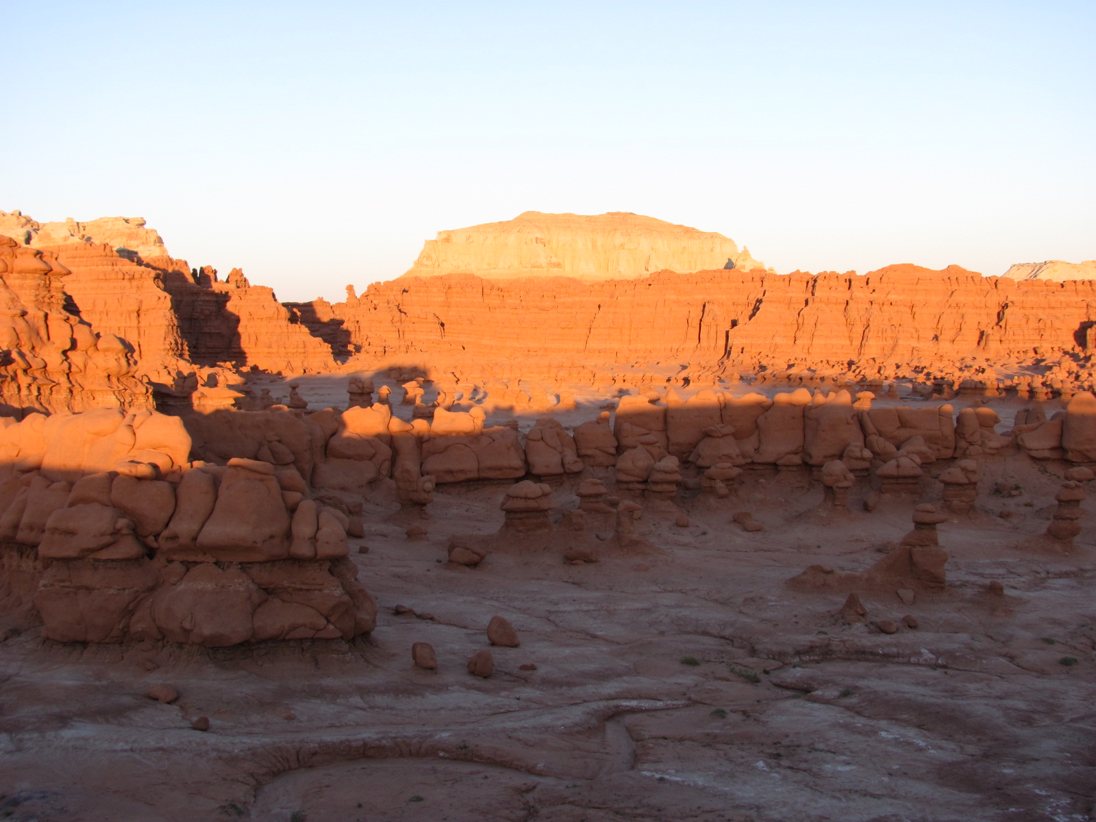
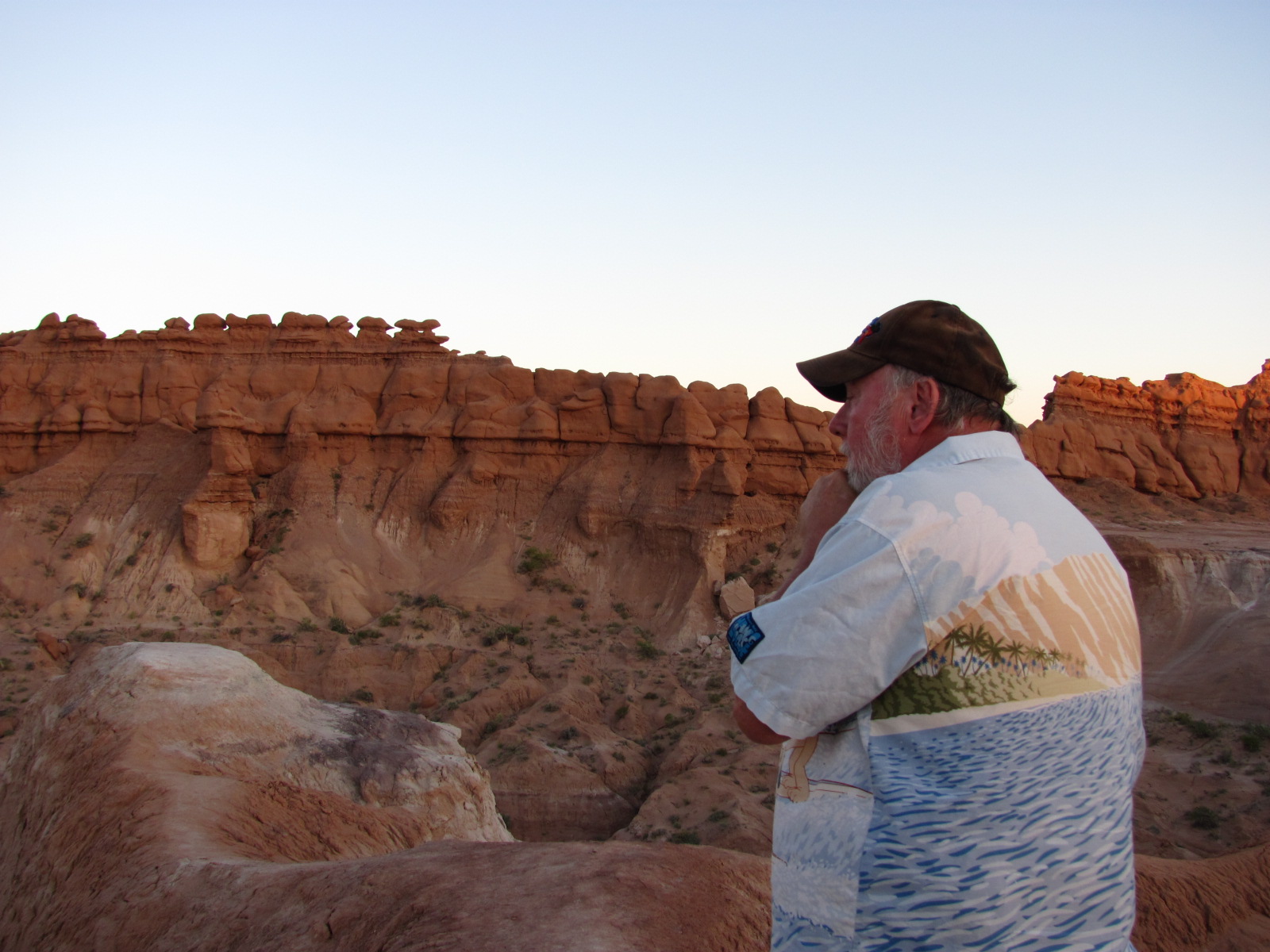
One of the coolest places we wanted to revisit this year was Goblin Valley State Park (http://www.utah.com/stateparks/goblin_valley.htm). Last year we visited in Aug. and we were about the only ones there. However, in June this year the campground was near
 ly full, which made it quite a different experience…much noisier so you don’t have that same eerie feeling. We ventured down to the valley about 8:30 PM, and it was still fairly light though the moon was already high in the sky. We walked down part of the Carmel Canyon Trail, and then cut over to the valley floor. As you may recall, the valley was once part of an ancient sea and consists of thousands of ghostlike rock formatio
 ns made of Entrada sandstone that were created by uplift as well as wind and water erosion. Our favorite goblin of course is what we like to call E.T….you can see the resemblance, can’t you? If you let your imagination go wild, you can see all sorts of faces and objects within the formations. In fact, we’re sure we saw Donald Duck! This year we also discovered that the state parks have Junior Ranger programs, so yes, we earned another badge even though it’s a different shape than the ones given by the national park. While it is off the beaten path, Goblin Valley State Park is definitely a must see if you are in the area.
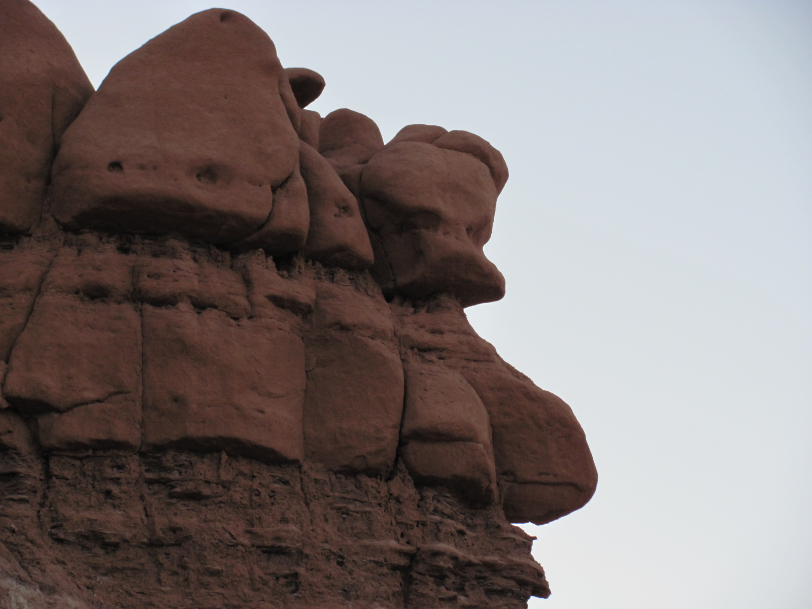
 The next day we stopped briefly at the Capitol Reef National Park (http://www.nps.gov/care) visitor center to get our NP passport book stamped. We had visited this park last year but the road through it takes you to where we needed to go. We were heading for Dead Horse Point State Park (http://www.utah.com/stateparks/dead_horse.htm) located about halfway between Arches and Canyonlands
 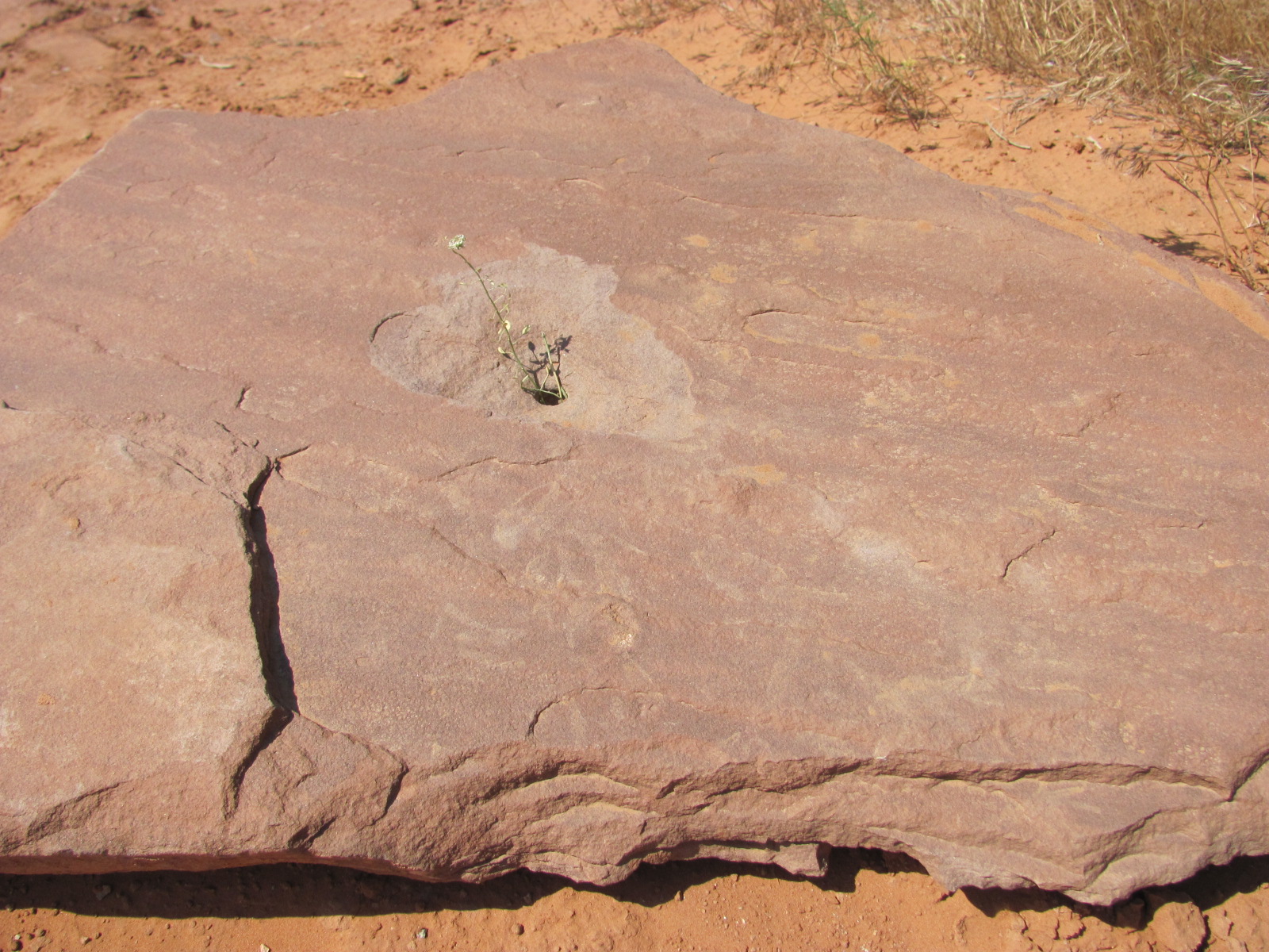 National Parks. This little gem is also off the beaten path but what impressive views from the visitor’s center and overlooks. We had booked 5 nights at the campground, and though it took some effort to get the RV leveled, we thoroughly enjoyed our stay in spite of those nasty little gnats and the heat. Thank goodness we at least had electricity to run the A/C! Plants and animals have adapted very well to this desert environment, and along the lines of “where there’s a will, there’s a way”, this tiny flower at our site is finding a way to grow.
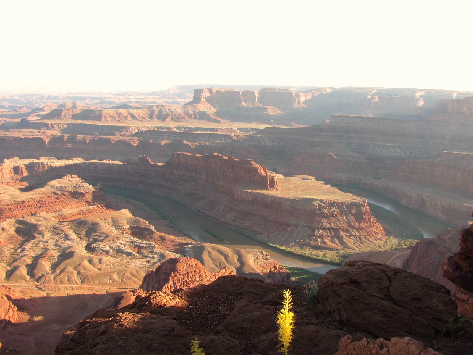 Dead Horse Point sits atop a plateau at an elevation of about 6,000 feet and the canyon towers about 2,000 feet above the Colorado River. The name comes from a legend that the point was once used to corral wild mustangs. Cowboys rounded up the horses, chose the ones they wanted, and for reasons unknown, left the other horses on the point with no water where they died of thirst (though we also read that the gate was left open so the horses could return to the open range but for some reason they stayed on the point). By the way, this area was also used in the final scene of the movie Thelma & Louise.
 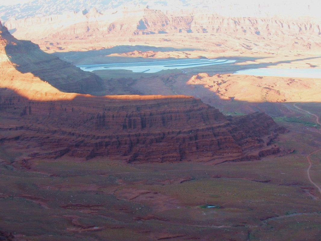 From one of the overlooks we saw some bright blue ponds in the distance and learned that they are actually solar evaporation ponds for potash (potassium chloride). Water is pumped from the Colorado River into the underground potash deposits, dissolving the salt. This salt solution is pumped into shallow, vinyl-lined ponds where it slowly evaporates in the hot sun. A blue dye is added to the water to help it absorb more of the sun’s rays, which gives it the bright blue color. When all the water has evaporated, the remaining potash is harvested and turned into fertilizer.
The park has a great visitor center with lots of informative exhibits. In fact, it’s one of the best we’ve seen, and while there, we earned another Junior Ranger badge. We also attended an evenin
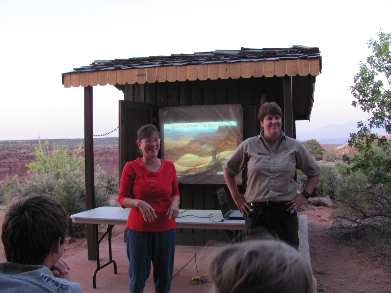 g ranger program on bats that was broken into three sections, the first being an ice breaker of charades using myths about bats and encouraging audience participation. During the next section she gave a very educational talk on bats in general and those found at Dead Horse Point. Did you know that a full-grown bat weighs no more than a dime?? For the final section around 9pm, we walked over to the rim to see if we could see any bats flying. Only saw a few and are they ever fast! She also told us that in about an hour if you sat on the front porch of the visitor center, you might be lucky enough to have some fly directly over your head to get at the insects hovering around the light. We actually came back later the next night to experience this, and a couple flew over about half a dozen times…very cool!
During our stay we made side trips to Canyonlands National Park (http://www.nps.gov/cany) and Arches National Park ((http://www.nps.gov/arch), both of which we had visited last year (July2009ArchesCanyonlands). Both are so amazing and so different. Russ commented if you had never been to the Grand Canyon, and someone brought you to Canyonlands and told you it was the
 Grand Canyon, there’d be no reason you wouldn’t believe him. We once again visited the Island in the Sky section of Canyonlands, one of three distinct sections and the most easily accessible. Our first stop was the Green River Overlook, and while there Russ made a discovery. The overlook’s fence is composed of logs and layers of stones. On the cap stone Russ noticed what looked like leaves spray painted on top, and he asked a nearby ranger about them. The ranger said he had never noticed them before, but they were indeed plant fossils!
Our main goal this time was to walk the Upheaval Dome Overlook Trail, a one mile round trip hike with an elevation gain of about 200 feet. Upheaval Dome measures 1 mile in diameter and looks like a large volcanic crater with peaks jutting from the center. It’s a mystery as to how it was created, and even scientists can’t agree on whether it was caused by a meteor impact or as a result of a salt dome. They are two extremely different theories that you’d think could be proven one way or the other. While up there, Russ even “discover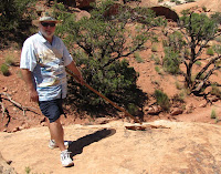 ed” a little arch (he's pointing to it below left).
 ed” a little arch (he's pointing to it below left).
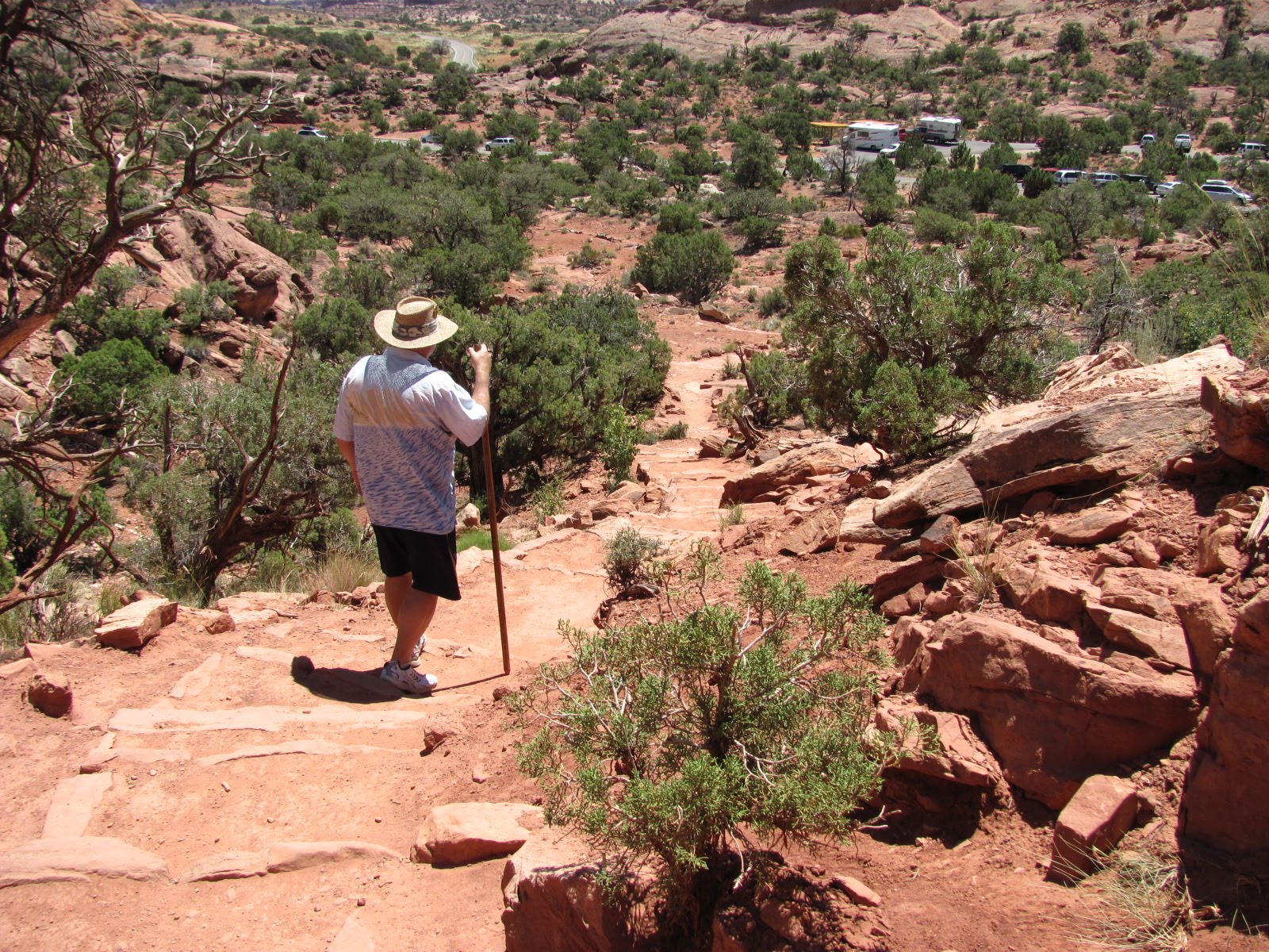
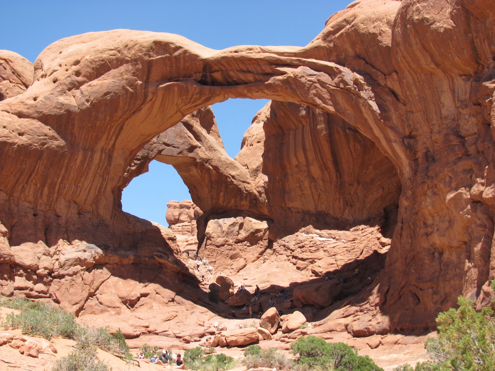
At Arches NP, we did little hiking as it was very hot. However we did get out at the Double Arch and walked about halfway down the trail. Double Arch actually has three major openings that began as one pothole arch and are still continuing to slowly enlarge. We also stopped at Delicate Arch, a free-standing sandstone formation that stands 45 feet high and 33 feet wide. The hike to the arch is 3 miles and considered strenuous, so we opted out of it again this year, but I was able to get a much better picture of it from the beginning of the trail. (Russ bought me a new camera for my birthday in March that has a 10x optical zoom.) And for all you Star Wars fans, we spotted Jabba the Hut nearby!


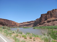
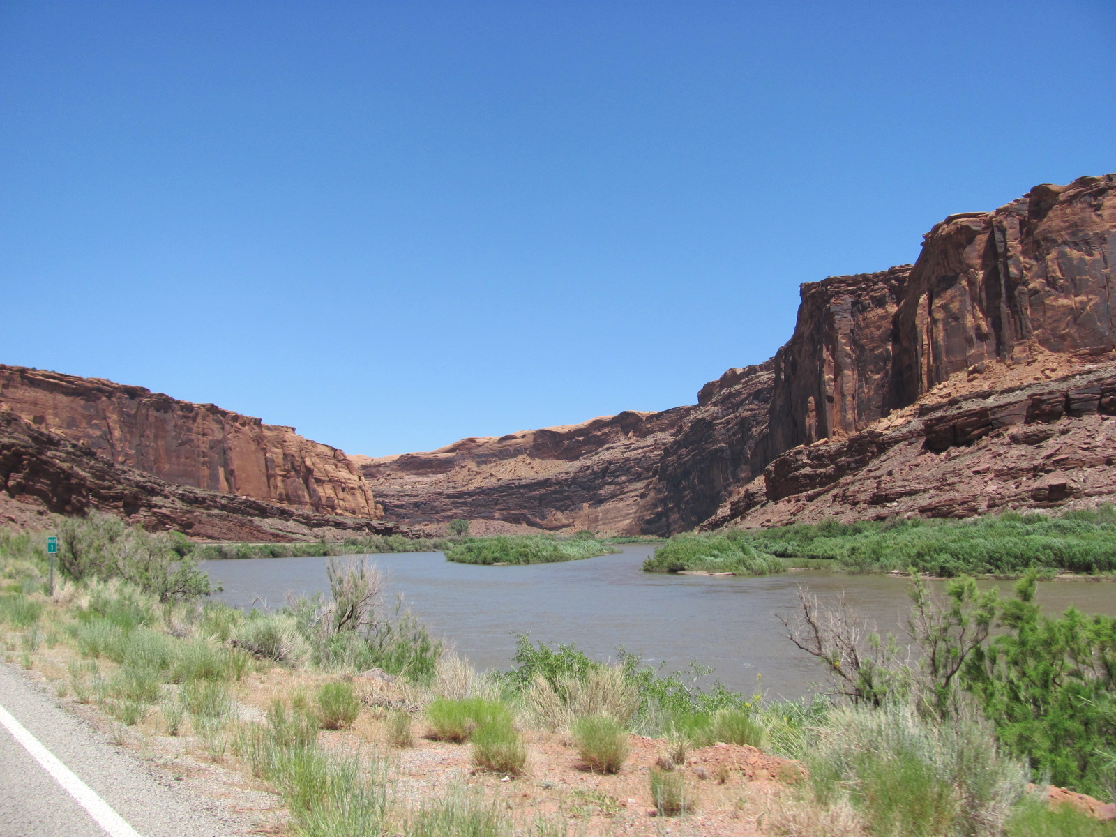
We took a drive one day along State Road 128, a scenic byway that takes you through the Colorado Riverway Recreation Area that cuts through the red rock gorge of the Colorado River. On the river below, we could see quite a number of rafters floating along the waterway. With the temperature over 100, it seems these people might have had the right idea!
Another day we loaded the dogs into the car driving into the nearby town of Moab, and then turned onto State Road 279, another Utah scenic byway following the Colorado River. Locally it is also known as “Potash Road” as it ends at a potash mine. Along the way we stopped at the Poison Spider Mesa Trail pullout to view mor e petroglyphs and some dinosaur footprints that are located high up on a rock slab and have been painted white for easier viewing. (We chose not to hike the trail up there since we had the dogs.)
 e petroglyphs and some dinosaur footprints that are located high up on a rock slab and have been painted white for easier viewing. (We chose not to hike the trail up there since we had the dogs.)
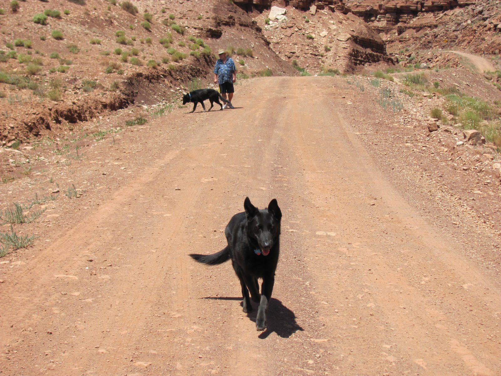
A bit
further down the road, we spotted a sign for the Jug Handle Arch so we turned right onto the dirt road to check it out. Traveling very slowly along this rocky road, we found ourselves among the cliffs at the bottom of a canyon. About 5 miles in, we p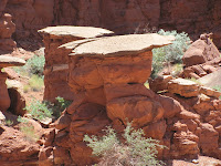 ulled over, and Russ stopped an oncoming car to ask how much further and if it was worth the trip. The guy indicated that it was still quite a ways and there were some deep ruts so he wasn’t sure we could make it without 4-wheel drive. He also said it was basically a huge rock that had fallen across the road but the scenery was be
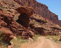 autiful. This seemed odd since we’ve learned during our travels that an arch is naturally formed from a hole in the rock and created through erosion. We let the dogs out to stretch their legs, and since there was hardly any traffic, Abby had a blast running up and down the road. Since we didn’t want to chance getting stuck, we turned around figuring it just wasn’t meant to be
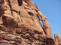 that we see the arch. Right before we were back at SR 279, guess what we saw at the intersection several hundred feet above the road? Yep, you guessed it…the Jug Handle Arch, measuring 46 feet high and only 3 feet wide. It had been right there where we first turned, but once again we had seen some amazing scenery off the beaten path.
 ulled over, and Russ stopped an oncoming car to ask how much further and if it was worth the trip. The guy indicated that it was still quite a ways and there were some deep ruts so he wasn’t sure we could make it without 4-wheel drive. He also said it was basically a huge rock that had fallen across the road but the scenery was be
 autiful. This seemed odd since we’ve learned during our travels that an arch is naturally formed from a hole in the rock and created through erosion. We let the dogs out to stretch their legs, and since there was hardly any traffic, Abby had a blast running up and down the road. Since we didn’t want to chance getting stuck, we turned around figuring it just wasn’t meant to be
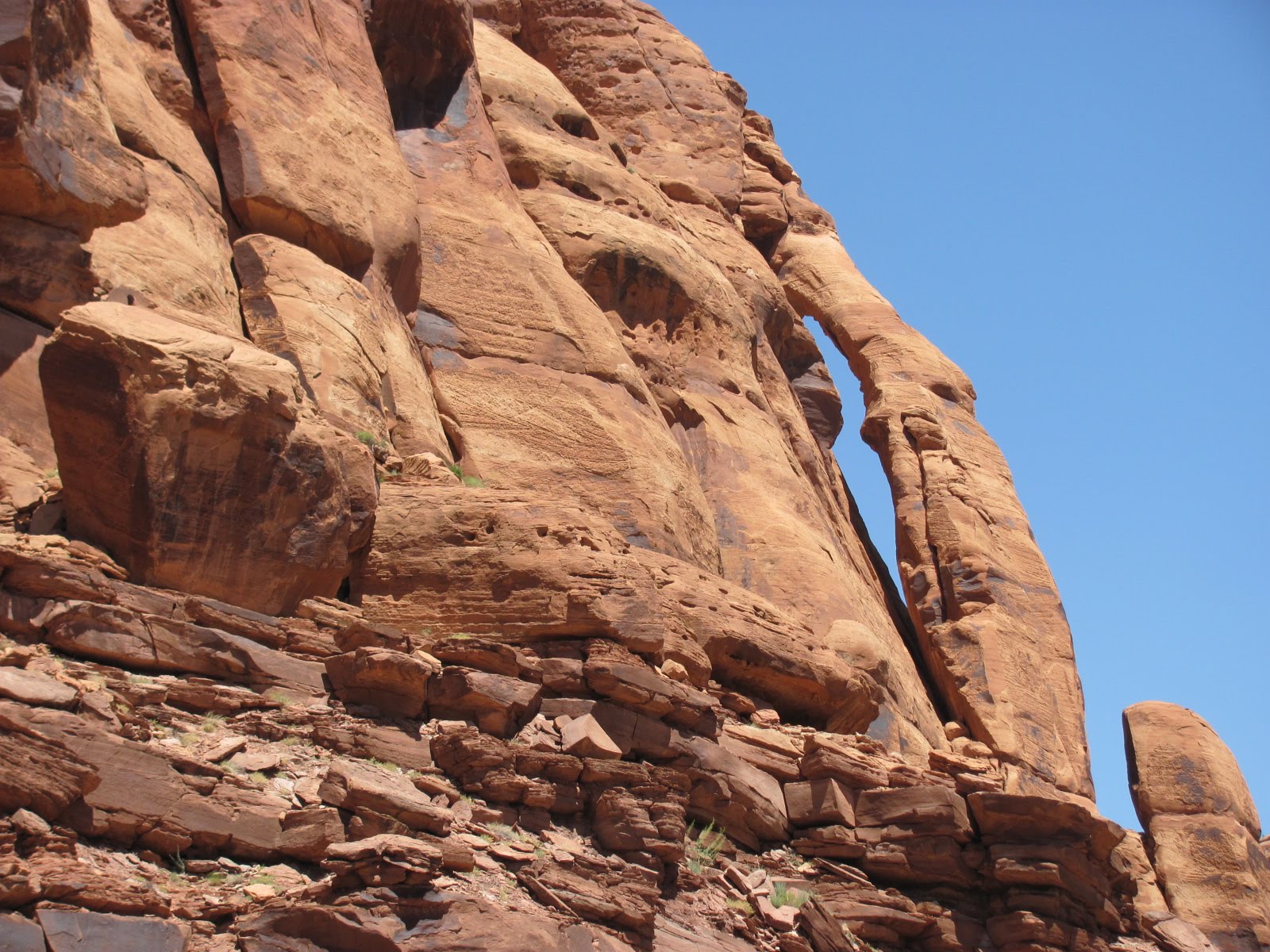 that we see the arch. Right before we were back at SR 279, guess what we saw at the intersection several hundred feet above the road? Yep, you guessed it…the Jug Handle Arch, measuring 46 feet high and only 3 feet wide. It had been right there where we first turned, but once again we had seen some amazing scenery off the beaten path.

1 comment:
I knew it... I had a feeling... somewhere in your travels... an alien would surface sooner or later. So ... E.T. didn't go home! Have fun. Richard
Post a Comment