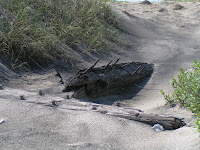
We had quite a busy day on Wed. as the three of us took off for the north end of the island towards Kitty Hawk. On our way we stopped at Coquina Beach where the ruins of the shipwrecked Laura A. Barnes lie. She was a 120-foot wooden four-masted schooner that went down in a dense fog in the Outer Banks during a Nor'easter on June 1, 1921, but the entire crew wa

s rescued by the men at the Bodie Island Coast Guard Station. Over the years storms and hurricanes have broken up parts of the ship, and the constantly shifting sands from the winds have covered and uncovered the ship many times. So what remains is really not much to see, but hey, we can say we saw what was there!

From here we headed for the Wright Brothers National Memorial, which is actually located in the town of what is now Kill Devil Hills. People often mistakenly think that Kitty Hawk is where the Wright brothers conducted their famous experiments with flight (we were some of those people). But actually the brothers just stayed for awhile with the Tate family in their Kitty Hawk home and conducted those first flights at a nearby field. We had also thought that the first flight took off from the top of a hill, but we were wrong on that, too. They actually landed

at the same level as they took off! At the Wright Brothers National Memorial we viewed a number of exhibits outlining their story, a full-scale reproduction of the flying machine, and listened to a Park Ranger’s presentation on how the plane worked. The photo at the right is an enlarged copy of an actual photo taken that day of the first flight. We then w

ent outside where a large granite boulder marks the spot where that first airplane left the ground and four numbered markers indicate the distance of each of the four flights made on that day. As you walk around and look at the exhibits, and get a better understanding of what they accomplished, you are truly taken back in time. Two bicycle makers fro

m Ohio building a flying machine….amazing! Although their original principles have been refined over the years, the basic way of controlling a plane have not really changed much. That first flight was truly an extraordinary journey that covered 120 feet in 12 seconds. A small piece of the wing and the fabric flew to the moon with Armstrong, Aldrin, and Collins in 1969….Kitty Hawk to Tranquility Base and back.

We drove a little further north towards the actual town of Kitty Hawk to visit the Monument to a Century of Flight, which was dedicated in 2003 on the centennial of powered flight (http://www.monumenttoacenturyofflight.org/). At the entrance is a granite marker inscribed with the poem “High Flight”. The words were written by James Magee, Jr., a 19-year-old American pilot, and recorded in song by John Denver. There’s a time capsule buried next to the marker that is

to be opened in 2103. The monument itself consists of 14 wing-shaped stainless steel pylons ascending in height from 10’ - 20’ in an orbit of 120’, the distance traveled by the Wright brothers on that first flight. Each pylon contains a black granite panel engraved with language and images about 100 of the most significant accomplishments in aviation in its first century from earthbound to the moon and beyond. Inside the orbit of pylons is a courtyard of 4,600 bricks engraved with messages of sponsors from around the world. The orbit of pylons culminates in a center bronze dome, six feet in diameter, depicting the continents of earth joined by a centennial message coming from Kitty Hawk.
After stopping f
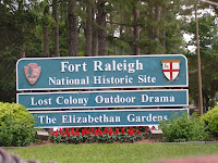
or a quick bite at Taco Bell/KFC, we drove over to Roanoke Island to check out Fort Raleigh, an earthen fort reconstructed exactly as it was built in 1585 on the exact location and operated by the National Park Service. It was England’s first attempt at a colony in the new world, but it did not go well. Named after Sir Walter Raleigh, the chief planner for this expedition, the “Citie of Raleigh” was to be located at the lower end of the Chesapeake Bay, but when they stopped briefly at Roanoke Island to re-supply, the boat pilot decided it was too far into the summer to go further and left the colonists there. John White was appointed Governor and worked at peaceful negotiations with the Indians, but because of earlier clashes with pr

evious visitors and miscommunications, there was an uneasy coexistence among them. During this time, White’s daughter gave birth to the first English child born in the New World and was named Virginia Dare, a name that is used throughout the region. Shortly after the birth, Governor White was forced to return to England for badly needed supplies, but with his ship being forced into service against a prevailing war, he was not able to return for 3 years. When he did return to the colony, there was no sign of the 116 colonists anywhere. Even the houses had been taken down. Only the letters ‘CROATOAN”, the name of a nearby island, was carved into a tree. Raleigh made several attempts over the next 12 years to find any trace of them but none was found. On the 355 acres of Fort R
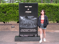
aleigh National Historic site archaeological digs are still being performed today with new, modern technology in the hopes of finding some clue as to what happened. It is referred to as the “Lost Colony” on which an outdoor symphonic drama is performed during the summer months. Also, at this site during the Civil War, slaves escaping the mainland flocked to the protection of the Union army, and a formal colony was established in 1863 called Freedmen's Colony. Freedmen's Colony is recognized as a historic National Underground Railroad Network to Freedom Site, and a marker was erected in 2001.
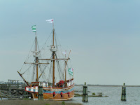
Driving through the historic district of the northern end of Roanoke Island through the town of Manteo, we passed the Elizabeth II ship, a replica of the 16th century ship that transported those who became known as the “Lost Colony”. This ship was built in 1983 to commemorate the 400th anniversary of the first English settlement in America.

On our way back to the campground, we passed Jockey's Ridge State Park, home to the East Coast's tallest natural sand dune that consists of 420 acres, is 1.5 miles long, and about 100 feet high (you are able to climb to the top). Geologists believe that Jockey's Ridge was formed when strong water currents from hurricanes and storms washed sand from large offshore shoals onto the beach. Throughout many years, the wind picked up this sand and blew it inland. These tiny grains of sand evolved into a system of dunes that now stretches for many miles along the coastline.
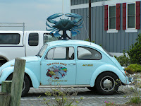
We made one last stop at Sugar Shack Seafood and picked up a couple fresh tuna steaks. (Scott isn’t into seafood very much.) Located right on the Manteo Causeway, they get ships dropping off fresh fish and seafood daily, and the steaks were very tasty.
The day before we’re set to leave for our next destination, we generally begin doing some preliminary work putting stuff away so we have less to do in the morning. Thurs. afternoon we emptied the black and grey water tanks (toilet and sinks), and while bending over to collapse the sewer hose support, I hit the top of my head on the corner of the slideout. Now I’ve hit it a couple times early on in our adventures, but it never bled and I’ve been extremely cautious since. However, this time I misjudged my location, and this time it did bleed. Russ was a great nurse and said he didn’t think it needed stitches, although he said it was nasty looking! During the next few days he diligently applied peroxide and Neosporin to keep it from becoming infected. He also made me wear a hat when out in the sun as he was concerned that with a layer of skin missing, it might readily burn (sorry no pictures!) So here it is 4 days later, and Russ still checks it a few times a day to make sure no infection has set in. Earlier today Russ suggested that washing my hair might be appropriate in the next day or two, which I’ll be glad to do!

No comments:
Post a Comment