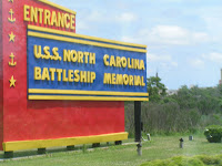
Driving from Charleston to where we would catch the ferry at Cedar Island, NC, was a relaxing, enjoyable, and interesting drive. We passed the U.S.S. North Carolina Battleship Memorial (though I couldn’t get a good picture of the ship as we drove by), and Hwy. 17, on which we were traveling, goes right through the middle of Camp LeJeune Marine Corps Base. In fact along this stretch of the highway are signs in
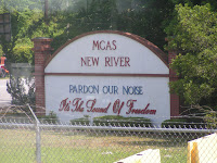
dicating that the road has been dedicated as Freedom Way. Most of the actual base is shrouded by trees and chain link fence along both sides of the road, but you can see housing barracks and the occasional sentry gate. One we passed was for the Marine Corps Air Station, New River Camp Geiger, School of Infantry. Their main entry sign reads “Pardon Our Noise It’s the Sound of Freedom.” There are a couple towns along the road with stores and restaurants presumably for those who live on and off base, and everywhere you looked you saw yellow ribbons tied on trees and large signs on the chain link fences welcoming home various soldiers by name. Quite a moving sight.

Further down the road in Morehead City, we found that train tracks are the center divide right down the middle of the highway! We were traveling north and heading southbound was the engine followed by two cars. Cross traffic has to
really be careful!
Originally our plan had been to spend the night in the Wal-Mart parking lot in Morehead City, which is about 40 miles from the ferry, but Russ discovered that we could actually park just outside the gate entrance the night before. Since our res
ervation was for 7:30am and he was told that they might start moving us onboard when the gates opened at 6am, it seemed the logical thing to do. We arrived about 6:30pm and there was already another RV parked, planning to spend the night, too. Bill and Carol have been fulltimers for 4 years, and it was going to be their first visit to the Outer Banks. For those of you who may not know, the Outer Banks

is a 200-mile long group of islands off the North Carolina coast that separate the Atlantic Ocean from the coastal sounds and inlets. These islands with their beaches, sand dunes, marshes, and woodlands are all part of the Cape Hatteras National Seashore operated by the National Park Service (
http://www.nps.gov/caha/).
There are bridges connecting a couple of the islands an
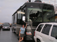
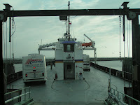
d a couple ferries connecting the others. This first ferry would take us 23 miles to Ocracoke Island, cost $45, and take 2 hrs. 15 min. to get there. Reservations are strongly suggested especially for a coach our size. Besides our two RVs, there was a tour bus with high school students and the rest were cars. As you can imagine, weight and balance are a key consideratio
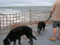
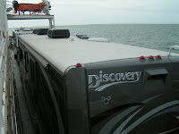
n as they load you onboard. The ferry wasn’t very full this trip and could have easily accommodated more cars, but we were happy with it the way it was as it allowed us more room to walk around. In fact we even took the dogs out for a walk! We caught up on a couple TV shows we had taped, chatted with Bill and Carol, and took the stairs to the upper deck for a view of the top of our coaches.
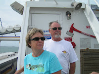
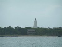
As we approached Ocracoke Island, we had a great view of the Ocracoke Lighthouse. Standing 76 feet tall, it is North Carolina’s oldest functioning lighthouse, and Bill was looking forward to climbing it during their trip. After disembarking from the ferry, it was a 14 mile drive to the next ferry that would take us across the Hatteras Inlet. The Outer Banks are only about a m
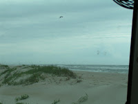
ile wide in most areas with NC State Hwy. 12 one lane each way down the middle. Driving along this road you can even see the ocean between sand dunes!
This second ferry is free and does not take reservations, but we arrived in plenty of time for the 11am ferry. When we arrived, there appeared to be two lines and we were directed to the one on the left. As it turns out, the one on the right was for commercial vehicles and island residents who have a special pass. We soon learned that the folks in the right line had pr

iority for boarding, and if there was room, those of us in the left lane would be allowed to board. Bill and Carol were in front of us, and initially we thought there was a possibility they would get on the 11am one but definitely not us. Another big commercial vehicle arrived and that knocked out their chances of boarding since these are smaller boats. We learned that depending on how many vehicles arrived for the right lane, we could be there all day waiting to board! The ferries were scheduled to run hourly, and since it was starting to rain, I decided to make us some lunch. No sooner had I started putting the sandwiches together than the ferry o
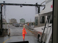
perators indicated it was time for us to board! Only 15 min. had passed but evidently they were running more ferries that day. So I held on, finished the sandwiches once we were on board, and during the 40 min. ferry ride, we ate lunch, watched some more TV, and Russ surfed the net. Not sure how many ferries were actually running that day, but we passed another one on the way, and as you can see by the photo on the right, there were plenty of cars lined up waiting to board going back.
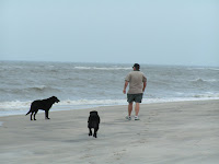
When we arrived at the campground, I asked if we could get a site closer to the ocean, and happily they were able to accommodate us. The first row is for members only, but they placed us in the second row which put us about 100 yards from the sand dunes that separate the campground from the beach with only another 100 yards to the water. Shortly after arriving at the campground, we took the dogs for a walk on the beach and enj
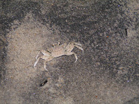
oyed the beauty and power of the ocean. Since we had visited most of the tourist attractions here last year, we spent most of our time walking on the beach, collecting shells, and just hanging out. During one of our early evening walks, we spotted several of these ghost crabs scurrying into and out of their holes in the sand. (If you’d like to read more about the area and last year’s visit, simply click on May 2008. There are two entries: The Outer Banks and "From Kitty Hawk to the Moon in 66 Years".)
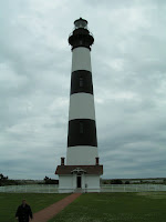
It was windy as usual everyday, but one day a storm rolled in with winds about 30 mph and had the RV a-rockin’ all night! Earlier that day before the storm hit, we decided to visit the Bodie (pronounced like body) Island Lighthouse (
http://www.nps.gov/archive/caha/bodielh.htm) since we had not visited it before, and there was a ranger talk at 11am. Standing 156 ft. tall, it is located 3,800 ft. from the ocean, and the rang
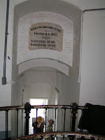
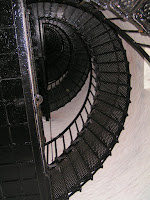
er said this was because the ground between was too soft and marshy. However, its height allows it to be seen just fine. Though it is still a functioning lighthouse, the metal stairs are over a hundred years old and in poor shape, not allowing visitors to climb. We were able to go into the attached storage building, and climb the 6 stairs to the base and look up the spiral staircase. One thing that seemed so odd as we tur
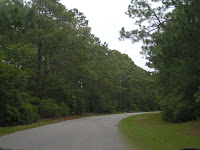
ned off NC-12 onto the road leading back to the lighthouse was the tall pines on either side. There are basically no tall trees anywhere else on the islands! We asked the ranger, and he said they were planted back in the 30s but that was about all he knew…gee, thanks.
On the drive back, we stopped at the Pea Island National Wildlife Refuge Visitor Center. Though we didn’t see any wildlife outside, they have some really cool displays inside
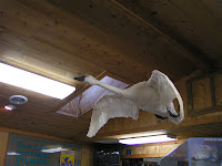
and out.
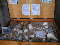
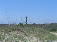
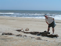
Tues. we drove to the beach near the Cape Hatteras Lighthouse searching for shells (of which there were many!) and ran across what appeared to be an old shipwreck. Closer observation showed a marking that indicated it was indeed part of an underwater archaeological unit.
With all the wind here on the islands, you can imagine it would be an ideal place for kite flying. (In fact kite surfing is HUGE here!) On a stop at the dollar store, we picked up a pack of 2 kites for a dollar and
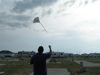
gave one of them a try. OK, so what do you expect for 50 cents? But finally Russ got it flying…you’re never too old to be a kid again!
Tomorrow we leave for four days at Virginia Beach, and though we won’t be as close to the ocean, we’ll only be two miles away!

No comments:
Post a Comment