*Birds we’ve seen on our 2010 trip so far: white-wing dove, ravens, Gamble’s quail, western tanager, roadrunner, violet-green swallow, California condor, great blue heron, mountain bluebird, wild turkey, black-chinned hummingbird, juniper titmouse, magpie, osprey, Canada geese, bank swallow, common mergansers, American white pelican, Great blue heron, red-tailed hawk, bald eagles
*National Parks/Monuments visited on 2010 trip so far: 24
*State Parks visited on 2010 trip so far: 4
*Total number of Jr. Ranger badges so far: 19
[Click on any picture to enlarge…then arrow back to the blog]
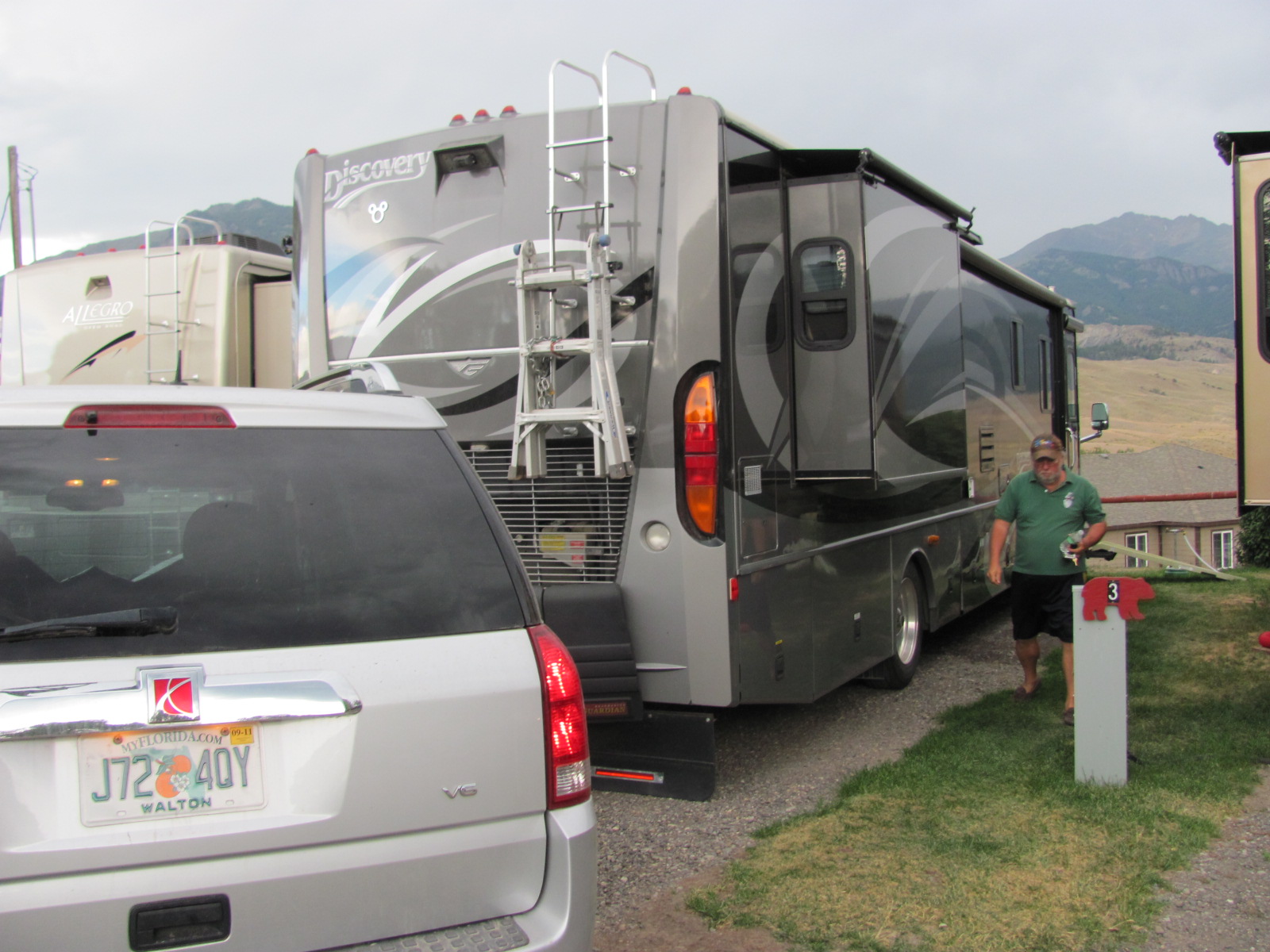 After 2 weeks of drycamping at Gros Ventre Campground in Grand Teton National Park, we headed 156 miles north to our next stop in Gardiner, MT. Gardiner is just outside the north entrance of Yellowstone National Park (http://www.nps.gov/yell/), and our site at Rocky Mountain RV Park (http://www.rockymountaincampground.com/) had a nice view overlooking the town of Gardiner with the moun
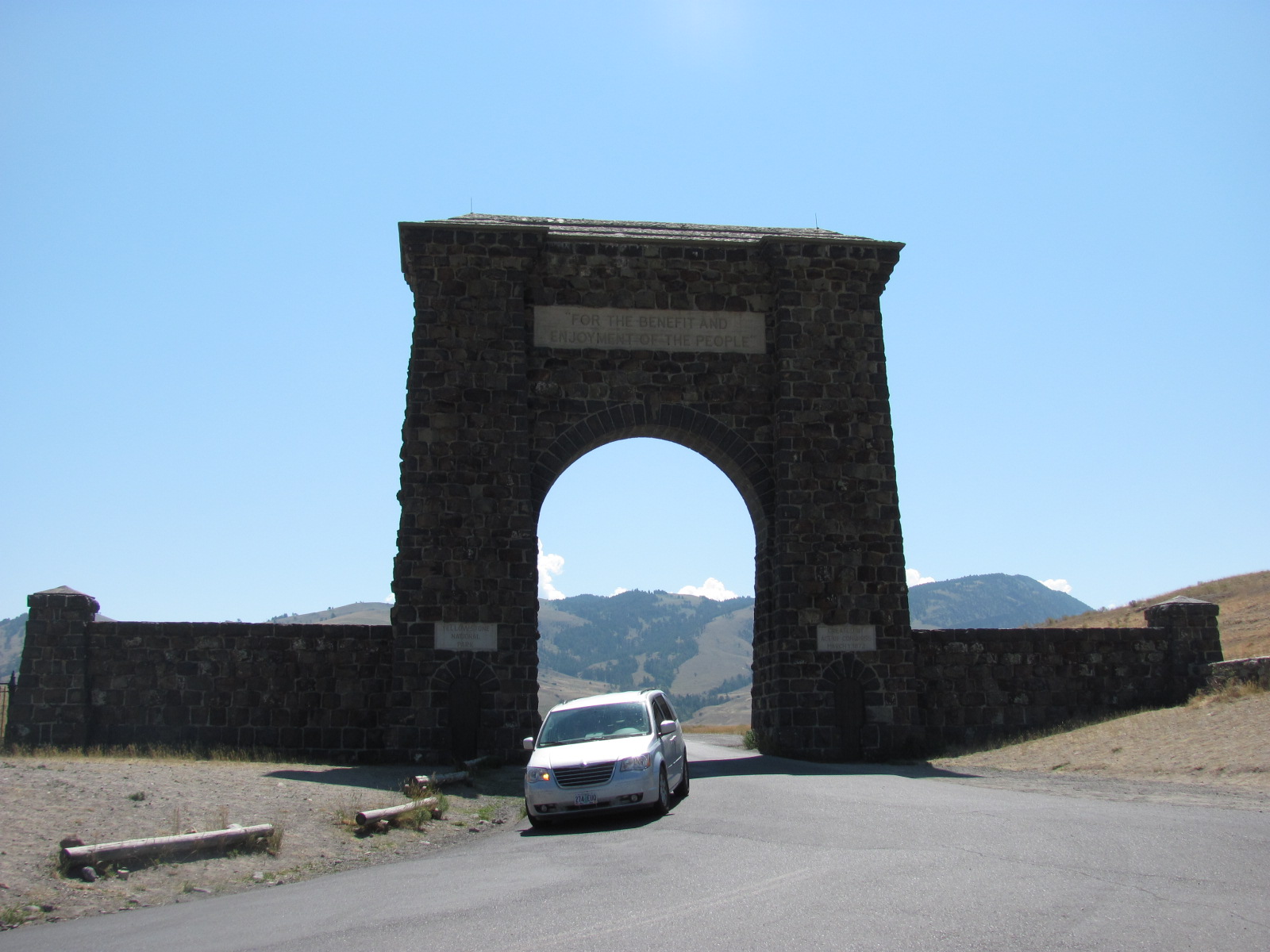 tains in the background. Although the sites in the campground were tight, the full-hookup site gave us an opportunity to recharge our batteries and even allowed for us to once again equalize our battery bank. We also had a view from our campsite of the Roosevelt Arch that was built in 1903 to honor President Teddy Roosevelt and is an icon to the Yellowstone north entrance.
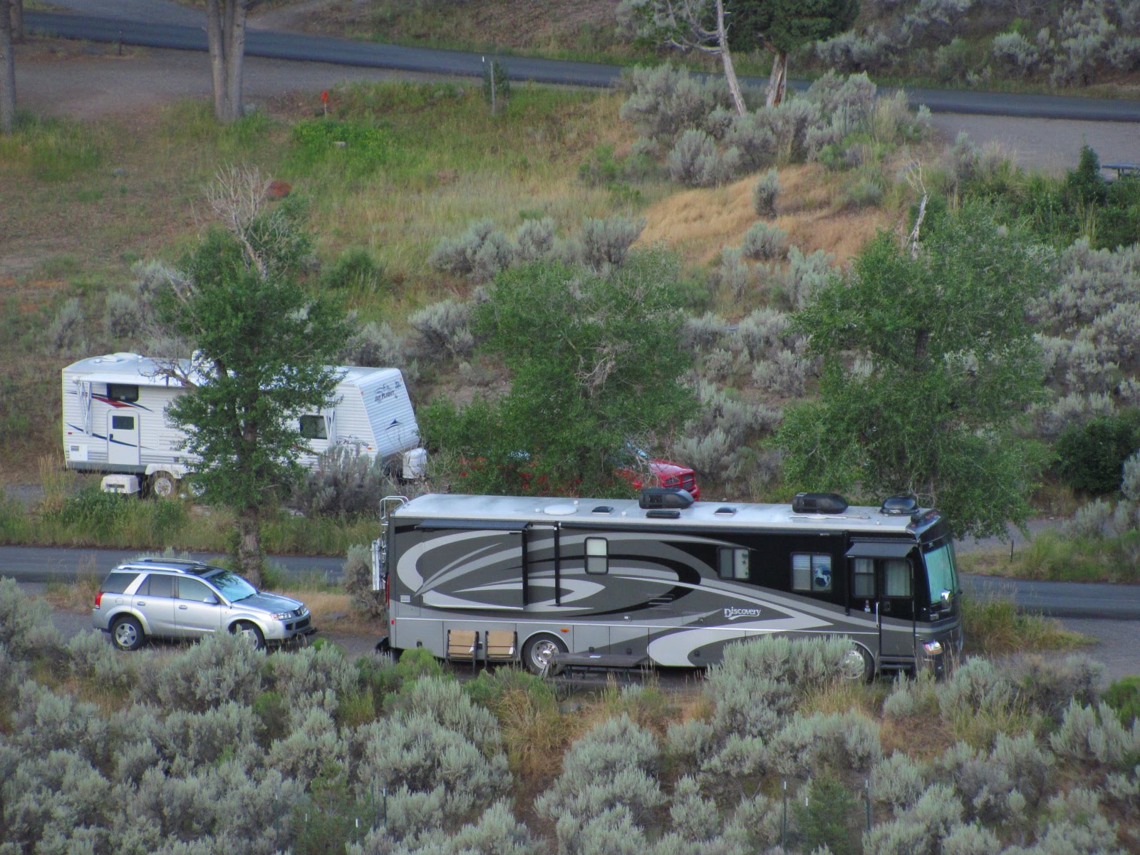
After spending a week at this campground, we moved 5 miles south into the park for a 2 week stay at Mammoth Campground. We arrived at this first-come, non-reservation, no hook-up park at 8am and were lucky enough to snag a great site offering shade in the afternoon, satellite reception, and a beautiful v
 iew of the surrounding mountains. This campground is located along the switchbacks leading up to the town of Mammoth Hot Springs and only a couple miles drive to the beautiful Travertine Terrace area. On many days it was not unusual to see elk roaming the campground, and though at times we noticed some road noise as it is not located far off the main north entran
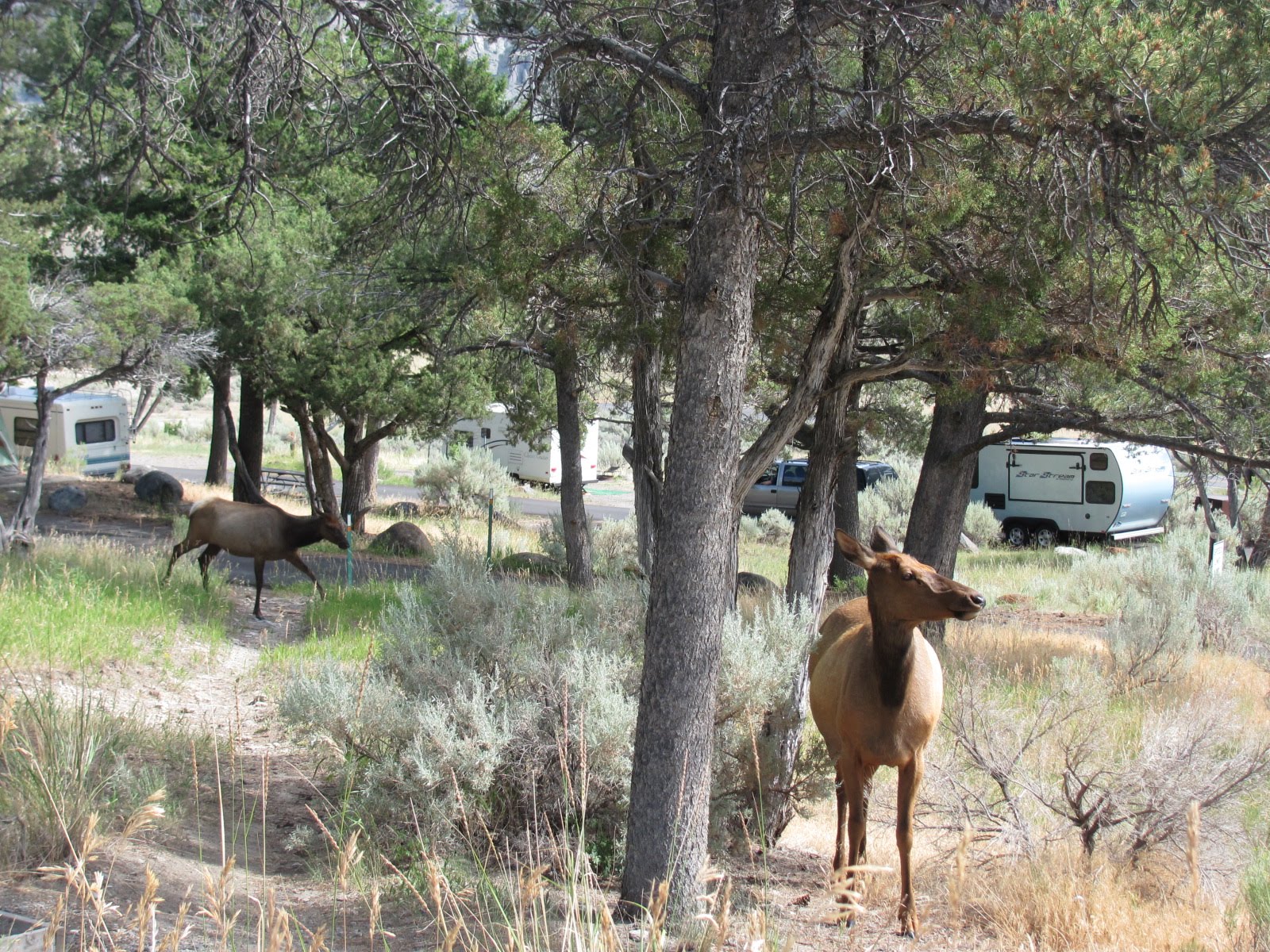 ce road, it was a great home base for our 2 week stay in Yellowstone. Our batteries again performed as designed with our generator running about 5 hours throughout the day. Generator use was only allowed from 8am – 8pm, and each morning promptly at 8, it started up, ran for about an hour, and then every few hours would restart for a short time to keep the batteries charged. At 6pm it generally kicked on and ran till 8pm as it topped off the battery bank in anticipation of 12 hours of quiet time.
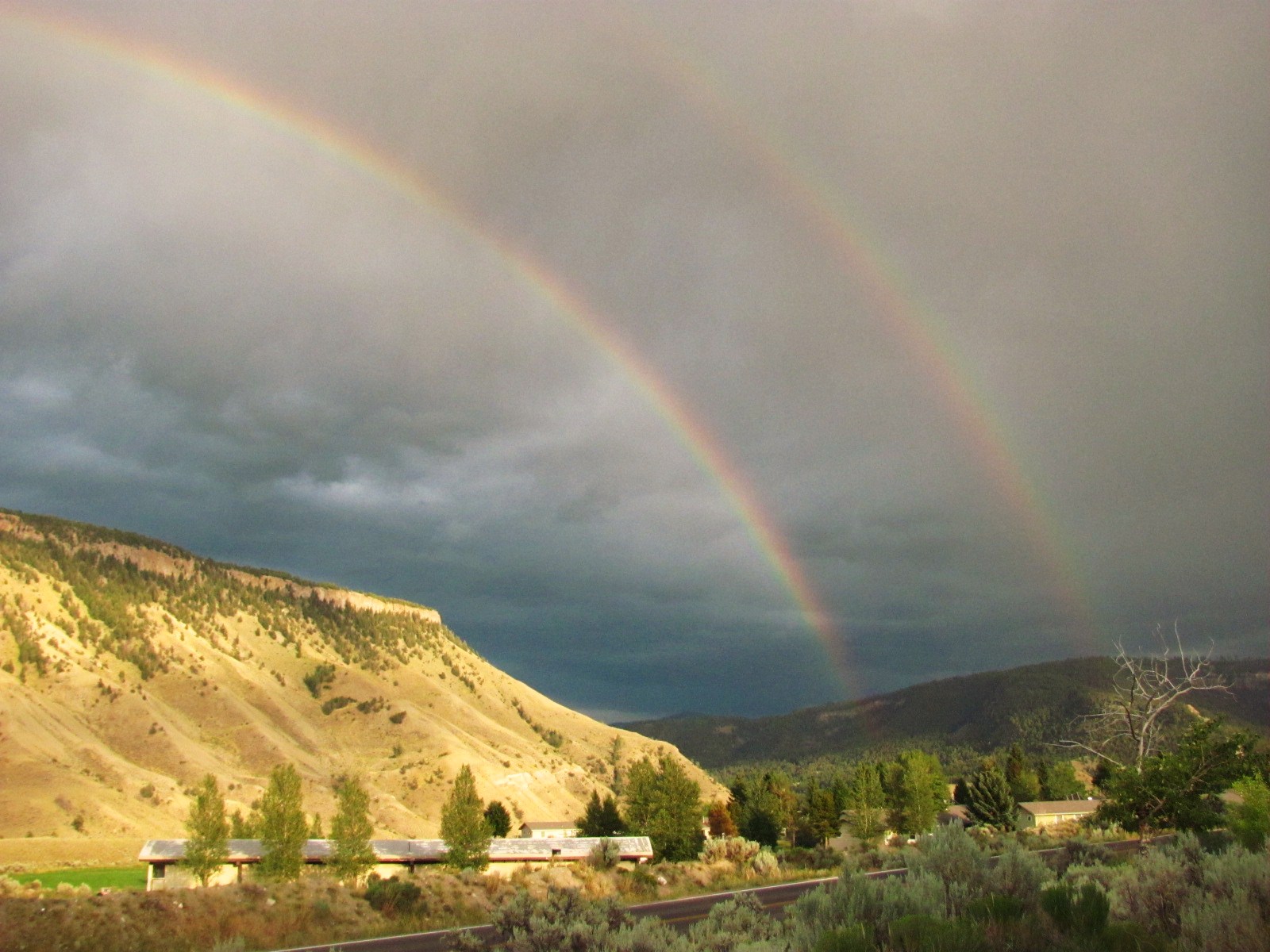
We also had the opportunity to meet campground volunteer hosts, Jim and Kay, who do a great job in making sure each camper has an enjoyable stay while there. We were so impressed with how they handled their daily chores that we spent time talking to them about volunteering at a national park. Mammoth Campground, in our opinion, would be the perfect place to volunteer. The area is not only beautiful, teaming with wildlife and thermal activity; it also has internet and satellite service as well as a reasonable commute to stock up the fridge. We are definitely going to investigate a volunteer position for next year.
For those of you who may not remember Charles Kuralt, he was a CBS correspondent, and beginning in 1967 was host of a segment called “On the Road”. Over the next 20 years, he and his crew visited every state in the country in a motorhome, logging more than a million miles. Avoiding the interstates, he
 preferred to take the back roads in search of America. He used to say, "Interstate highways allow you to drive coast to coast, without seeing anything". We had mentioned him earlier in our travels as you can read by following this link: (2007TimetoReflect).
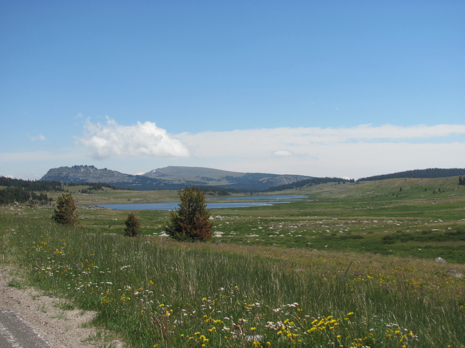
One of the areas he reported on was the Beartooth Highway which he called “the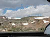 most beautiful drive in America”. This drive originates outside the northeast entrance of Yellowstone and follows Rt. 212 into Montana and back into Wyoming. Along the way you travel through the Gallatin National Forest, Shoshone National Forest, Custer National Forest, through the small towns of Silver Gate, Cooke City, and Top of
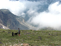 the World, over the Beartooth Pass, and down into Red Lodge, MT. We decided to take the 170-mile roundtrip drive to Beartooth Pass, and on Wed. morning loaded the dogs into the car and headed out. We left with great expectations and in returning 7 hours later, we were not disappointed. We have traveled many scenic and historic roads over the last 3 years, and while each was unique and beautiful in its own right, the Beartooth Highway was definitely
 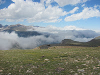 the best.
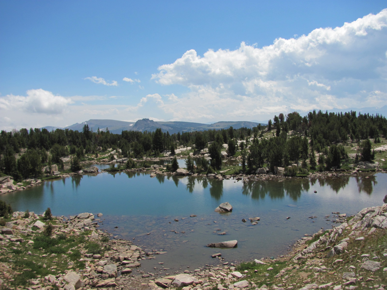
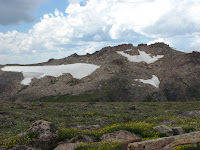
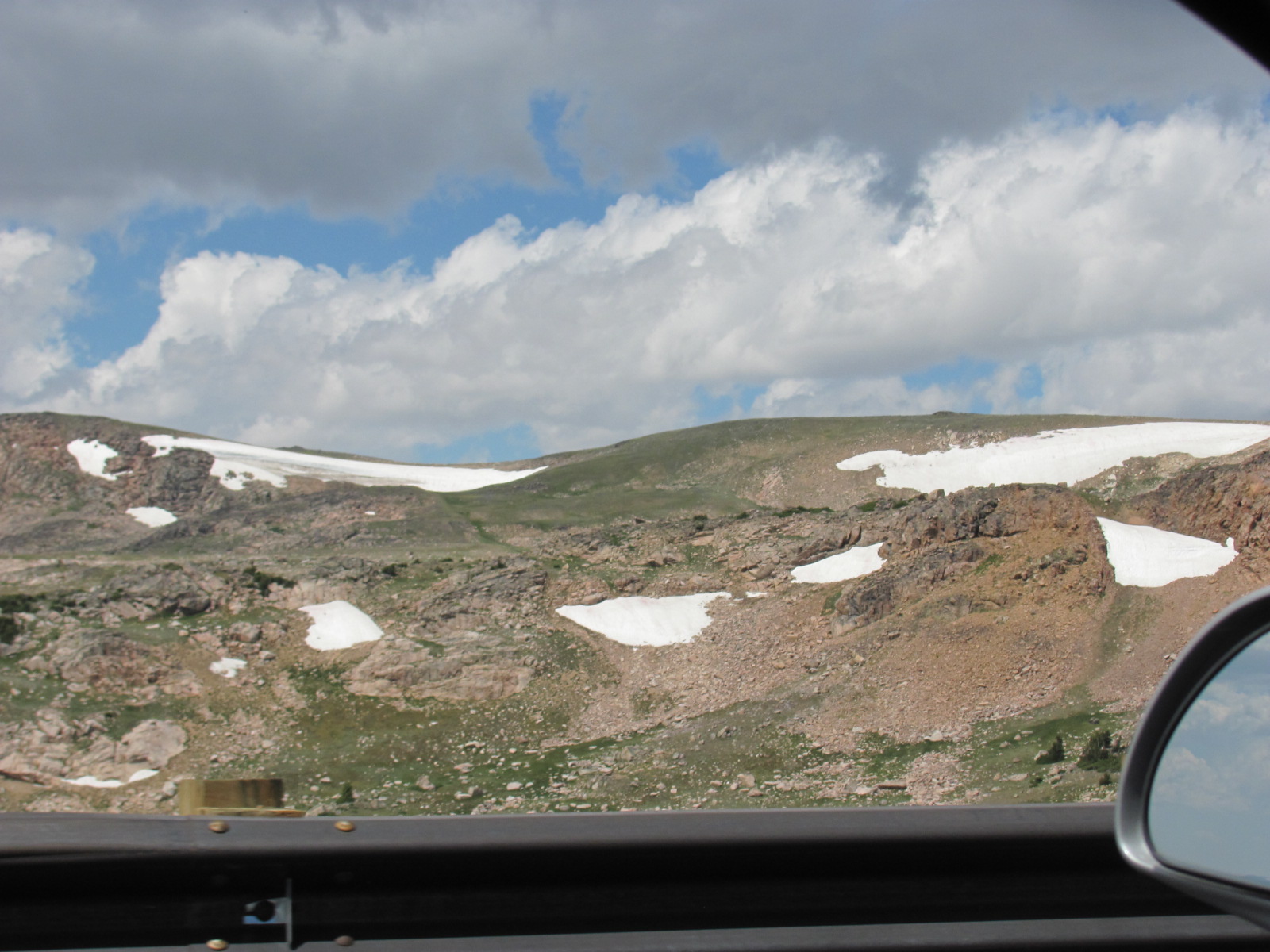
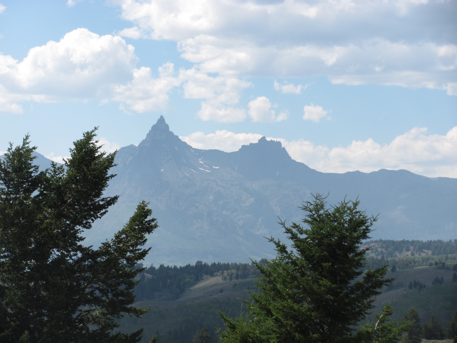
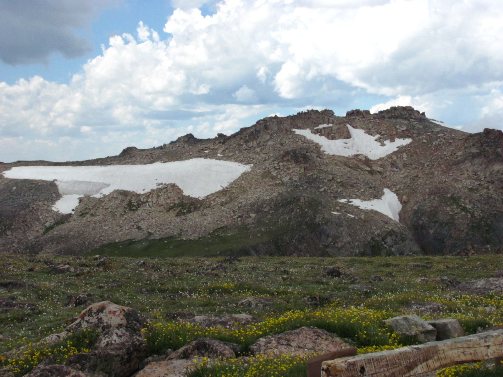
From the northeast entrance to the Beartooth Pass was 37 miles of amazing scenery with an elevation change of 3,582 ft. to a height of 10,947 ft. The temperature at the northeast entrance was 78 degrees, and as a storm rolled through while at the top of the pass, the temperature dropped to 48 degrees with a little bit of sleet. Time and again we pulled to the side of the road to tak e in the views. There are 20 peaks soaring over 12,000 feet along the route. In the distance not far to the west Pilot Peak at 11,708 ft. and Index Peak at 11,313 ft. were most impressive. At times we were looking down at glaciers along the mountain sides. Glacial lakes and the round boulders associated with the glaciers of long ago were abundant. Standing there and taking in all the beauty we seemed to be lost in time in trying to imagine what this area looked like millions of years ago.
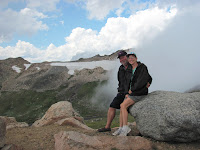
 most beautiful drive in America”. This drive originates outside the northeast entrance of Yellowstone and follows Rt. 212 into Montana and back into Wyoming. Along the way you travel through the Gallatin National Forest, Shoshone National Forest, Custer National Forest, through the small towns of Silver Gate, Cooke City, and Top of
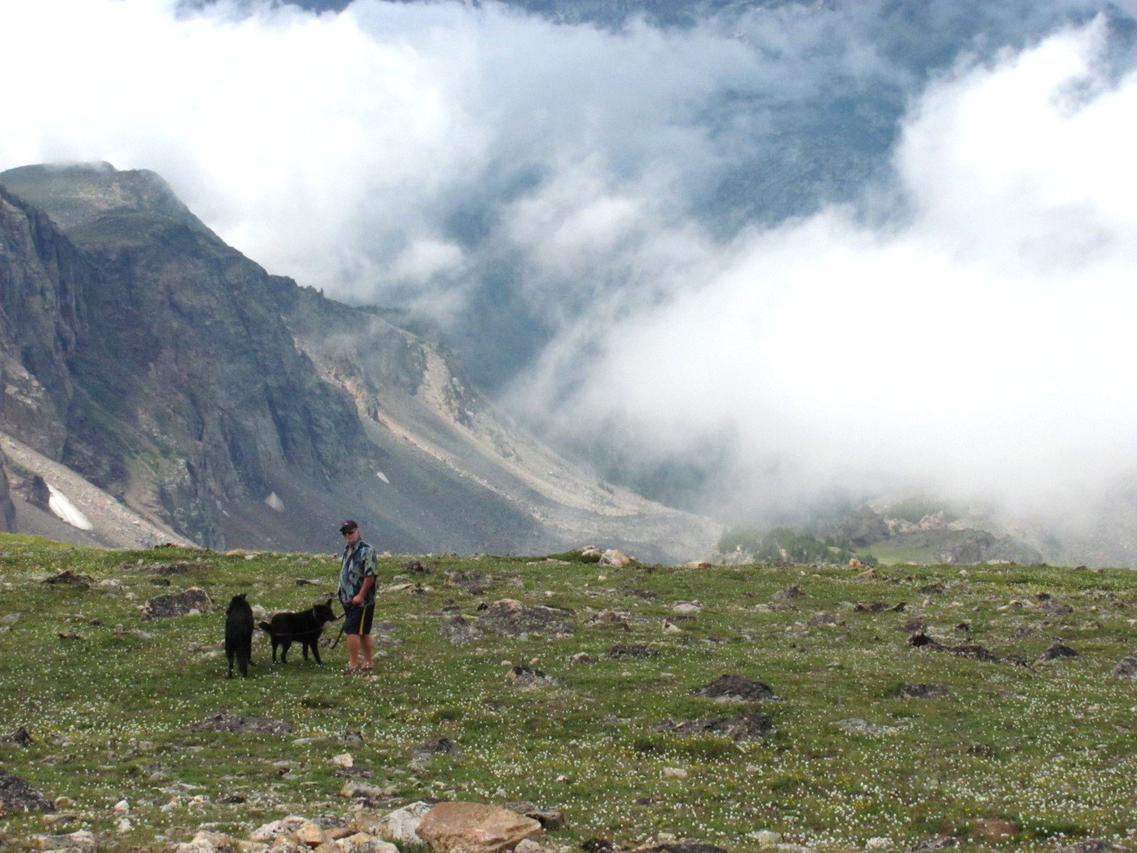 the World, over the Beartooth Pass, and down into Red Lodge, MT. We decided to take the 170-mile roundtrip drive to Beartooth Pass, and on Wed. morning loaded the dogs into the car and headed out. We left with great expectations and in returning 7 hours later, we were not disappointed. We have traveled many scenic and historic roads over the last 3 years, and while each was unique and beautiful in its own right, the Beartooth Highway was definitely
  the best.
From the northeast entrance to the Beartooth Pass was 37 miles of amazing scenery with an elevation change of 3,582 ft. to a height of 10,947 ft. The temperature at the northeast entrance was 78 degrees, and as a storm rolled through while at the top of the pass, the temperature dropped to 48 degrees with a little bit of sleet. Time and again we pulled to the side of the road to tak
 e in the views. There are 20 peaks soaring over 12,000 feet along the route. In the distance not far to the west Pilot Peak at 11,708 ft. and Index Peak at 11,313 ft. were most impressive. At times we were looking down at glaciers along the mountain sides. Glacial lakes and the round boulders associated with the glaciers of long ago were abundant. Standing there and taking in all the beauty we seemed to be lost in time in trying to imagine what this area looked like millions of years ago.
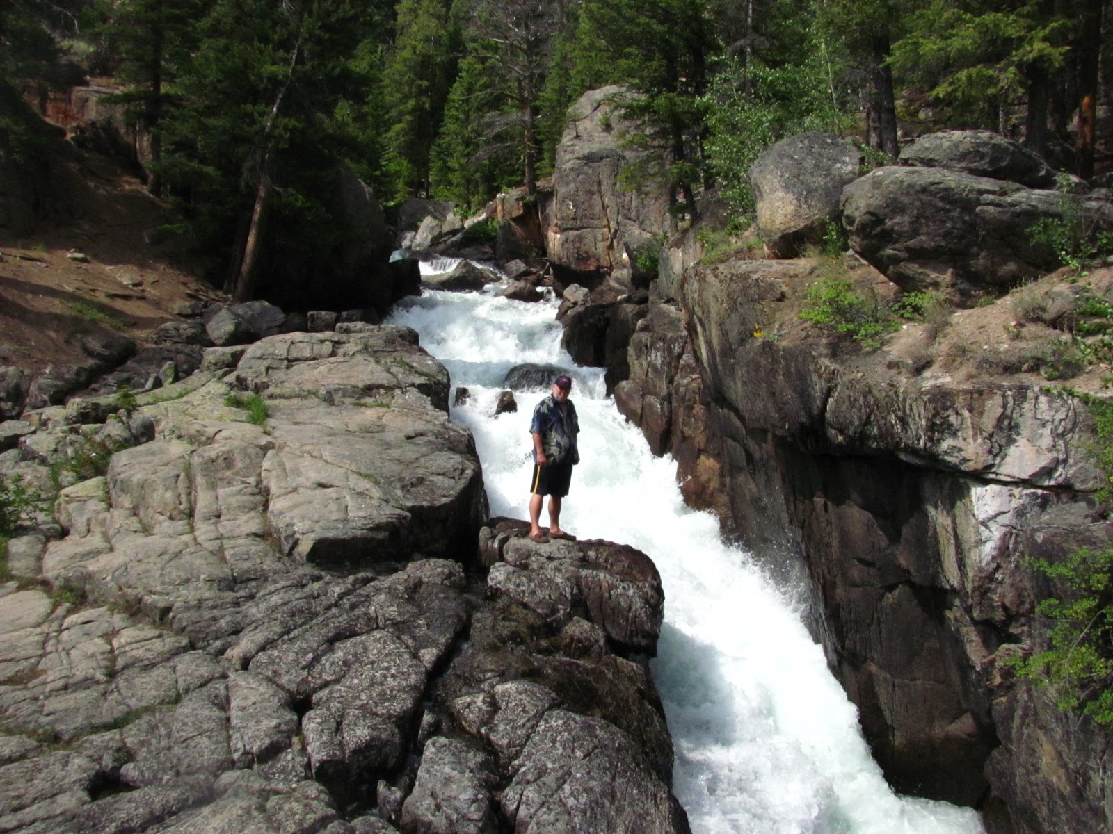 On our way back to the campground, we stopped at a waterfall located just off the road, not far outside the park entrance, and climbed the adjacent trail a short distance to get a closer look. The force and power of the water was amazing.
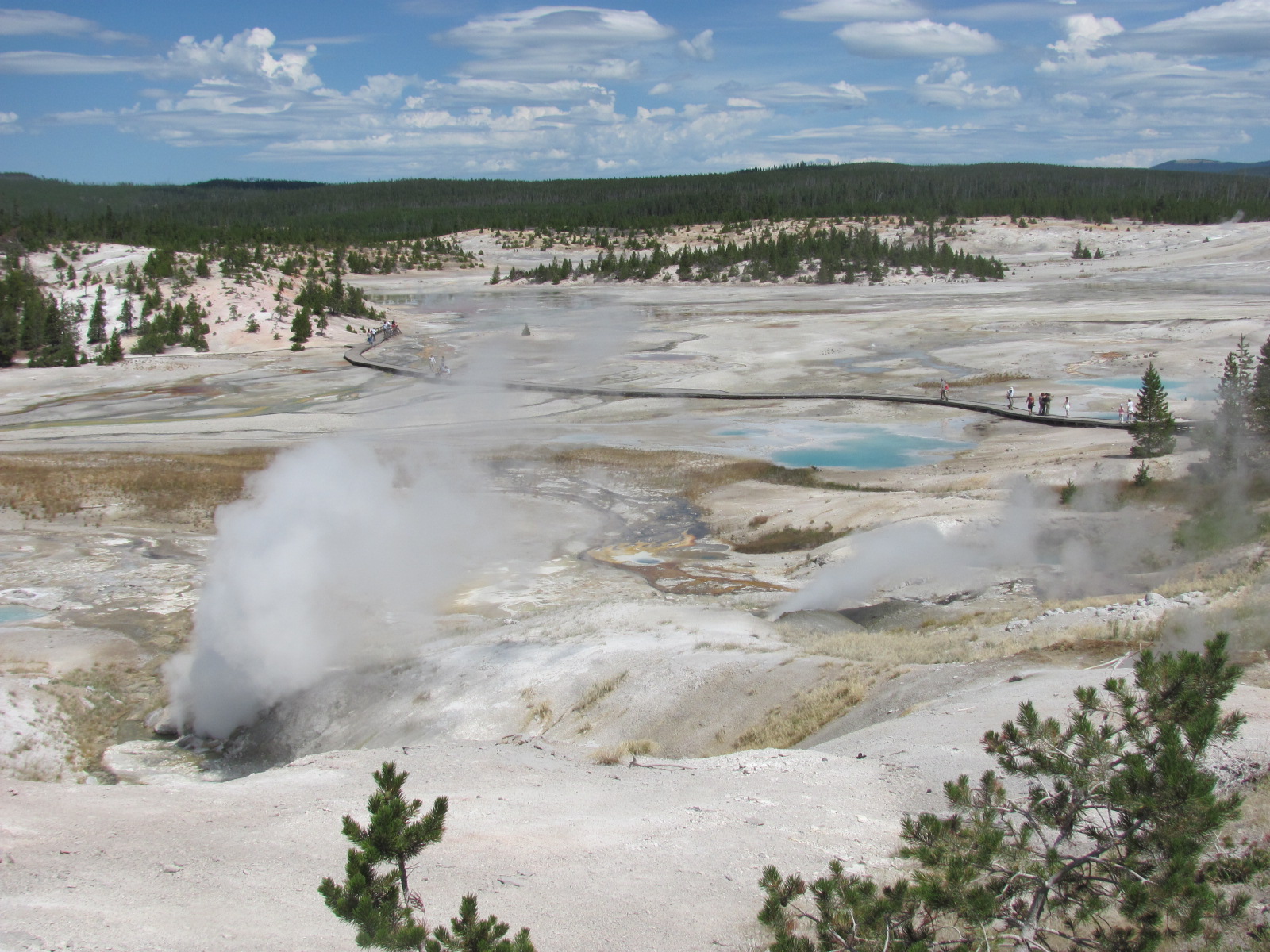
Did you know that Yellowstone National Park encompasses 2.2 million acres and has quite a diverse landscape? Most people only think of Old Faithful when they think of Yellowstone, but it is so much more...mountains, valleys, canyons, waterfalls, hot springs, bubbling mudpots, and wildlife. On an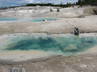 other day we traveled over 20 miles to the Norris Geyser Basin and then another 12 to the Canyon Village area. Norris Geyser Basin is one of the most active and hottest geyser basins in the park because it is situated on the intersection of 3 major faults. When you really think about the fact that in some areas just 3 to 8 miles below the surface is molten rock (magma), it boggles the mind! We walked the Porcelain Basin trail passin
 g steam vents, hot springs, fumaroles, and small geysers. The colors created by the thermopiles (heat-loving microorganisms) are spectacular. On the other side at the Back Basin trail we watched the eruption of Steamboat Geyser, the world’s tallest active geyser. Though it can shoot 300 ft. into the air during a major eruption, more commonly it only erupts about 10 – 40 ft. which was the case during our visit. (The last major eruption was in 2005.)

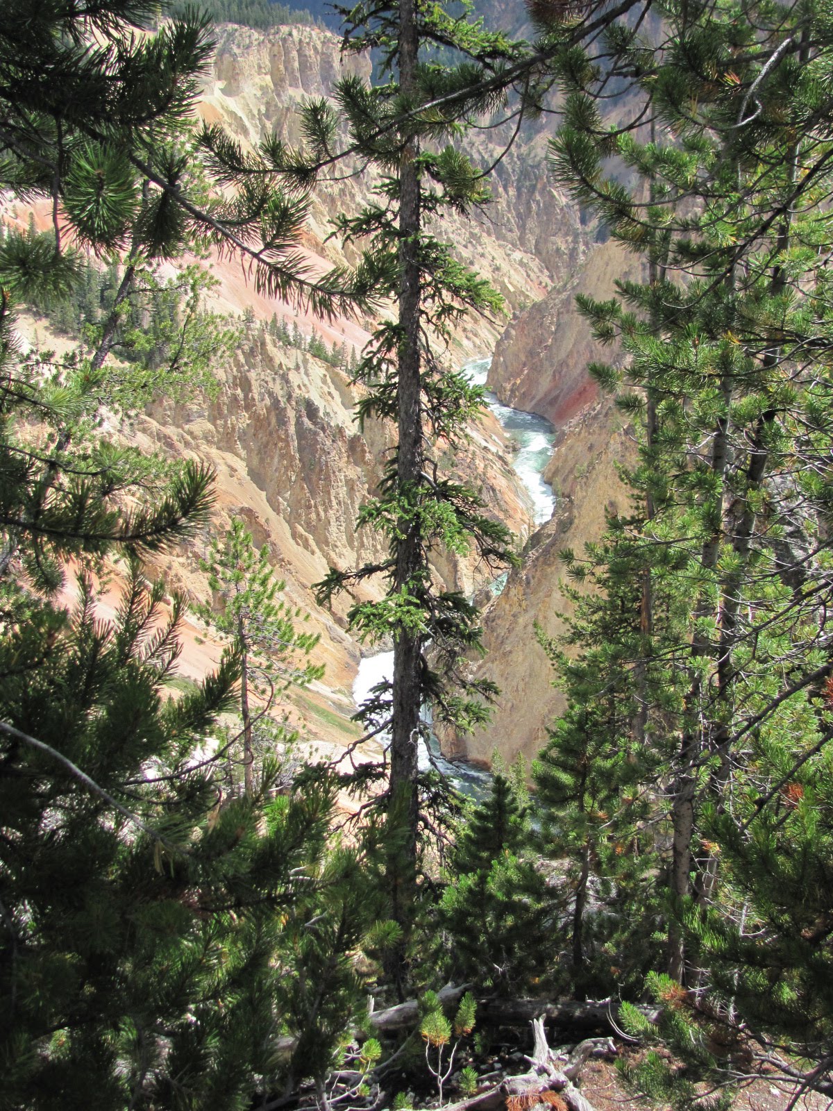
In the Canyon Village area we drove the north and south rim loops of the “Grand Canyon of the Yellowstone”. Carved by the Yellowstone River, this canyon is approximately 20 miles long, more than 1,000 feet deep, and up to 4,000 feet in width. There are two waterfalls – the Up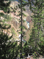 per Falls dropping 109 feet and the Lower Falls plunging 308 feet - that afford many photo opportunities with Artist Point offering the most spectacular view of the Lower Falls (photo at left). Since we had visited this area last year, we didn’t get out at every overlook, but Artist Point is well worth visiting every time. (For more info and pictures on the park, you can click on this link to last year’s visit - 2009Yellowstone).
 other day we traveled over 20 miles to the Norris Geyser Basin and then another 12 to the Canyon Village area. Norris Geyser Basin is one of the most active and hottest geyser basins in the park because it is situated on the intersection of 3 major faults. When you really think about the fact that in some areas just 3 to 8 miles below the surface is molten rock (magma), it boggles the mind! We walked the Porcelain Basin trail passin
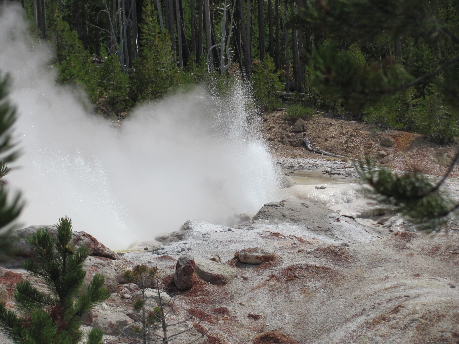 g steam vents, hot springs, fumaroles, and small geysers. The colors created by the thermopiles (heat-loving microorganisms) are spectacular. On the other side at the Back Basin trail we watched the eruption of Steamboat Geyser, the world’s tallest active geyser. Though it can shoot 300 ft. into the air during a major eruption, more commonly it only erupts about 10 – 40 ft. which was the case during our visit. (The last major eruption was in 2005.)
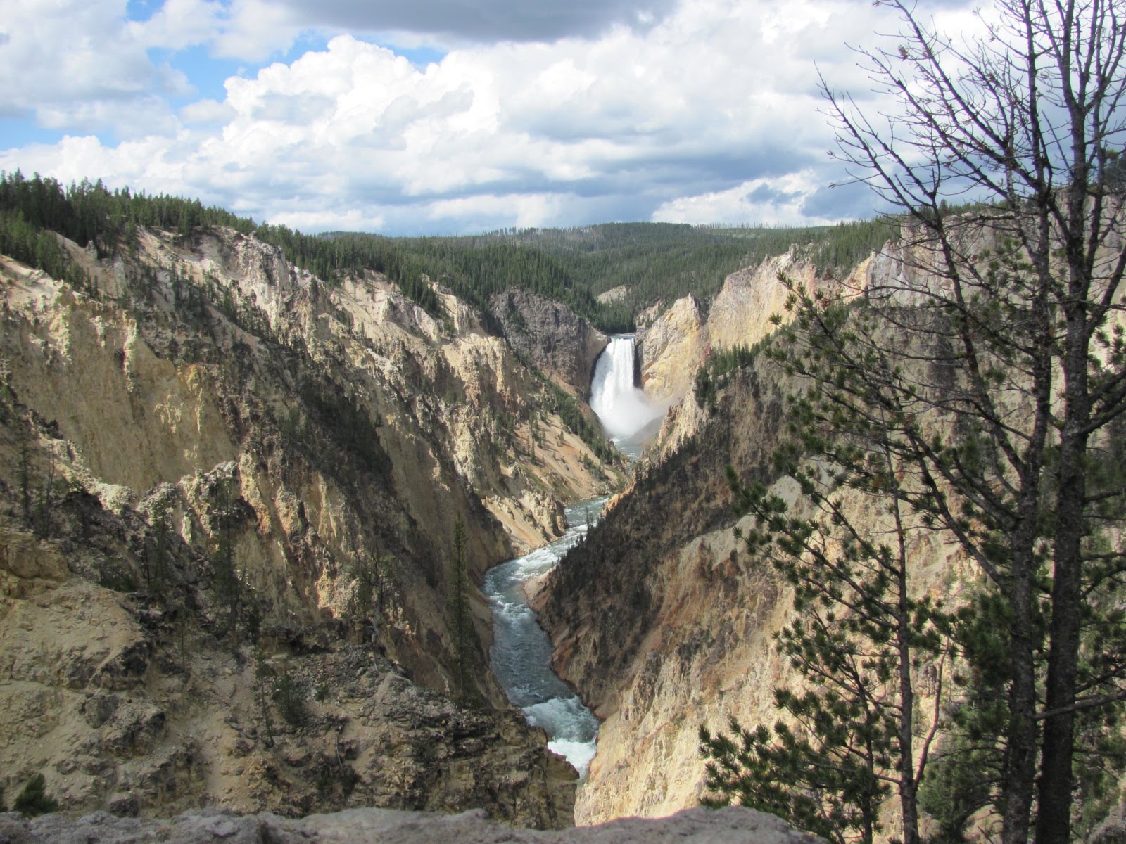
In the Canyon Village area we drove the north and south rim loops of the “Grand Canyon of the Yellowstone”. Carved by the Yellowstone River, this canyon is approximately 20 miles long, more than 1,000 feet deep, and up to 4,000 feet in width. There are two waterfalls – the Up
 per Falls dropping 109 feet and the Lower Falls plunging 308 feet - that afford many photo opportunities with Artist Point offering the most spectacular view of the Lower Falls (photo at left). Since we had visited this area last year, we didn’t get out at every overlook, but Artist Point is well worth visiting every time. (For more info and pictures on the park, you can click on this link to last year’s visit - 2009Yellowstone).
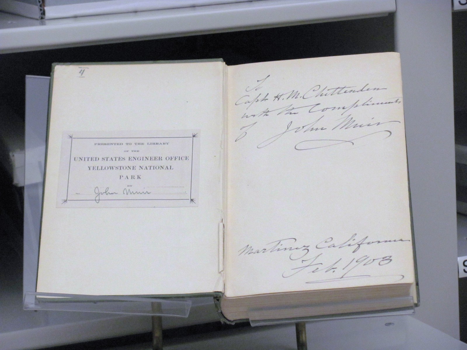 During our stay we discovered that just up the road in Gardiner was the Yellowstone Heritage and Research Center, and free tours are given to the public by appointment on Tues. and Thurs. The HRC is a storage facility that houses over 5.3 million items of the park’s archives, rare books, original artwork, museum pieces, fossils, a h
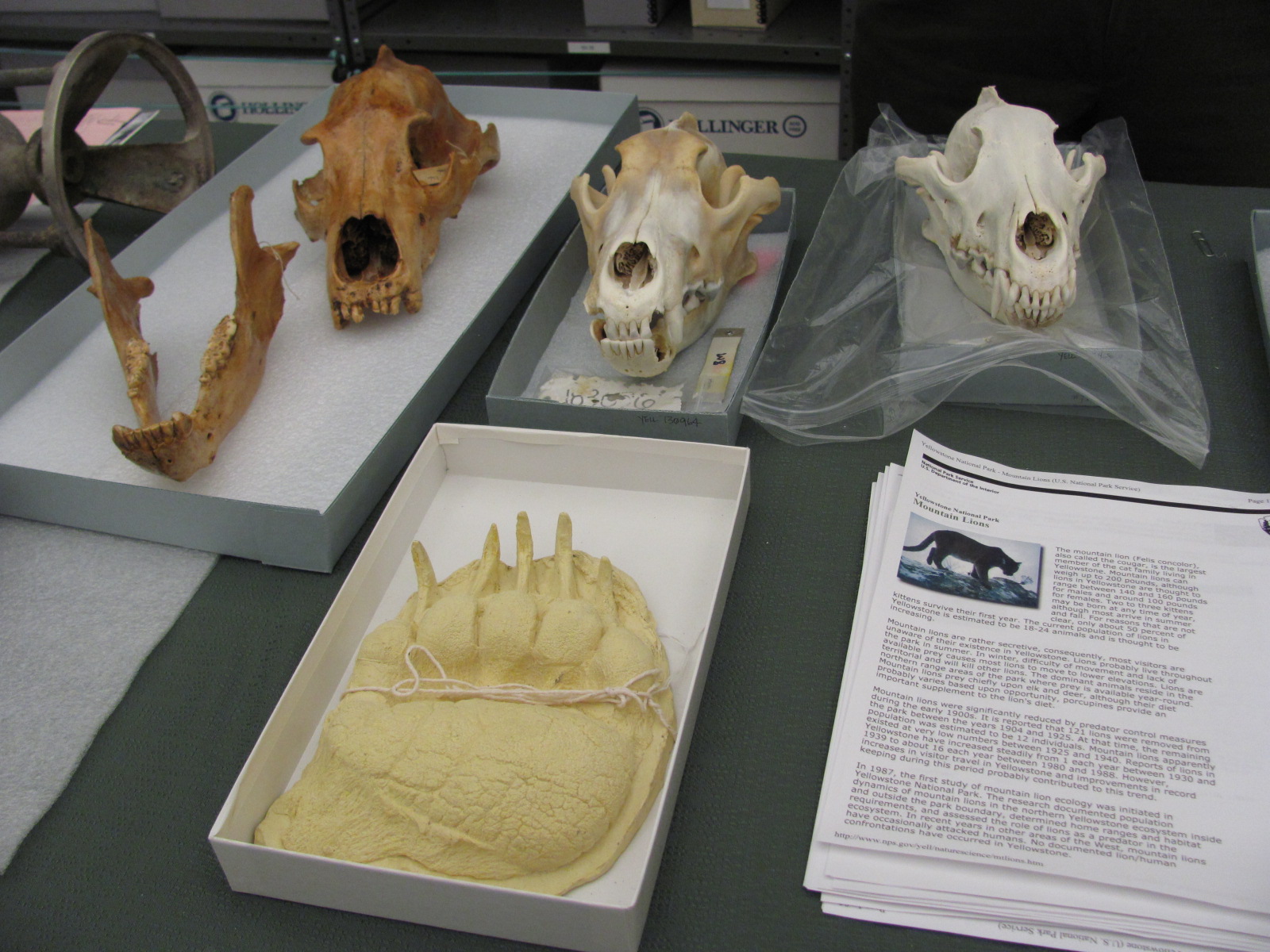 erbarium, and a research library that is open to the public. The tour lasted a little more than an hour, and it was quite interesting to learn about the facility and see such things as an original letter written by Teddy Roosevelt in 1894 before he was President, a book inscribed by conservationist John Muir in 1903, skulls of cougars, bears, and wolves, and the original watercolor sketches of Thomas Moran.
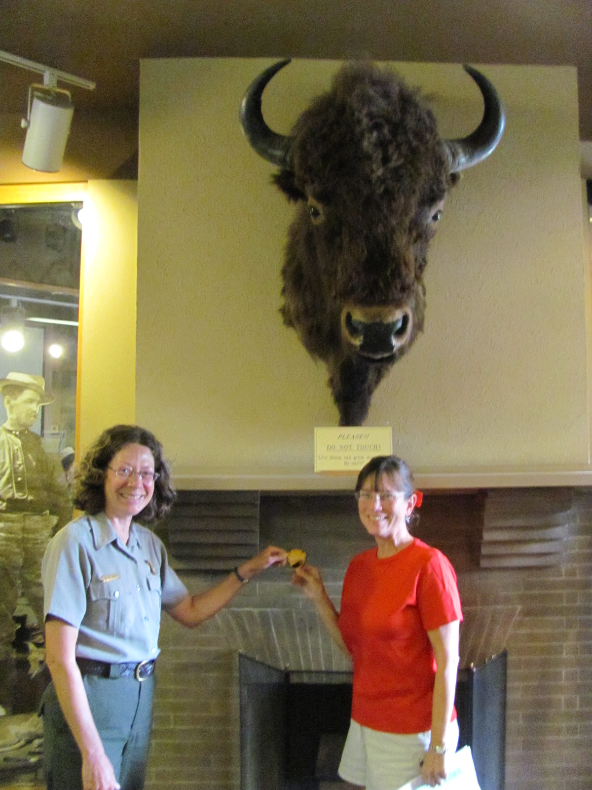 While in Yellowstone I earned my 19th Junior Ranger badge, or more technically a patch. For some reason this park no longer issues the replica ranger badges, instead favoring a couple different patches. When given a choice, I generally opt for the patch, but since Russ prefers the badges to wear on his hat, he decided to skip this program. When we were here last year, we didn't know that as adults we could become Jr. Rangers. How fitting that the last one I earn is from the first national park ever created.
A couple miles from the campground is an area where the Ga
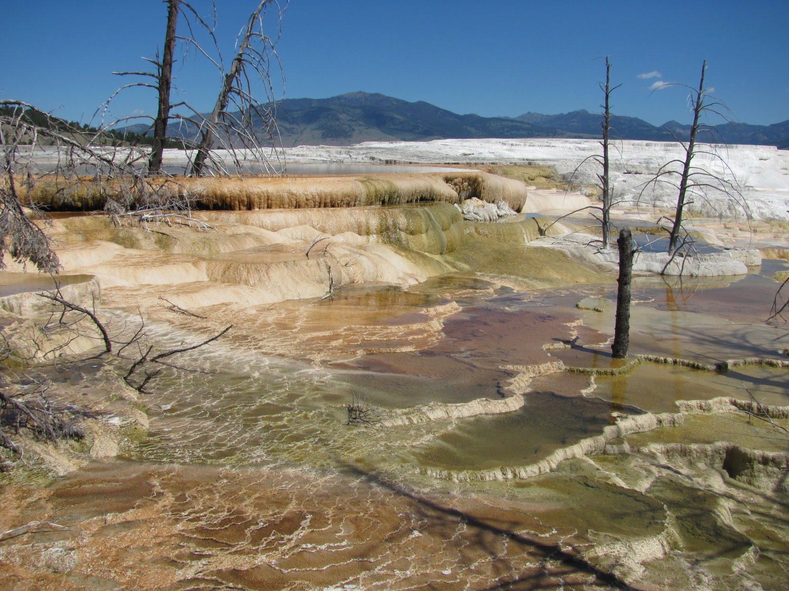
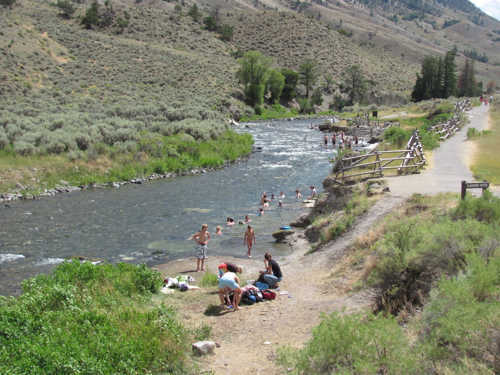 rdner River meets the Boiling River, a location of the largest discharge of thermal water in Yellowstone. It is one of only a couple of safe places within the park where visitors can actually soak in the warm waters. After walking along a ½ mile trail, you arrive at the spot where the 140 degree Fahrenheit underground discharg
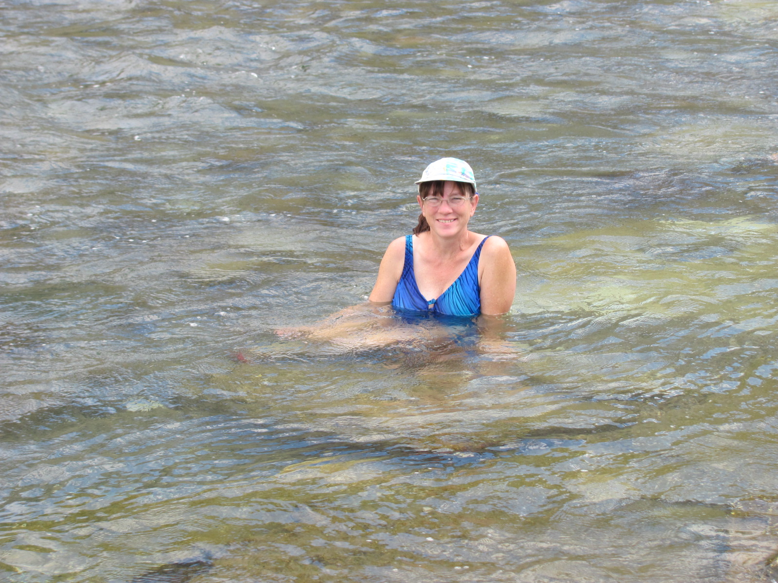 e from Mammoth Hot Springs joins the cold river water creating a nice warm, soaking temperature. The area is quite rocky so not good for swimming and water shoes are recommended because the rocks are slippery from the algae. While sitting in the river, at times we’d feel a rush of hot water on our backs followed by a rush of cold…quite a memorable experience! In the words of Charles Kuralt, “America is a great story and there is a river on every page of it.”

No comments:
Post a Comment