*Birds we’ve seen on our 2011 trip so far: mountain bluebird, golden eagle, Indigo bunting, Lazuli bunting, Say’s Phoebe, yellow-rumped warbler, Western Tanager, bald eagle, blue heron, American white pelican, trumpeter swan, osprey, magpie, mountain bluebird, Clark’s Nutcracker
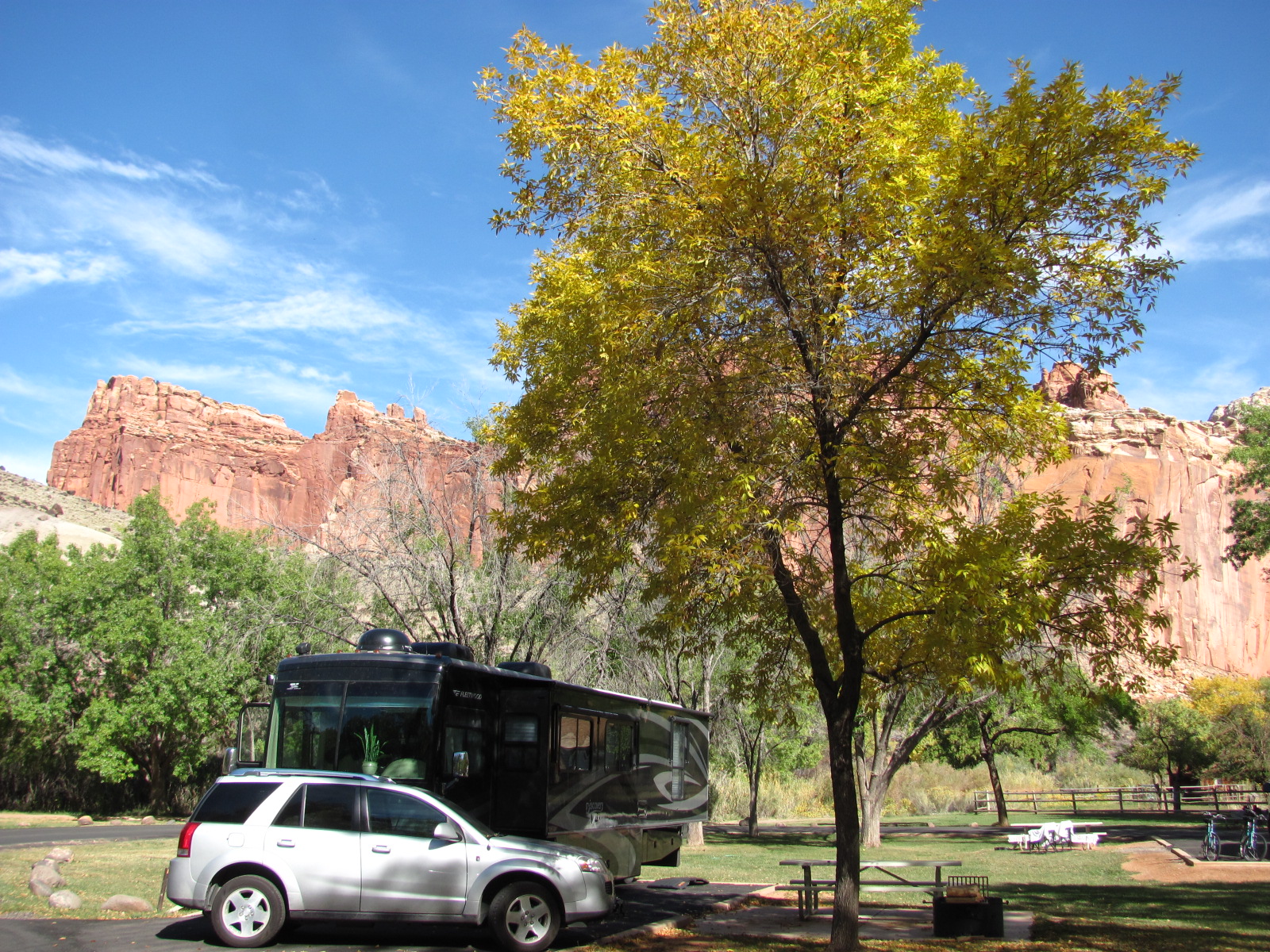
We had decided to make a return trip to Capitol Reef National Park (www.nps.gov/care) for a couple of days on our way south. Dotty and Gary were so happy to see us, and we had made plans to have them over for dinner during our stay. Their son, Brian, was staying with them and helping out so of course h
 e was invited, too. We had also invited the rangers, but Kyle was the only one to make it as everyone else was out of town or already had plans (though Holly stopped by later with her fiancé). Russ also invited Walter, a man camping by himself in the site behin
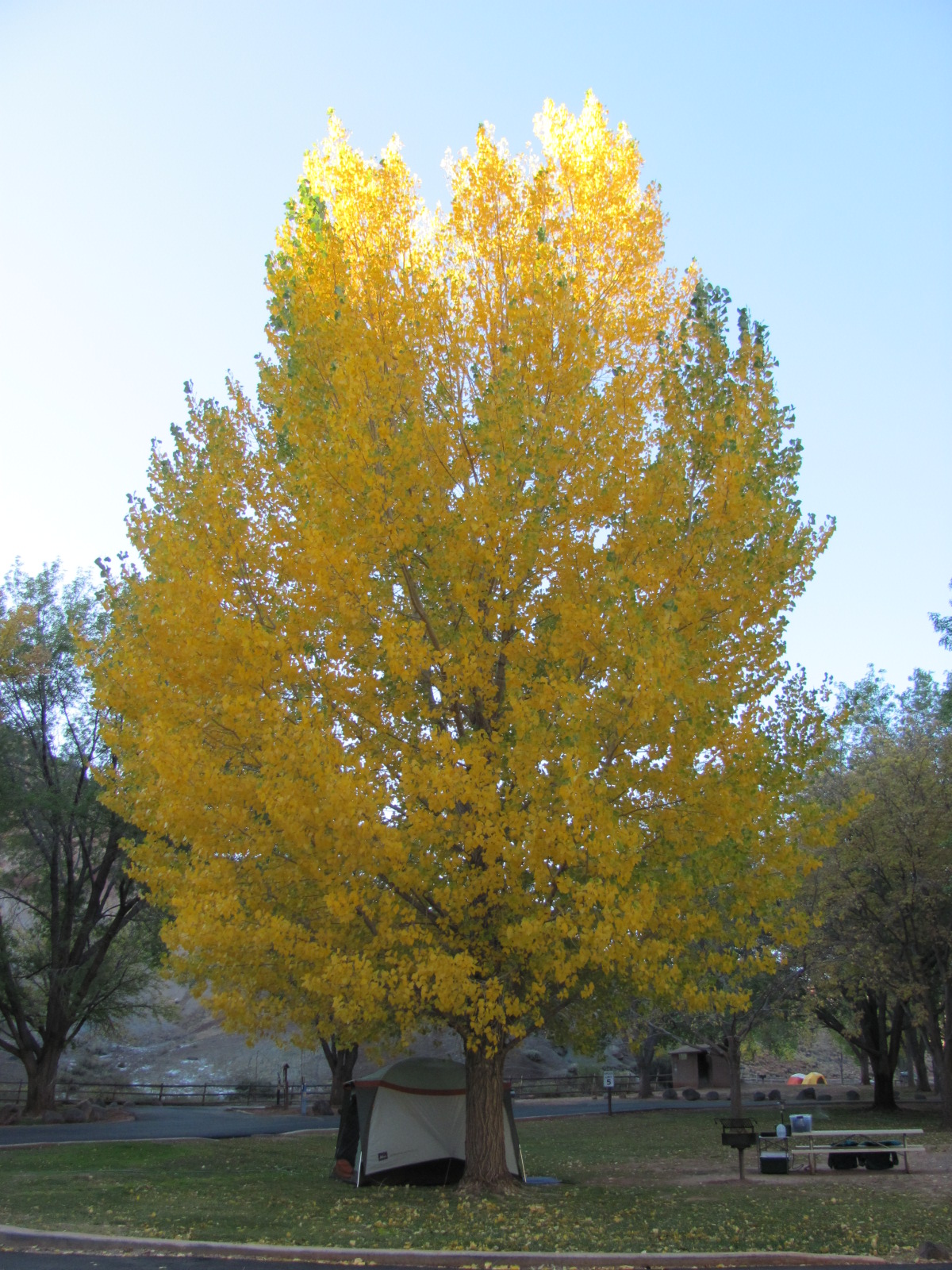 d us who we had chatted with shortly after arriving. I kept it simple with spaghetti and garlic bread, but Dotty insisted on bringing a salad and one of her fabulous desserts. Many of the trees were turning color, and there were still apples ripe for picking left in some of the orchards. Of course we had to pick a few near the campground, and they were delicious! We had a wonderful visit with
  Dotty, Gary, and the others, and even managed to catch a glimpse of the International Space Station flyover again one night and watched our beloved St. Louis Cardinals beat the Milwaukee Brewers for a trip to the World Series! (Yes, I’m crazy enough to take photos of happening events on TV!)
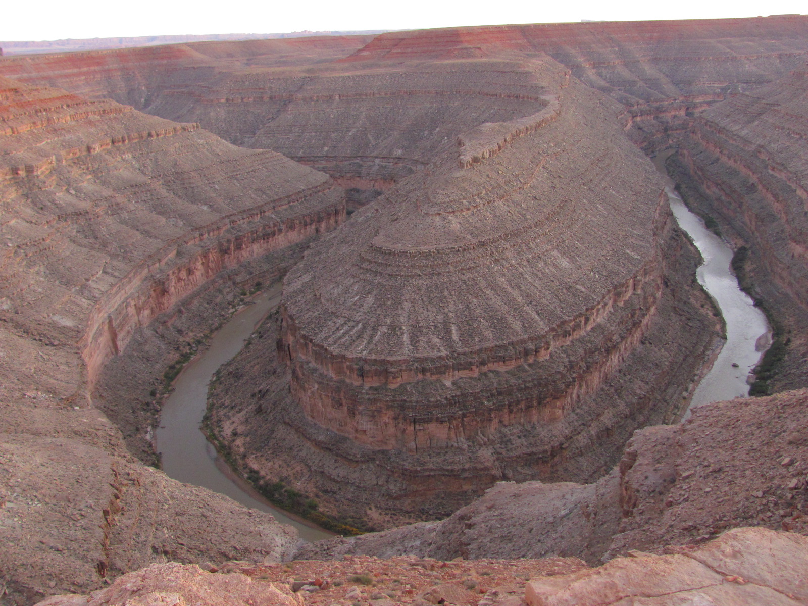
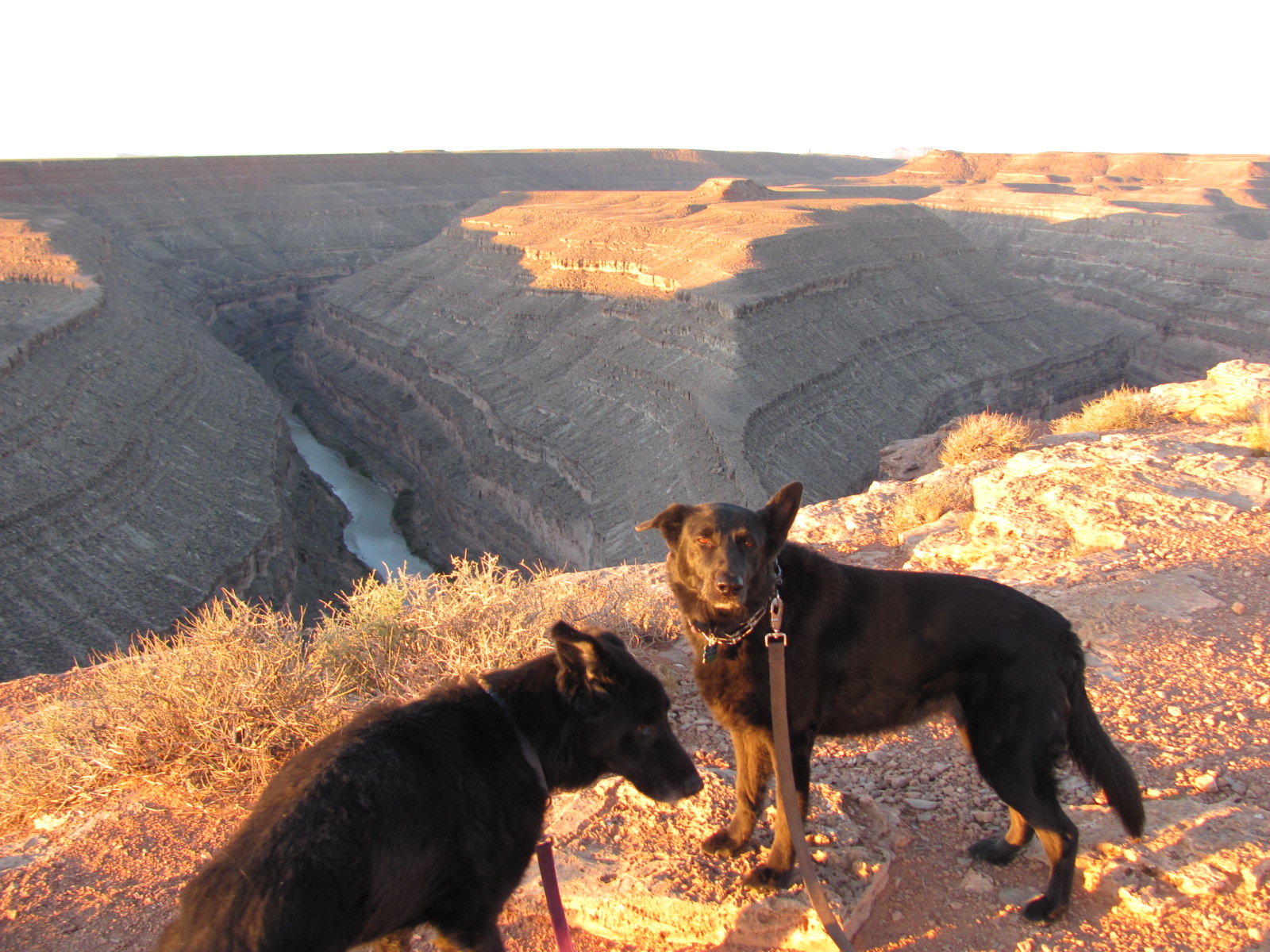
Our next stop was Goosenecks State Park (Goosenecks) in southeast Utah. It gets its name from the tight turns made by the San Juan River in the canyon below, and is said to be one of the best examples of an “entrenched meander” in the wo
 rld. (Never could get a panoramic photo showing all the bends at once.) This park is basically in the middle of nowhere with no trees whatsoever and sits about 1,000 feet above the winding river which exposes rock layers dating back nearly 300 million years. Camping is basically wherever you want to park with no hookups th
 ough there are 4 “sites” with a picnic table and fire ring, and we chose one along the canyon rim not far from the cliff’s edge (see photo taken of the RV from across the ridge). There are no fees at this park, and we stayed 3 nights building a fire nightly while sitting under the stars, amazed at the clarity of the Milky Way, and even watched the International Space Station pass overhead each night. On our last night we were the only people in the park, not another person for at least 20 miles…a little spooky!
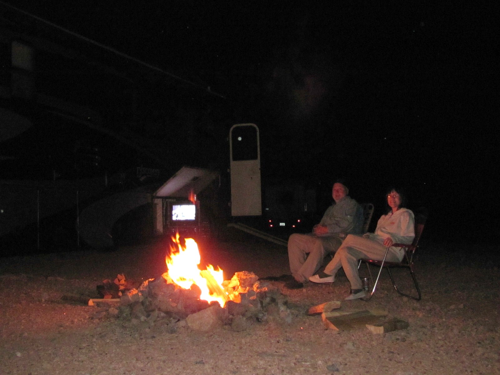
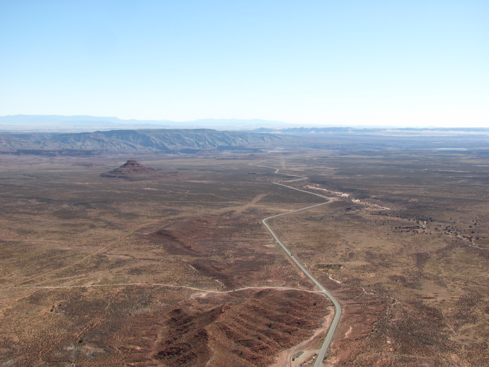
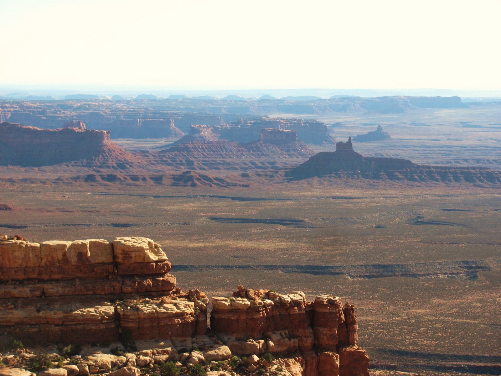 Goosenecks was a great location for taking day trips to other places such as the nearby Valley of the Gods. Since we were planning to visit Monument Valley during our stay, and this is basically a mini version of that, we decided to forgo driving the very rough 17 mile road that takes you through the Valley. However, I did get a shot of some of the spires and buttes from above as we traveled along the Moki Dugway towards Natural Bridges.
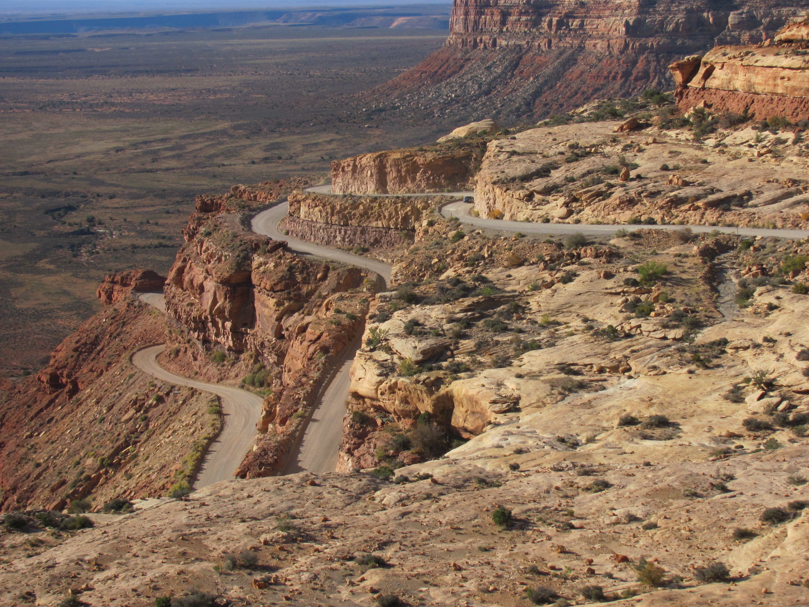
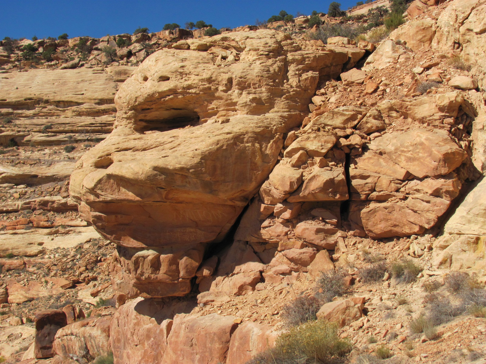
Now what is Moki (pronounced mokee) Dugway you ask? It’s a graded gravel and dirt road carved into the face of the cliff edge of Cedar Mesa that was originally built for the uranium ore trucks for travel back in the 1950s. Over the next 3 miles the steep switchbacks take you up about 1,000 ft. to an elevation of 6,425 ft. with spectacular views of the valley floor below and some fascinating geological formations (does that look like a skull to you?)
 Natural Bridges National Monument (www.nps.gov/nabr) is about 45 miles from Goosenecks SP and “preserves some of the finest examples of natural stone architecture in the southwest”. There are three natural bridges that have formed over millions of years, and after viewing the brief presentation at the Visitor Center, we set out on the 9-mile driving loop. The first sto
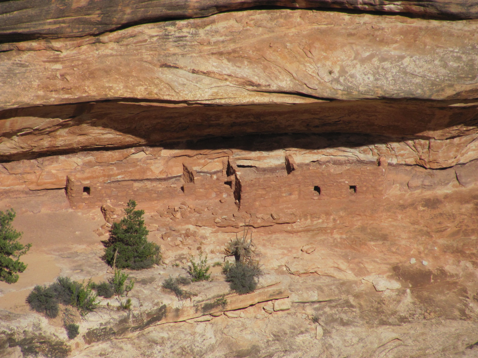 p provides a view of Sipapu Bridge (at left) which is Hopi for “place of emergence” and is the largest of the three bridges with a span of 268 ft. and a height of 220 ft. Next stop was the Horsecollar Ruin, an ancestral Anasazi cliff dwelling near the base of the canyon that was
 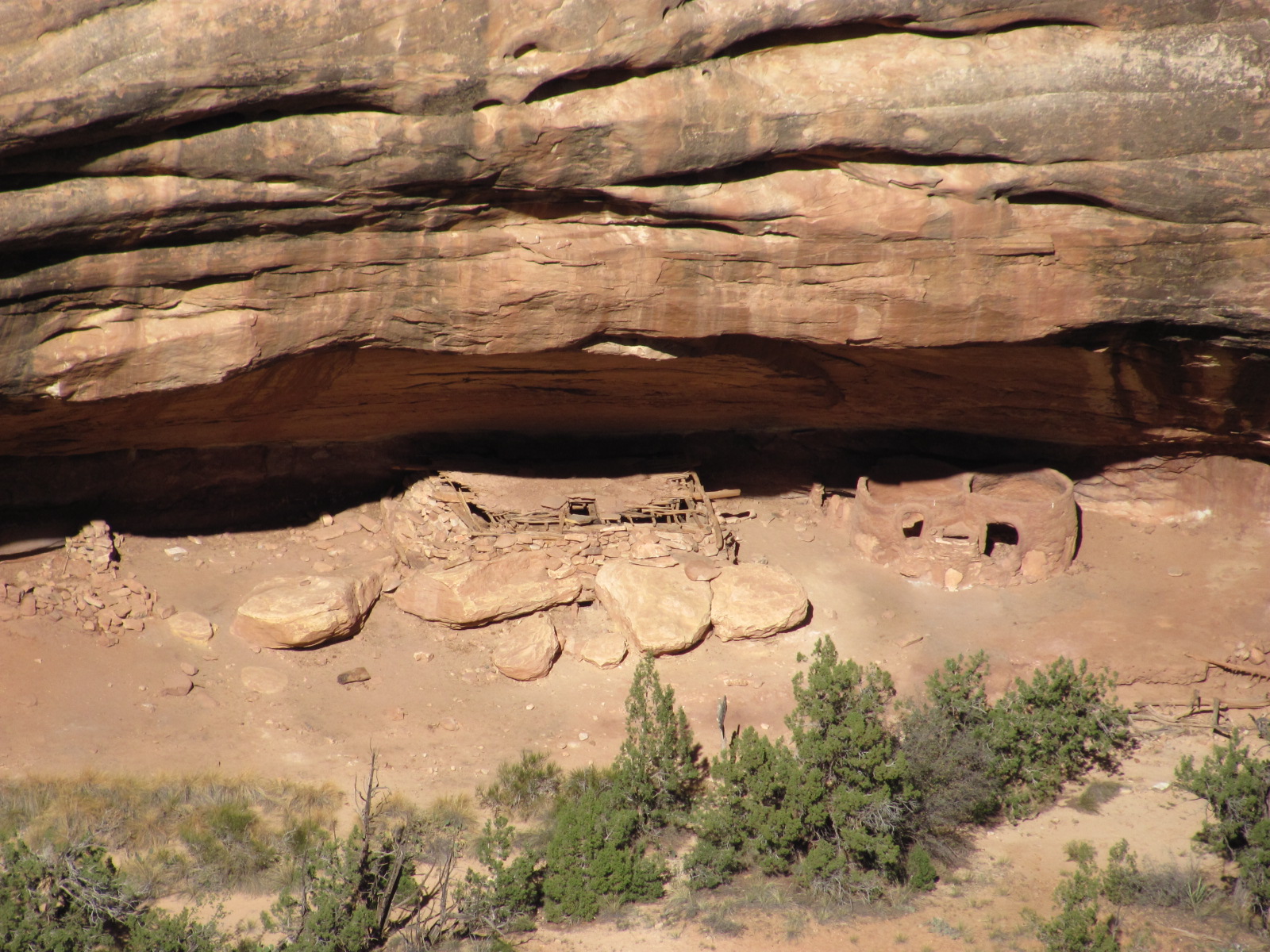 abandoned more than 700 years ago. We had to hike about 3/10 of a mile along an unfenced rocky path to get to the overlook (you can’t reach the ruin from this trail and neither of us were into hiking all the way down there and back anyway!) Stop #3 was the Kachina Bridge (at right) so named for the rock art at the base of the
 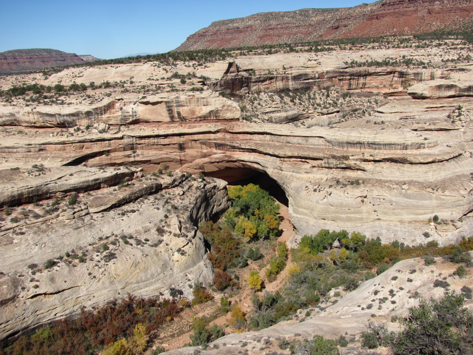 bridge that is supposed to resemble Kachina dolls (though we couldn’t see that from our vantage point). It’s considered the “youngest” of the three bridges and spans 204 ft. with a height of 210 ft. The smallest, thinnest, and what is considered the “oldest” of the three is Owachomo Bridge, the last stop on our drive. Its Hopi
 name means “rock mound” and is so named for the rock formation located at the east end of the bridge (pictured at left...a zoomed in view of the bridge below right). Owachomo spans 180 ft. with a height of 106 ft., but due to its fragility, who knows how much longer it will st
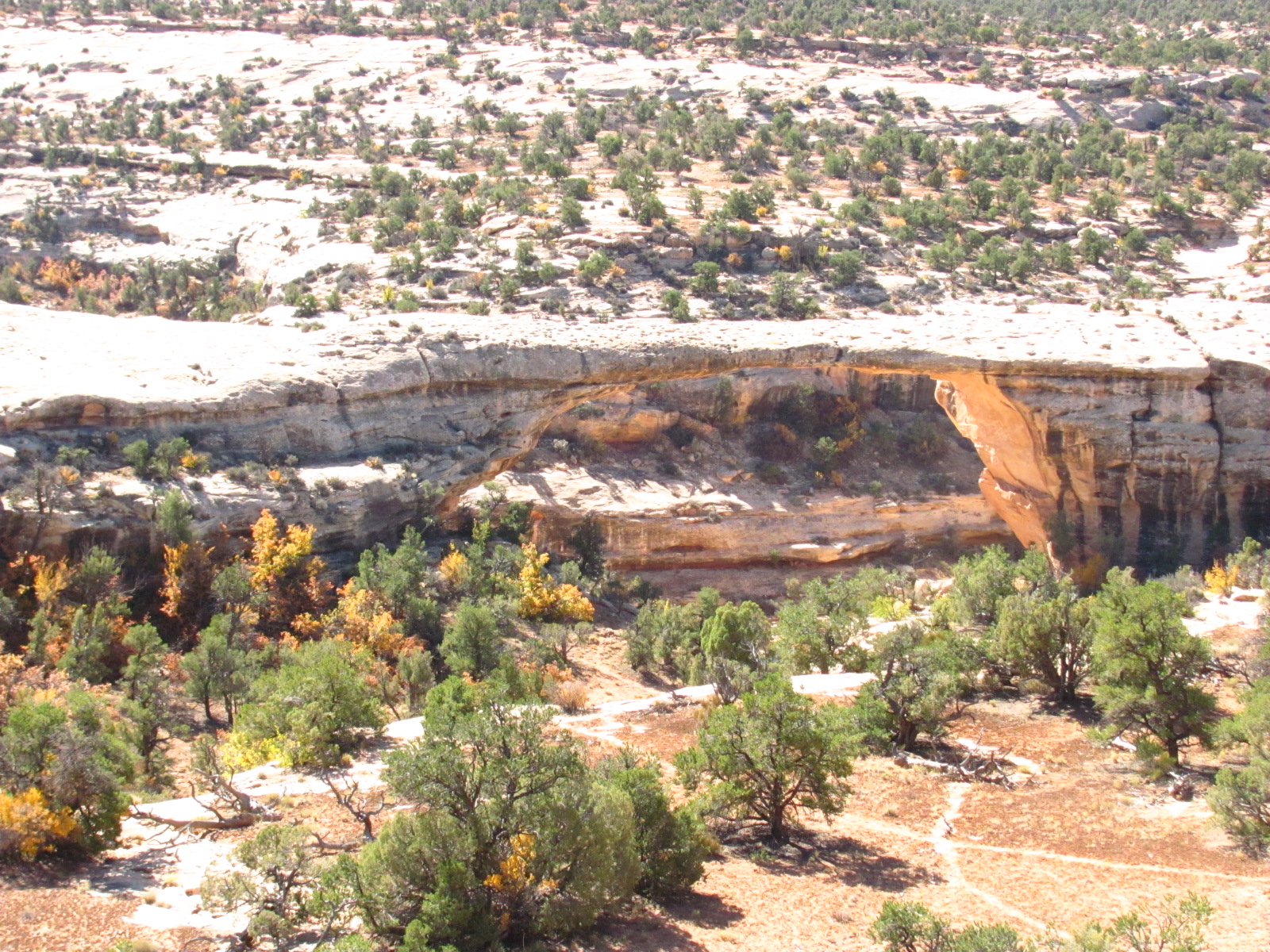 and. Though not as spectacular as Arches National Park, this was still a worthwhile stop at a place we'd heard so much about.
Our plan for the next day was a visit to Monument Valley, another day trip about 30 miles away.


1 comment:
Enjoy reading your posts michelle and randy
Post a Comment